Корвара (Corvara, Corvara)
.svg)
- коммуна в регионе Абруццо, Италия
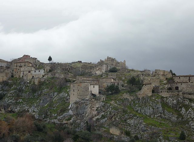
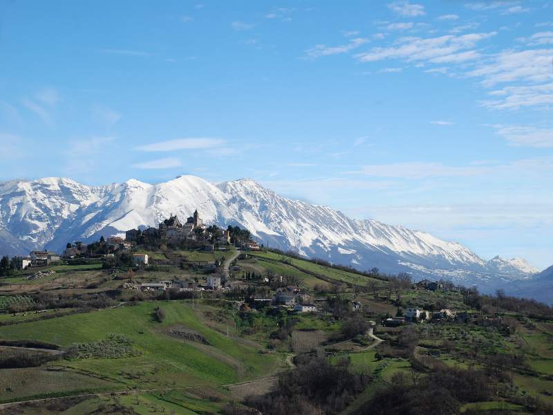
 Hiking in Корвара
Corvara, located in the Abruzzo region of Italy, is a fantastic destination for hiking enthusiasts. Nestled in a picturesque valley surrounded by the stunning Gran Sasso and Monti della Laga National Park, the area offers a wide variety of trails that cater to all levels of hikers, from beginners to experienced mountaineers.
Popular Hiking Trails
-
The Corvara Loop Trail: This trail provides a scenic overview of the village and surrounding mountains. It’s relatively easy, making it suitable for families and those looking for a leisurely hike.
-
Monti della Laga Trails: There are several trails that lead into the Monti della Laga range, offering stunning views, diverse landscapes, and opportunities to spot local wildlife. The trails vary in difficulty, so hikers can choose based on their experience level.
-
Castello di Rocca Calascio: While not directly in Corvara, this iconic castle is a popular destination for hikers in the area. The hike to the castle offers breathtaking panoramic views and is a great way to experience the region's history.
-
Lago di Campotosto: A bit further afield, this beautiful lake offers several hiking routes around its perimeter, with options for both short walks and more challenging paths that explore the surrounding hills.
What to Expect
-
Scenery: Expect stunning views of the Apennine mountains, lush valleys, and vibrant flora and fauna. The region is known for its beautiful landscapes, especially during spring and autumn when the colors are vivid.
-
Flora and Fauna: Abruzzo is famous for its biodiversity. You might spot various species of birds, deer, and other wildlife along the trails.
-
Weather: The best time to hike in Corvara is usually from late spring to early autumn when the weather is generally mild and dry. Summer can be warm, while late autumn might bring unpredictable weather, so always check forecasts before heading out.
Practical Tips
-
Gear: Wear sturdy hiking boots and carry plenty of water, snacks, a map, and sun protection. If you plan to hike in higher elevations, be prepared for cooler temperatures and changing weather.
-
Guided Tours: If you’re unfamiliar with the area, consider joining a guided hiking tour. Local guides can provide valuable insight into the region’s history, culture, and ecology.
-
Respect Nature: Follow the Leave No Trace principles to help preserve the beauty of the trails and surrounding environment.
Hiking in Corvara, Abruzzo, provides a perfect blend of adventure, scenic beauty, and cultural experience. Whether you're trekking through wildflower meadows or exploring ancient villages, you'll have an unforgettable outdoor experience in this charming region of Italy.
- Страна:

- Почтовый код: 65020
- Телефонный код: 085
- Код автомобильного номера: PE
- Координаты: 42° 16' 31" N, 13° 52' 25" E


- GPS треки (wikiloc): [Ссылка]
- Высота над уровнем моря: 625 м m
- Площадь: 13.73 кв.км
- Население: 232
- Википедия русская: wiki(ru)
- Википедия английская: wiki(en)
- Википедия национальная: wiki(it)
- Хранилище Wikidata: Wikidata: Q51360
- Катеория в википедии: [Ссылка]
- код Freebase: [/m/0fg8mv]
- код GeoNames: Альт: [6541215]
- ID отношения в OpenStreetMap: [41912]
- код ISTAT: 068016
- кадастровый код Италии: D078
Граничит с регионами:


Капестрано
- коммуна Италии
Hiking in Капестрано
Capestrano, a picturesque village located in the Abruzzo region of Italy, offers hikers a unique blend of natural beauty, historical sites, and cultural experiences. Here are some key points about hiking in Capestrano:...
- Страна:
- Почтовый код: 67022
- Телефонный код: 0862
- Код автомобильного номера: AQ
- Координаты: 42° 16' 10" N, 13° 46' 0" E
- GPS треки (wikiloc): [Ссылка]
- Высота над уровнем моря: 465 м m
- Площадь: 43.66 кв.км
- Население: 897
- Веб сайт: [Ссылка]


Бриттоли
- коммуна Италии
Hiking in Бриттоли
Brittoli, a picturesque mountain village in the Abruzzo region of Italy, offers stunning landscapes and a variety of hiking opportunities for outdoor enthusiasts. Nestled amidst the Apennine Mountains, Brittoli provides an excellent base for exploring the natural beauty and cultural heritage of the area....
- Страна:
- Почтовый код: 65010
- Телефонный код: 085
- Код автомобильного номера: PE
- Координаты: 42° 19' 1" N, 13° 51' 41" E
- GPS треки (wikiloc): [Ссылка]
- Высота над уровнем моря: 779 м m
- Площадь: 15.99 кв.км
- Население: 272
- Веб сайт: [Ссылка]


Бусси-суль-Тирино
- коммуна Италии
Hiking in Бусси-суль-Тирино
Bussi sul Tirino is a picturesque town located in the Abruzzo region of Italy, nestled along the Tirino River and surrounded by beautiful mountainous landscapes. This area offers a variety of hiking opportunities, catering to both novice and experienced hikers. Here are some highlights to consider when planning your hiking adventure in Bussi sul Tirino:...
- Страна:
- Почтовый код: 65022
- Телефонный код: 085
- Код автомобильного номера: PE
- Координаты: 42° 13' 0" N, 13° 49' 0" E
- GPS треки (wikiloc): [Ссылка]
- Высота над уровнем моря: 344 м m
- Площадь: 25.91 кв.км
- Население: 2447
- Веб сайт: [Ссылка]

Пескосансонеско
- коммуна Италии
Hiking in Пескосансонеско
Pescosansonesco is a charming village located in the Abruzzo region of Italy, nestled in the mountains of the Gran Sasso and Monti della Laga National Park. This area is known for its stunning natural landscapes, making it a fantastic destination for hiking enthusiasts....
- Страна:
- Почтовый код: 65020
- Телефонный код: 085
- Код автомобильного номера: PE
- Координаты: 42° 15' 0" N, 13° 53' 0" E
- GPS треки (wikiloc): [Ссылка]
- Высота над уровнем моря: 550 м m
- Площадь: 18.35 кв.км
- Население: 497
- Веб сайт: [Ссылка]

Пьетранико
- коммуна Италии
Hiking in Пьетранико
Pietranico is a small village located in the Abruzzo region of Italy, surrounded by stunning natural landscapes that are perfect for hiking enthusiasts. Nestled in the foothills of the Gran Sasso mountain range, Pietranico offers a variety of trails suitable for different skill levels, from leisurely walks to more challenging hikes....
- Страна:
- Почтовый код: 65020
- Телефонный код: 085
- Код автомобильного номера: PE
- Координаты: 42° 17' 0" N, 13° 55' 0" E
- GPS треки (wikiloc): [Ссылка]
- Высота над уровнем моря: 590 м m
- Площадь: 14.77 кв.км
- Население: 477
- Веб сайт: [Ссылка]