Графство Бентхайм (County of Bentheim, Landkreis Grafschaft Bentheim)

 Hiking in Графство Бентхайм
The County of Bentheim is located in the northwest of Germany, near the border with the Netherlands. It's known for its picturesque landscapes, charming villages, and rich cultural heritage, which makes it a wonderful location for hiking enthusiasts. Here’s an overview of what you can expect while hiking in this beautiful district:
Trails and Landscapes
-
Diverse Terrain: The region offers diverse landscapes, including forests, heathlands, and rolling hills. The area's unique geology, with sandstone formations, creates both visually stunning scenery and a variety of trail difficulties.
-
Hiking Trails: The County of Bentheim features a network of well-marked hiking trails. Popular routes include:
- The Bentheimer Wald: This forest area is perfect for leisurely walks or more challenging hikes, with trails that meander through lush vegetation.
- The "Hiking Trail of the Year": Certain trails have received accolades for their quality and picturesque views, often featuring local flora and fauna.
-
Historic Sites: Many hiking routes will take you past historical sites such as the Bentheim Castle, which is an impressive medieval structure perched on a hill and offers panoramic views of the surrounding landscape.
Nature and Wildlife
- The region is home to various wildlife, especially in protected areas. Birdwatching and spotting native animals can enhance the hiking experience.
- Nature reserves, such as the "Dümpelmoor," offer peaceful settings where you can enjoy the natural sounds and sights of the area.
Local Culture and Amenities
- Many trails pass through quaint villages where you can experience local culture, cuisine, and hospitality. It’s a great opportunity to sample regional dishes or visit local markets.
- Facilities such as parking areas, restrooms, and sometimes picnic spots are often available along many trails.
Tips for Hiking in Bentheim
- Seasonal Considerations: The best time to hike is during the spring and autumn months when the weather is mild. Summer can be warm, while winters may bring snow, impacting trail accessibility.
- Gear and Preparation: Always wear appropriate hiking boots and carry essentials like water and snacks. A map or GPS device is strongly recommended to navigate the trails.
- Respect Nature: Follow local guidelines to preserve the natural beauty of the area. Stick to marked trails and take any litter with you.
Conclusion
Hiking in the County of Bentheim can be a truly enriching experience, combining outdoor adventure with historical and cultural exploration. Whether you're a beginner or an experienced hiker, there's something for everyone in this beautiful corner of Germany. Happy hiking!
- Страна:

- Столица: Нордхорн
- Код автомобильного номера: NOH
- Координаты: 52° 25' 12" N, 7° 4' 48" E


- GPS треки (wikiloc): [Ссылка]
- Высота над уровнем моря: 17 м m
- Площадь: 981.00 кв.км
- Население: 135770
- Веб сайт: http://www.grafschaft-bentheim.de/
- Википедия русская: wiki(ru)
- Википедия английская: wiki(en)
- Википедия национальная: wiki(de)
- Хранилище Wikidata: Wikidata: Q5939
- Катеория в википедии: [Ссылка]
- код Freebase: [/m/013snd]
- код GeoNames: Альт: [3221075]
- код BNF: [12562177w]
- код VIAF: Альт: [136019094]
- ID отношения в OpenStreetMap: [62550]
- код GND: Альт: [4071981-9]
- идентификатор местоположения ArchINFORM: [3370]
- код LCNAF: Альт: [n87949523]
- код TGN: [7076842]
- код NLI: [001017980]
- код NUTS: [DE94B]
- код района Германии: 03456
Включает регионы:

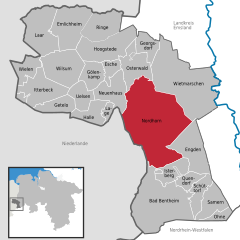
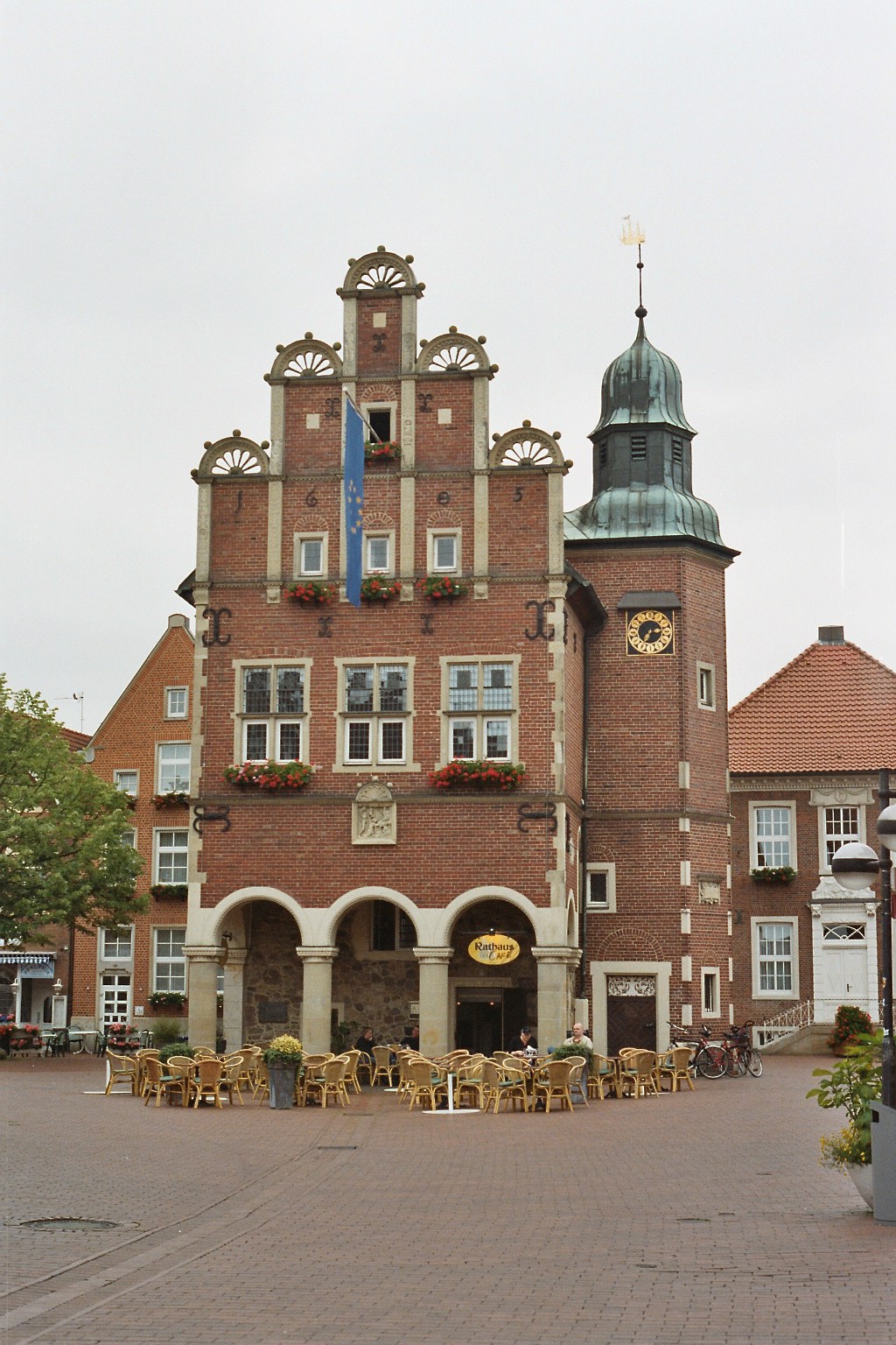
Нордхорн
- город в Германии
Hiking in Нордхорн
Nordhorn, located in Lower Saxony, Germany, is a charming town that offers various opportunities for hiking and enjoying nature. While Nordhorn itself is not as well-known for hiking as some of the more rugged regions of Germany, it still has some lovely trails and surrounding areas worth exploring....
- Страна:
- Почтовый код: 48527–48531
- Телефонный код: 05941; 05926; 05925; 05921
- Код автомобильного номера: NOH
- Координаты: 52° 26' 0" N, 7° 4' 0" E
- GPS треки (wikiloc): [Ссылка]
- Высота над уровнем моря: 23 м m
- Площадь: 149.69 кв.км
- Население: 53286
- Веб сайт: [Ссылка]
Граничит с регионами:

Эмсланд
Hiking in Эмсланд
Emsland, located in Lower Saxony, Germany, is a fantastic region for hiking enthusiasts. Known for its wide-open landscapes and rich natural beauty, Emsland offers a variety of trails that cater to hikers of all levels....
- Страна:
- Столица: Меппен
- Код автомобильного номера: EL
- Координаты: 52° 40' 12" N, 7° 15' 0" E
- GPS треки (wikiloc): [Ссылка]
- Высота над уровнем моря: 25 м m
- Площадь: 2882.07 кв.км
- Население: 321391
- Веб сайт: [Ссылка]


Штейнфурт
Hiking in Штейнфурт
Hiking in the Steinfurt district, located in North Rhine-Westphalia, Germany, offers a variety of scenic trails and natural landscapes that are ideal for outdoor enthusiasts. The region is characterized by its rolling hills, woodlands, and charming villages, making it a great place for hiking and exploring nature....
- Страна:
- Код автомобильного номера: ST
- Координаты: 52° 10' 12" N, 7° 40' 12" E
- GPS треки (wikiloc): [Ссылка]
- Высота над уровнем моря: 42 м m
- Площадь: 1795.76 кв.км
- Веб сайт: [Ссылка]
Боркен
Hiking in Боркен
Borken is a district located in North Rhine-Westphalia, Germany, and it offers a variety of hiking opportunities for outdoor enthusiasts. The region is characterized by its diverse landscapes, which include forests, meadows, rivers, and a mix of natural and agricultural areas....
- Страна:
- Код автомобильного номера: BOR
- Координаты: 51° 55' 0" N, 6° 55' 0" E
- GPS треки (wikiloc): [Ссылка]
- Высота над уровнем моря: 65 м m
- Площадь: 1420.98 кв.км
- Веб сайт: [Ссылка]