
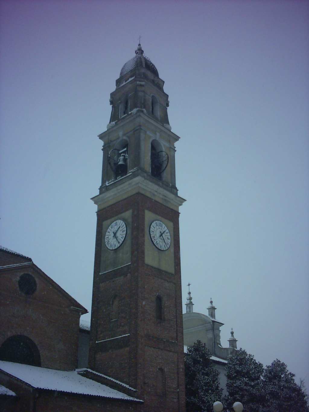
Кремона (Cremona, Cremona)
.svg)
- коммуна Италии
 Hiking in Кремона
Cremona, located in northern Italy, is best known for its rich history, particularly in music and violin making. While it isn’t a mountain region, there are some lovely hiking opportunities nearby and in the surrounding areas.
Hiking Options near Cremona:
-
Po River Park (Parco del Po):
- This park is close to Cremona and offers flat, scenic trails alongside the Po River. You can enjoy beautiful landscapes, wildlife, and the serene riverside environment. The trails are suitable for all levels of hikers.
-
The Oglio River Park (Parco dell'Oglio):
- This protected area features various trails winding along the Oglio River and through lush forests, rural landscapes, and small villages. There are several marked paths, making it great for a leisurely hike or a more extended exploration.
-
Hill Trails in the Franciacorta Region:
- To the east of Cremona, the Franciacorta region provides rolling hills and vineyards. There are trails around Lake Iseo and numerous small paths between vineyards and charming villages. It's a beautiful area for those who enjoy hiking with wine-tasting opportunities along the way.
-
Cremona’s Surrounding Hills:
- While Cremona is relatively flat, you can find some minor hills and areas for walking just outside the city. The countryside offers tranquil walks where you can appreciate the rural charm of Lombardy.
Hiking Preparation:
- Best Time to Hike: The best seasons for hiking in and around Cremona are spring (April to June) and autumn (September to October) when the weather is mild, and the landscapes are vibrant.
- Gear: Comfortable hiking shoes, water, a hat, and sunscreen are essential. A map or a hiking app can be helpful for navigating trails.
Local Tips:
- Explore Local Cuisine: After your hike, enjoy traditional food at local trattorias. Cremona is known for its cured meats and excellent cheeses.
- Stay Safe: Always inform someone about your hiking plans, especially if you venture into less populated areas, and be aware of the local wildlife.
Hiking around Cremona may not be mountainous, but it offers beautiful landscapes and cultural experiences that make for a rewarding outdoor adventure!
- Страна:

- Почтовый код: 26100
- Телефонный код: 0372
- Код автомобильного номера: CR
- Координаты: 45° 8' 0" N, 10° 2' 0" E


- GPS треки (wikiloc): [Ссылка]
- Высота над уровнем моря: 47 м m
- Площадь: 69.7 кв.км
- Население: 72095
- Веб сайт: http://www.comune.cremona.it
- Википедия русская: wiki(ru)
- Википедия английская: wiki(en)
- Википедия национальная: wiki(it)
- Хранилище Wikidata: Wikidata: Q6231
- Галерея изображений в википедии: [Ссылка]
- Катеория в википедии: [Ссылка]
- Карты в википедии: [Ссылка]
- код Freebase: [/m/01lfvj]
- код GeoNames: Альт: [6541851]
- код VIAF: Альт: [147747283]
- ID отношения в OpenStreetMap: [44189]
- код GND: Альт: [4010700-0]
- идентификатор местоположения ArchINFORM: [970]
- код LCNAF: Альт: [n80106752]
- место в MusicBrainz: [17be3971-9d7f-4376-89d8-dc0e4a6db8b1]
- код темы Quora: [Cremona-Italy]
- код TGN: [7005868]
- UN/LOCODE: [ITCRE]
- код в Большой каталанской энциклопедии: [0020556]
- код в Большой российской энциклопедии онлайн: [2109297]
- код Цифрового атласа Римской империи: [5543]
- код NLI: [000980805]
- код в Итальянской энциклопедии онлайн: [cremona]
- код ISTAT: 019036
- кадастровый код Италии: D150
- код US National Archives: 10044632
Граничит с регионами:


Кастельветро-Пьачентино
- коммуна Италии
Hiking in Кастельветро-Пьачентино
Castelvetro Piacentino is a charming town located in the Emilia-Romagna region of Italy, and it offers a variety of outdoor activities, including hiking. The surrounding area features scenic landscapes with rolling hills, vineyards, and beautiful countryside views that make for a pleasant hiking experience. Here are some highlights for hiking in and around Castelvetro Piacentino:...
- Страна:
- Почтовый код: 29010
- Телефонный код: 0523
- Код автомобильного номера: PC
- Координаты: 45° 6' 0" N, 9° 59' 0" E
- GPS треки (wikiloc): [Ссылка]
- Высота над уровнем моря: 39 м m
- Площадь: 35.06 кв.км
- Население: 5331
- Веб сайт: [Ссылка]
Монтичелли-д’Онджина
- коммуна Италии
Hiking in Монтичелли-д’Онджина
Monticelli d'Ongina, located in the Emilia-Romagna region of Italy, is a charming small town that is not primarily known as a hiking destination. However, it is situated near the beautiful Po River and surrounded by a picturesque landscape that offers opportunities for outdoor activities, including hiking....
- Страна:
- Почтовый код: 29010
- Телефонный код: 0523
- Код автомобильного номера: PC
- Координаты: 45° 5' 0" N, 9° 56' 0" E
- GPS треки (wikiloc): [Ссылка]
- Высота над уровнем моря: 40 м m
- Площадь: 46.33 кв.км
- Население: 5287
- Веб сайт: [Ссылка]
Персико-Дозимо
- коммуна Италии
Hiking in Персико-Дозимо
Persico Dosimo is a quaint locality in the municipality of Cremona, Italy, known for its picturesque landscapes and serene environment. While not a mainstream hiking destination, it can serve as a starting point for exploring the surrounding countryside and rural paths that showcase the natural beauty of the region....
- Страна:
- Почтовый код: 26043
- Телефонный код: 0372
- Код автомобильного номера: CR
- Координаты: 45° 11' 0" N, 10° 6' 0" E
- GPS треки (wikiloc): [Ссылка]
- Высота над уровнем моря: 48 м m
- Площадь: 20.61 кв.км
- Население: 3387
- Веб сайт: [Ссылка]
Маланьино
- коммуна Италии
Hiking in Маланьино
Malagnino is a small town located in the province of Cremona, Lombardy, Italy. While it may not be as well-known as some other hiking destinations in Italy, it does offer opportunities for outdoor exploration and enjoying the natural surroundings....
- Страна:
- Почтовый код: 26030
- Телефонный код: 0372
- Код автомобильного номера: CR
- Координаты: 45° 8' 0" N, 10° 7' 0" E
- GPS треки (wikiloc): [Ссылка]
- Высота над уровнем моря: 43 м m
- Площадь: 10.82 кв.км
- Население: 1728
- Веб сайт: [Ссылка]
Сесто-ед-Юнити
- коммуна Италии
Hiking in Сесто-ед-Юнити
Sesto ed Uniti, located in the province of Cremona in Lombardy, Italy, isn’t primarily known as a hiking destination compared to the more mountainous regions of the country. However, it offers charming rural landscapes and various trails that can be explored by nature enthusiasts looking for a peaceful experience....
- Страна:
- Почтовый код: 26028
- Телефонный код: 0372
- Код автомобильного номера: CR
- Координаты: 45° 11' 0" N, 9° 55' 0" E
- GPS треки (wikiloc): [Ссылка]
- Высота над уровнем моря: 52 м m
- Площадь: 26.49 кв.км
- Население: 3213
- Веб сайт: [Ссылка]
Станьо-Ломбардо
- коммуна Италии
Hiking in Станьо-Ломбардо
Stagno Lombardo, located in the Lombardy region of northern Italy, offers a variety of outdoor activities, including hiking, thanks to its scenic landscapes and rich natural beauty. While it might not be as famous as some other hiking destinations in Lombardy, it can still provide a great experience for those looking to explore the countryside and enjoy nature....
- Страна:
- Почтовый код: 26049
- Телефонный код: 0372
- Код автомобильного номера: CR
- Координаты: 45° 4' 0" N, 10° 5' 0" E
- GPS треки (wikiloc): [Ссылка]
- Высота над уровнем моря: 36 м m
- Площадь: 40.2 кв.км
- Население: 1550
- Веб сайт: [Ссылка]

Кастельверде
- коммуна Италии
Hiking in Кастельверде
Castelverde, located in the Lazio region of Italy, is an area that offers a unique blend of natural beauty and cultural heritage suitable for hiking enthusiasts. While it may not be as widely known as other hiking destinations in Italy, it still boasts some scenic trails and opportunities for outdoor exploration....
- Страна:
- Почтовый код: 26022
- Телефонный код: 0372
- Код автомобильного номера: CR
- Координаты: 45° 11' 15" N, 9° 59' 49" E
- GPS треки (wikiloc): [Ссылка]
- Высота над уровнем моря: 52 м m
- Площадь: 30.89 кв.км
- Население: 5715
- Веб сайт: [Ссылка]
Спинадеско
- коммуна Италии
Hiking in Спинадеско
Spinadesco is a small municipality located in the province of Cremona, Lombardy, Italy. While it may not be the first destination that comes to mind for hiking, the surrounding region offers some lovely spots for nature walks and outdoor activities....
- Страна:
- Почтовый код: 26020
- Телефонный код: 0372
- Код автомобильного номера: CR
- Координаты: 45° 9' 0" N, 9° 56' 0" E
- GPS треки (wikiloc): [Ссылка]
- Высота над уровнем моря: 48 м m
- Площадь: 17.21 кв.км
- Население: 1508
- Веб сайт: [Ссылка]
Гадеско-Пьеве-Дельмона
- коммуна Италии
Hiking in Гадеско-Пьеве-Дельмона
Gadesco-Pieve Delmona is a small commune located in the province of Cremona in the Lombardy region of Italy. While it may not be widely known as a prime hiking destination, it offers opportunities for hiking enthusiasts to explore the scenic countryside and the Po River area....
- Страна:
- Почтовый код: 26030
- Телефонный код: 0372
- Код автомобильного номера: CR
- Координаты: 45° 9' 0" N, 10° 6' 0" E
- GPS треки (wikiloc): [Ссылка]
- Высота над уровнем моря: 44 м m
- Площадь: 17.1 кв.км
- Население: 2017
- Веб сайт: [Ссылка]
Джерре-де'-Каприоли
- коммуна Италии
Hiking in Джерре-де'-Каприоли
Gerre de' Caprioli is a charming village in the province of Mantua, Lombardy, Italy. While it may not be as well-known as some of the more popular hiking destinations in Italy, it offers opportunities for nature lovers and those looking to escape into scenic landscapes....
- Страна:
- Почтовый код: 26040
- Телефонный код: 0372
- Код автомобильного номера: CR
- Координаты: 45° 5' 0" N, 10° 3' 0" E
- GPS треки (wikiloc): [Ссылка]
- Высота над уровнем моря: 37 м m
- Площадь: 7.72 кв.км
- Население: 1331
- Веб сайт: [Ссылка]
Бонемерзе
- коммуна Италии
Hiking in Бонемерзе
Bonemerse is a charming area often recognized for its picturesque landscapes and opportunities for hiking and outdoor activities. However, it’s important to clarify that Bonemerse is a village located in Italy, particularly in the province of Como, in the Lombardy region. While Bonemerse itself may not have extensive hiking trails, it is situated close to various natural parks and mountainous terrain where you can find excellent hiking options....
- Страна:
- Почтовый код: 26040
- Телефонный код: 0372
- Код автомобильного номера: CR
- Координаты: 45° 7' 0" N, 10° 5' 0" E
- GPS треки (wikiloc): [Ссылка]
- Высота над уровнем моря: 40 м m
- Площадь: 5.9 кв.км
- Население: 1520
- Веб сайт: [Ссылка]