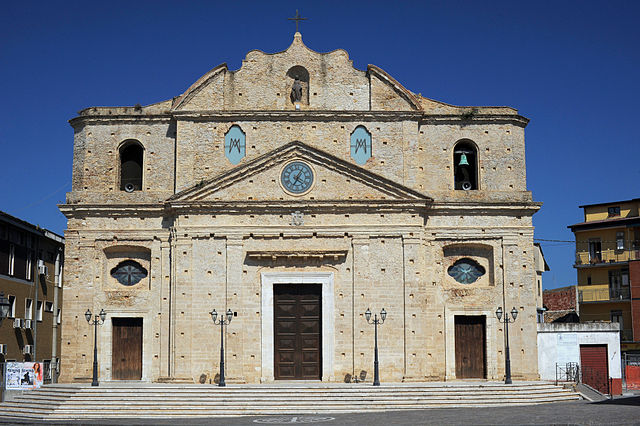
Кротоне (Crotone, Crotone)
.svg)
- коммуна Италии
 Hiking in Кротоне
Crotone, located on the eastern coast of Calabria, Italy, offers a beautiful natural landscape for hiking enthusiasts. The region is characterized by its rugged coastline, rolling hills, and the picturesque Sila National Park, which is nearby. Here are some highlights of hiking in Crotone:
Scenic Routes
-
Sila National Park: This expansive park features a variety of trails that weave through dense forests, pristine lakes, and meadows. You can find routes suitable for all skill levels, from gentle walks to more challenging hikes.
-
Capo Colonna: This coastal area offers trails with stunning views of the Ionian Sea and the ancient ruins of the Temple of Hera Lacinia. A hike here gives you a mix of historical sites and breathtaking coastal scenery.
-
The Aspromonte National Park: A bit further from Crotone, this park boasts steep mountains, spectacular views, and unique geological formations. It’s a great area for more experienced hikers looking for a challenge.
Flora and Fauna
The region around Crotone is rich in biodiversity, with a wide variety of plants and animals. While hiking, you might encounter diverse wildlife and unique Mediterranean flora.
Tips for Hiking in Crotone
- Best Times to Hike: Spring (April to June) and autumn (September to October) are ideal for hiking due to milder temperatures and fewer tourists.
- Preparation: Always carry sufficient water, snacks, appropriate hiking gear, and a map or GPS device. Some trails may not be well-marked.
- Local Guides: Consider hiring a local guide, especially for more remote areas. They can provide insights into the natural and cultural history of the region.
Cultural Aspects
Crotone and the surrounding areas are rich in history and culture, so hike with an eye for historical landmarks, local flora, and regional cuisine. Be sure to take breaks to enjoy the views and the local culinary delights, such as cheeses and cured meats.
Overall, hiking in Crotone provides a blend of natural beauty, historical significance, and cultural richness, making it an excellent destination for outdoor enthusiasts.
- Страна:

- Почтовый код: 88900
- Телефонный код: 0962
- Код автомобильного номера: KR
- Координаты: 39° 5' 0" N, 17° 7' 0" E


- GPS треки (wikiloc): [Ссылка]
- Высота над уровнем моря: 8 м m
- Площадь: 182 кв.км
- Население: 62657
- Веб сайт: http://www.comune.crotone.it
- Википедия русская: wiki(ru)
- Википедия английская: wiki(en)
- Википедия национальная: wiki(it)
- Хранилище Wikidata: Wikidata: Q6681
- Галерея изображений в википедии: [Ссылка]
- Катеория в википедии: [Ссылка]
- код Freebase: [/m/0kyxp]
- код GeoNames: Альт: [6541463]
- код BNF: [12270347q]
- код VIAF: Альт: [153601049]
- ID отношения в OpenStreetMap: [39779]
- код GND: Альт: [4200589-9]
- код LCNAF: Альт: [n80035735]
- место в MusicBrainz: [a7e825b2-d9ee-4bef-b985-f62fbc2acc7e]
- UN/LOCODE: [ITCRV]
- код в энциклопедии «Британника онлайн»: [place/Crotone-Italy]
- код в Большой каталанской энциклопедии: [0020803]
- код в Encyclopædia Universalis: [crotone]
- код Цифрового атласа Римской империи: [16739]
- код NLI: [000978817]
- Nomisma ID: [Crotone-Italy]
- код ISTAT: 101010
- кадастровый код Италии: D122
Граничит с регионами:

Кутро
- коммуна Италии
Hiking in Кутро
Cutro, located in the Calabria region of southern Italy, is not as widely known for hiking as other areas in Italy, but it does offer some beautiful landscapes and opportunities for outdoor activities. Here are a few points to consider if you're looking to hike in and around Cutro:...
- Страна:
- Почтовый код: 88842
- Телефонный код: 0962
- Код автомобильного номера: KR
- Координаты: 39° 2' 3" N, 16° 58' 55" E
- GPS треки (wikiloc): [Ссылка]
- Высота над уровнем моря: 226 м m
- Площадь: 133.69 кв.км
- Население: 10462
- Веб сайт: [Ссылка]


Изола-ди-Капо-Риццуто
- коммуна Италии
Hiking in Изола-ди-Капо-Риццуто
Isola di Capo Rizzuto is a stunning coastal area located in Calabria, Italy, known for its natural beauty, rich history, and diverse ecosystems. Hiking in this region offers a fantastic opportunity to explore its unique landscapes, including coastal cliffs, sandy beaches, and the beautiful Mediterranean vegetation....
- Страна:
- Почтовый код: 88841
- Телефонный код: 0962
- Код автомобильного номера: KR
- Координаты: 38° 58' 0" N, 17° 6' 0" E
- GPS треки (wikiloc): [Ссылка]
- Высота над уровнем моря: 180 м m
- Площадь: 126.65 кв.км
- Население: 17832
- Веб сайт: [Ссылка]
Рокка-ди-Нето
- коммуна Италии
Hiking in Рокка-ди-Нето
Rocca di Neto is a municipality located in the Calabria region of southern Italy, offering a blend of natural beauty and cultural heritage. While it may not be one of the most famous hiking destinations, there are several trails and natural spots in and around the area that can provide a delightful hiking experience....
- Страна:
- Почтовый код: 88821
- Телефонный код: 0962
- Код автомобильного номера: KR
- Координаты: 39° 11' 18" N, 17° 0' 15" E
- GPS треки (wikiloc): [Ссылка]
- Высота над уровнем моря: 180 м m
- Площадь: 44.93 кв.км
- Население: 5681
- Веб сайт: [Ссылка]


Скандале
- коммуна Италии
Hiking in Скандале
Scandale is a lovely area located in the Lake District of England, known for its stunning scenery and diverse hiking opportunities. The region features a mix of breathtaking landscapes, including hills, valleys, and lakes, making it a popular destination for walkers and outdoor enthusiasts....
- Страна:
- Почтовый код: 88831
- Телефонный код: 0962
- Код автомобильного номера: KR
- Координаты: 39° 7' 0" N, 16° 58' 0" E
- GPS треки (wikiloc): [Ссылка]
- Высота над уровнем моря: 350 м m
- Площадь: 54.26 кв.км
- Население: 3100
- Веб сайт: [Ссылка]


Стронголи
- коммуна Италии
Hiking in Стронголи
Strongoli, located in the Calabria region of southern Italy, is surrounded by stunning landscapes that provide excellent opportunities for hiking enthusiasts. This area is characterized by a mix of coastal and mountainous terrains, making it a unique destination for outdoor activities....
- Страна:
- Почтовый код: 88816
- Телефонный код: 0962
- Код автомобильного номера: KR
- Координаты: 39° 16' 0" N, 17° 4' 0" E
- GPS треки (wikiloc): [Ссылка]
- Высота над уровнем моря: 342 м m
- Площадь: 85.56 кв.км
- Население: 6518