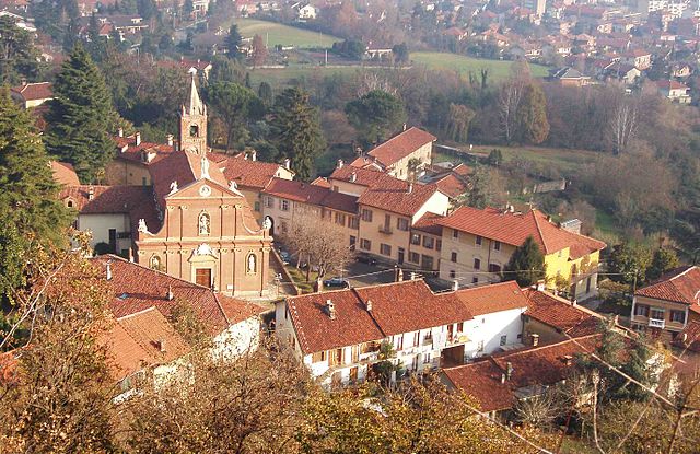
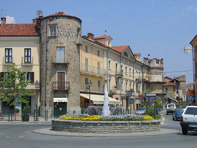
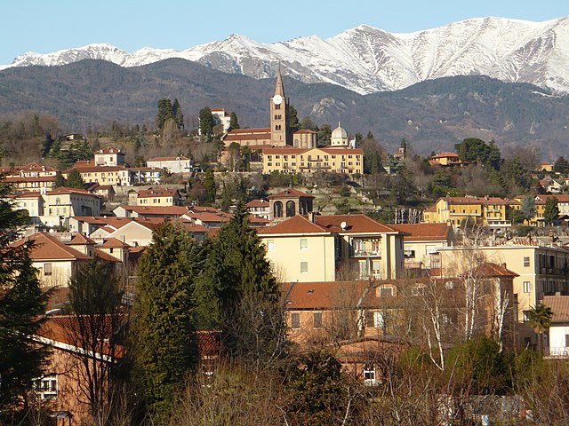
Кумьяна (Cumiana, Cumiana)

- коммуна в регионе Пьемонт, Италия
 Hiking in Кумьяна
Cumiana, located in the Piedmont region of Italy, offers beautiful landscapes and various hiking opportunities set within the backdrop of the Italian Alps. The area boasts a mix of rolling hills, forests, and scenic trails that cater to both beginners and more experienced hikers. Here’s some information to help you explore hiking in Cumiana:
Trails and Routes:
-
Sentiero dei Vigneti: This scenic vineyard trail offers rolling views of the surrounding countryside. This trail is relatively easy and suitable for families or casual walkers.
-
Parco Naturale La Mandria: A short drive from Cumiana, this natural park features marked trails that allow you to explore diverse ecosystems, including forests, meadows, and waterways. It’s a great spot for both hiking and wildlife spotting.
-
Monte Pirchiriano: For those looking for a more challenging hike, Monte Pirchiriano is nearby. The hike provides stunning views of the Susa Valley and the surrounding mountains. It typically takes a few hours to reach the summit.
Points of Interest:
- Abbazia di Santa Maria di Ricetto: This historic abbey can be a rewarding destination on certain hiking routes, adding a cultural element to your hike.
- Local Flora and Fauna: The area is rich in biodiversity, showcasing various plant species and wildlife native to the region.
Tips for Hiking in Cumiana:
- Best Time to Hike: Spring and autumn are ideal for hiking, with pleasant temperatures and beautiful landscapes.
- Trail Maps: Make sure to pick up a local trail map or use a hiking app to stay oriented.
- Gear: Wear appropriate footwear and bring enough water, snacks, and a first aid kit.
- Local Regulations: Be aware of any local regulations regarding hiking, especially in protected areas.
Getting There:
Cumiana is accessible by public transportation or car, and it’s relatively close to larger cities like Turin, making it a feasible day trip for those staying in urban areas.
Overall, Cumiana provides a fantastic opportunity for hiking enthusiasts and nature lovers to explore the beauty of northern Italy. Be sure to respect the environment during your hikes and enjoy the regional charm!
- Страна:

- Почтовый код: 10040
- Телефонный код: 011
- Код автомобильного номера: TO
- Координаты: 44° 59' 0" N, 7° 22' 0" E


- GPS треки (wikiloc): [Ссылка]
- Высота над уровнем моря: 377 м m
- Площадь: 60.73 кв.км
- Население: 7873
- Веб сайт: http://www.comune.cumiana.to.it/
- Википедия русская: wiki(ru)
- Википедия английская: wiki(en)
- Википедия национальная: wiki(it)
- Хранилище Wikidata: Wikidata: Q9328
- Галерея изображений в википедии: [Ссылка]
- Катеория в википедии: [Ссылка]
- код Freebase: [/m/0g6vx2]
- код GeoNames: Альт: [6537273]
- код VIAF: Альт: [154732531]
- ID отношения в OpenStreetMap: [43835]
- WOEID: [714914]
- код TGN: [1044442]
- код ISTAT: 001097
- кадастровый код Италии: D202
Граничит с регионами:

Пьоссаско
- коммуна Италии
Hiking in Пьоссаско
Piossasco, located in the Piedmont region of Italy, offers a variety of hiking opportunities, particularly suitable for those who enjoy exploring beautiful landscapes and nature. Here are some aspects to consider if you're looking to hike in and around Piossasco:...
- Страна:
- Почтовый код: 10045
- Телефонный код: 011
- Код автомобильного номера: TO
- Координаты: 44° 59' 0" N, 7° 28' 0" E
- GPS треки (wikiloc): [Ссылка]
- Высота над уровнем моря: 304 м m
- Площадь: 40.15 кв.км
- Население: 18322
- Веб сайт: [Ссылка]
Пишина
- коммуна Италии
Hiking in Пишина
Piscina, located in the Piedmont region of northern Italy, is a charming destination for hiking enthusiasts. Nestled in the foothills of the Alps, it offers a variety of trails that showcase scenic landscapes, dense forests, and sparkling streams....
- Страна:
- Почтовый код: 10060
- Телефонный код: 0121
- Код автомобильного номера: TO
- Координаты: 44° 55' 0" N, 7° 26' 0" E
- GPS треки (wikiloc): [Ссылка]
- Высота над уровнем моря: 288 м m
- Площадь: 9.9 кв.км
- Население: 3364
- Веб сайт: [Ссылка]


Трана
- коммуна в Италии
Hiking in Трана
Trana, a picturesque area located in Norway, offers a variety of hiking opportunities suitable for different skill levels. Here’s an overview of what you can expect when hiking in Trana:...
- Страна:
- Почтовый код: 10090
- Телефонный код: 011
- Код автомобильного номера: TO
- Координаты: 45° 2' 0" N, 7° 25' 0" E
- GPS треки (wikiloc): [Ссылка]
- Высота над уровнем моря: 372 м m
- Площадь: 16.41 кв.км
- Население: 3861
- Веб сайт: [Ссылка]


Вольвера
- коммуна в Италии
Hiking in Вольвера
Volvera, located in the Piedmont region of Italy, is a charming area that offers a variety of hiking opportunities amid beautiful natural landscapes and historical sites. While it may not be as widely known for hiking as some larger parks or mountains, it still provides several enjoyable trails for outdoor enthusiasts....
- Страна:
- Почтовый код: 10040
- Телефонный код: 011
- Код автомобильного номера: TO
- Координаты: 44° 57' 0" N, 7° 30' 0" E
- GPS треки (wikiloc): [Ссылка]
- Высота над уровнем моря: 251 м m
- Площадь: 20.98 кв.км
- Население: 8675
- Веб сайт: [Ссылка]


Айраска
- коммуна Италии
Hiking in Айраска
Airasca is a small town located in the Piedmont region of Italy, not far from Turin. While it may not be a well-known hiking destination, there are several opportunities for outdoor enthusiasts to enjoy nature in the surrounding areas....
- Страна:
- Почтовый код: 10060
- Телефонный код: 011
- Код автомобильного номера: TO
- Координаты: 44° 55' 0" N, 7° 29' 0" E
- GPS треки (wikiloc): [Ссылка]
- Высота над уровнем моря: 257 м m
- Площадь: 15.74 кв.км
- Население: 3726
- Веб сайт: [Ссылка]


Канталупа
- коммуна Италии
Hiking in Канталупа
Cantalupa, located in the Piedmont region of Italy, offers beautiful landscapes and a variety of hiking opportunities suitable for all levels of hikers. Here are some key points about hiking in and around Cantalupa:...
- Страна:
- Почтовый код: 10060
- Телефонный код: 0121
- Код автомобильного номера: TO
- Координаты: 44° 56' 45" N, 7° 19' 49" E
- GPS треки (wikiloc): [Ссылка]
- Высота над уровнем моря: 459 м m
- Площадь: 11.2 кв.км
- Население: 2613
- Веб сайт: [Ссылка]


Фроссаско
- коммуна Италии
Hiking in Фроссаско
Frossasco, located in the Piedmont region of Italy, is a charming town that offers several great hiking opportunities. Nestled in the foothills of the Italian Alps, it provides access to beautiful natural landscapes and scenic trails. Here are some key points about hiking in and around Frossasco:...
- Страна:
- Почтовый код: 10060
- Телефонный код: 0121
- Код автомобильного номера: TO
- Координаты: 44° 56' 0" N, 7° 21' 0" E
- GPS треки (wikiloc): [Ссылка]
- Высота над уровнем моря: 376 м m
- Площадь: 20.15 кв.км
- Население: 2853
- Веб сайт: [Ссылка]

Джавено
- коммуна Италии
Hiking in Джавено
Giaveno is a picturesque town located in the Susa Valley in the Piedmont region of Italy, known for its stunning natural landscapes, rich history, and a variety of hiking opportunities. Here are some highlights of hiking in the Giaveno area:...
- Страна:
- Почтовый код: 10094
- Телефонный код: 011
- Код автомобильного номера: TO
- Координаты: 45° 2' 0" N, 7° 21' 0" E
- GPS треки (wikiloc): [Ссылка]
- Высота над уровнем моря: 506 м m
- Площадь: 71.74 кв.км
- Население: 16417
- Веб сайт: [Ссылка]


Пинаска
- коммуна Италии
Hiking in Пинаска
Pinasca, located in the Piedmont region of Italy, offers a wonderful experience for hikers and nature enthusiasts. Tucked away at the foot of the mountains, Pinasca provides access to beautiful landscapes, trails, and outdoor activities. Here are some highlights about hiking in this area:...
- Страна:
- Почтовый код: 10060
- Телефонный код: 0121
- Код автомобильного номера: TO
- Координаты: 44° 57' 0" N, 7° 14' 0" E
- GPS треки (wikiloc): [Ссылка]
- Высота над уровнем моря: 560 м m
- Площадь: 34.72 кв.км
- Население: 2964
- Веб сайт: [Ссылка]

Пинероло
- коммуна Италии
Hiking in Пинероло
Pinerolo, located in the Piedmont region of Italy, is surrounded by beautiful mountainous terrain, making it a fantastic destination for hiking enthusiasts. Here are some key points about hiking in Pinerolo:...
- Страна:
- Почтовый код: 10064
- Телефонный код: 0121
- Код автомобильного номера: TO
- Координаты: 44° 53' 0" N, 7° 20' 0" E
- GPS треки (wikiloc): [Ссылка]
- Высота над уровнем моря: 376 м m
- Площадь: 50.34 кв.км
- Население: 35947
- Веб сайт: [Ссылка]