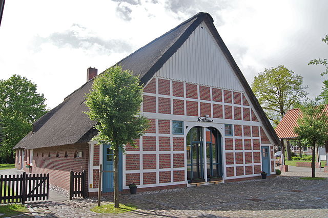
Дюденбюттель (Düdenbüttel, Düdenbüttel)

 Hiking in Дюденбюттель
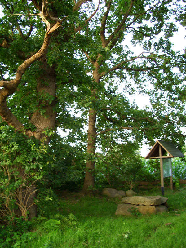
Düdenbüttel, a small village in Lower Saxony, Germany, offers a tranquil environment for hiking enthusiasts, though it may not be as well-known for hiking compared to larger national parks or mountain areas. Here are some key points about hiking in and around Düdenbüttel:
Scenic Routes
- Natural Landscapes: The area is characterized by rural landscapes, including fields, forests, and small waterways. Hiking here allows you to enjoy nature, with plenty of opportunities to observe local flora and fauna.
- Paths and Trails: There may be several local walking paths and trails, often traversing through agricultural lands and wooded areas. It's ideal for leisurely walks rather than challenging hikes.
Nearby Attractions
- Nature Reserves: Consider exploring nearby nature reserves that might offer marked trails and more rugged terrain.
- Cultural Elements: The area may also have historical points of interest, such as traditional farms or local architecture.
Hiking Tips
- Weather: Always check the weather forecast before heading out, as conditions can change quickly.
- Proper Gear: Wear appropriate footwear, carry enough water, and dress in layers to accommodate changing temperatures.
- Local Maps: It’s advisable to have a local map or use GPS on your device, as some trails may not be well-marked.
Community Engagement
- Local Guide Services: Check if there are any local hiking groups or guides that offer walks or hikes, providing insights into the natural surroundings and local history.
Overall, while Düdenbüttel may not be a major hiking destination, it offers a peaceful setting perfect for nature enjoyment and short hikes, especially for those looking for a quiet escape.
- Страна:

- Почтовый код: 21709
- Телефонный код: 04144
- Код автомобильного номера: STD
- Координаты: 53° 35' 28" N, 9° 21' 0" E


- GPS треки (wikiloc): [Ссылка]
- Высота над уровнем моря: 14 м m
- Площадь: 10.18 кв.км
- Население: 981
- Веб сайт: http://www.oldendorf-himmelpforten.de/
- Википедия русская: wiki(ru)
- Википедия английская: wiki(en)
- Википедия национальная: wiki(de)
- Хранилище Wikidata: Wikidata: Q509973
- Катеория в википедии: [Ссылка]
- код Freebase: [/m/02r_gp1]
- код Freebase: [/m/02r_gp1]
- код Freebase: [/m/02r_gp1]
- код Freebase: [/m/02r_gp1]
- код Freebase: [/m/02r_gp1]
- код Freebase: [/m/02r_gp1]
- код GeoNames: Альт: [6552792]
- код GeoNames: Альт: [6552792]
- код GeoNames: Альт: [6552792]
- код GeoNames: Альт: [6552792]
- код GeoNames: Альт: [6552792]
- код GeoNames: Альт: [6552792]
- код VIAF: Альт: [248746682]
- код VIAF: Альт: [248746682]
- код VIAF: Альт: [248746682]
- код VIAF: Альт: [248746682]
- код VIAF: Альт: [248746682]
- код VIAF: Альт: [248746682]
- ID отношения в OpenStreetMap: [444950]
- ID отношения в OpenStreetMap: [444950]
- ID отношения в OpenStreetMap: [444950]
- ID отношения в OpenStreetMap: [444950]
- ID отношения в OpenStreetMap: [444950]
- ID отношения в OpenStreetMap: [444950]
- код GND: Альт: [4784864-9]
- код GND: Альт: [4784864-9]
- код GND: Альт: [4784864-9]
- код GND: Альт: [4784864-9]
- код GND: Альт: [4784864-9]
- код GND: Альт: [4784864-9]
- идентификатор муниципалитетов в Германии: 03359014
- идентификатор муниципалитетов в Германии: 03359014
- идентификатор муниципалитетов в Германии: 03359014
- идентификатор муниципалитетов в Германии: 03359014
- идентификатор муниципалитетов в Германии: 03359014
- идентификатор муниципалитетов в Германии: 03359014
Включает регионы:
Grefenmoor
Hiking in Grefenmoor
Grefenmoor is a beautiful natural area that offers a variety of hiking opportunities, making it a great destination for outdoor enthusiasts. Although it's not one of the most widely known hiking spots, it does have its unique charm and features....
- Страна:
- Почтовый код: 21709
- Координаты: 53° 35' 40" N, 9° 22' 55" E
- GPS треки (wikiloc): [Ссылка]
Weißenmoor
Hiking in Weißenmoor
Weißenmoor, located in Germany, offers a unique hiking experience with its diverse landscapes and natural beauty. If you’re planning a hike there, here are a few things to consider:...
- Страна:
- Почтовый код: 21709
- Координаты: 53° 34' 46" N, 9° 22' 34" E
- GPS треки (wikiloc): [Ссылка]
Граничит с регионами:

Хамма
Hiking in Хамма
Hammah, located in the Al Wusta Governorate of Oman, offers some unique hiking experiences. While not as widely known as other hiking destinations in Oman, Hammah is characterized by its rugged terrain, stunning landscapes, and rich biodiversity....
- Страна:
- Почтовый код: 21714
- Телефонный код: 04144
- Код автомобильного номера: STD
- Координаты: 53° 38' 0" N, 9° 23' 0" E
- GPS треки (wikiloc): [Ссылка]
- Высота над уровнем моря: 8 м m
- Площадь: 29.29 кв.км
- Население: 3102
- Веб сайт: [Ссылка]


Химмельпфортен
Hiking in Химмельпфортен
Himmelpforten is a charming village located in the Lower Saxony region of Germany, surrounded by scenic landscapes that are perfect for hiking enthusiasts. While the village itself may not have extensive hiking trails, it offers access to several nearby nature reserves, forests, and water bodies that provide excellent hiking opportunities....
- Страна:
- Почтовый код: 21709
- Телефонный код: 04144
- Код автомобильного номера: STD
- Координаты: 53° 37' 0" N, 9° 18' 0" E
- GPS треки (wikiloc): [Ссылка]
- Высота над уровнем моря: 6 м m
- Площадь: 18.29 кв.км
- Население: 5263
- Веб сайт: [Ссылка]


Фреденбек
Hiking in Фреденбек
Fredenbeck is a small town located in Lower Saxony, Germany, and while it may not be as widely recognized for hiking as some larger national parks or mountain regions, it offers quaint scenery and opportunities for outdoor activities. Here’s what you can expect when hiking in and around Fredenbeck:...
- Страна:
- Почтовый код: 21717
- Телефонный код: 04149
- Код автомобильного номера: STD
- Координаты: 53° 31' 33" N, 9° 24' 26" E
- GPS треки (wikiloc): [Ссылка]
- Высота над уровнем моря: 10 м m
- Площадь: 48.62 кв.км
- Население: 6018
- Веб сайт: [Ссылка]

Хайнбоккель
Hiking in Хайнбоккель
Heinbockel is a small village located in Lower Saxony, Germany. While it may not be the most widely recognized hiking destination, the surrounding areas often offer picturesque landscapes and various trails for outdoor enthusiasts....
- Страна:
- Почтовый код: 21726
- Телефонный код: 04149; 04144
- Код автомобильного номера: STD
- Координаты: 53° 35' 0" N, 9° 20' 0" E
- GPS треки (wikiloc): [Ссылка]
- Высота над уровнем моря: 15 м m
- Площадь: 22.7 кв.км
- Население: 1414
- Веб сайт: [Ссылка]


Штаде
- город в Германии, в земле Нижняя Саксония
Hiking in Штаде
Stade is a picturesque town in Lower Saxony, Germany, with a rich maritime history and beautiful surroundings. While Stade itself may not be a well-known hiking destination, it is located near several natural areas and parks that offer hiking opportunities. Here are some aspects to consider for hiking in and around Stade:...
- Страна:
- Почтовый код: 21684; 21683; 21682; 21680
- Телефонный код: 04141
- Код автомобильного номера: STD
- Координаты: 53° 36' 3" N, 9° 28' 35" E
- GPS треки (wikiloc): [Ссылка]
- Высота над уровнем моря: 9 м m
- Площадь: 110.04 кв.км
- Население: 46378
- Веб сайт: [Ссылка]