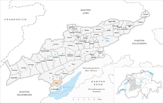
Дьесс (Diesse, Diesse)

 Hiking in Дьесс
Diesse, situated in the Jura Mountains region of Switzerland, offers some fantastic hiking opportunities with stunning landscapes, diverse flora and fauna, and picturesque views of the surrounding mountains and valleys.
Hiking Trails
-
Variety of Trails: Diesse features a variety of trails suitable for different skill levels, ranging from easy walks to challenging hikes. The trails typically lead through lush forests, past charming farms, and provide access to impressive viewpoints.
-
Moint Tendre: A popular hike in the area is to Mont Tendre, the highest point in the Jura Mountains. The trail to this summit is moderately challenging and rewards hikers with breathtaking panoramic views.
-
Naturally Scenic: Hikes around Diesse often include beautiful meadows, dense woods, and the opportunity to spot local wildlife, such as deer, hares, and various bird species. The region is particularly beautiful in spring and summer when wildflowers bloom.
Practical Considerations
- Weather: Always check the weather before heading out, as conditions can change rapidly in mountain areas.
- Gear: Wear sturdy hiking boots, and dress in layers to manage temperature changes during your hike. Additionally, bring plenty of water and snacks.
- Navigation: Make sure to have a map or GPS device, as some trails may be less marked than in more tourist-heavy areas.
Local Tips
- Cultural Experience: Be open to experiencing the local culture and traditions. You may encounter local farms where you can sample regional cheese or other products.
- Respect Nature: As always, practice Leave No Trace principles to preserve the beauty of the natural environment.
If you're planning a trip, consider checking in with a local hiking group or tourism office for additional resources, guided hikes, or up-to-date information on trail conditions. Happy hiking in Diesse!
- Страна:

- Почтовый код: 2517
- Телефонный код: 032
- Код автомобильного номера: BE
- Координаты: 47° 6' 55" N, 7° 7' 5" E


- GPS треки (wikiloc): [Ссылка]
- Высота над уровнем моря: 838 м m
- Площадь: 9.44 кв.км
- Веб сайт: http://www.diesse.ch
- Википедия русская: wiki(ru)
- Википедия английская: wiki(en)
- Википедия национальная: wiki(de)
- Хранилище Wikidata: Wikidata: Q66837
- Катеория в википедии: [Ссылка]
- код Freebase: [/m/07nmb0]
- код GeoNames: Альт: [2661017]
- ID отношения в OpenStreetMap: [1682422]
- код GND: Альт: [4657298-3]
- идентификатор HDS: [429]
- код швейцарского муниципалитета: [0721]
Граничит с регионами:


Ламбуэн
Hiking in Ламбуэн
Lamboing, located in Switzerland, is known for its picturesque landscapes and offers several hiking opportunities amidst breathtaking scenery. Here are some highlights for hiking in the Lamboing area:...
- Страна:
- Почтовый код: 2516
- Телефонный код: 032
- Код автомобильного номера: BE
- Координаты: 47° 7' 4" N, 7° 8' 10" E
- GPS треки (wikiloc): [Ссылка]
- Высота над уровнем моря: 820 м m
- Площадь: 9.1 кв.км
- Веб сайт: [Ссылка]


Нодс
Hiking in Нодс
Hiking in Nods, Switzerland, offers a unique experience surrounded by picturesque landscapes and a serene atmosphere. Nods is a small village located in the Jura region, known for its rolling hills, dense forests, and beautiful meadows....
- Страна:
- Почтовый код: 2518
- Телефонный код: 032
- Код автомобильного номера: BE
- Координаты: 47° 6' 55" N, 7° 4' 55" E
- GPS треки (wikiloc): [Ссылка]
- Высота над уровнем моря: 885 м m
- Площадь: 26.7 кв.км
- Население: 761
- Веб сайт: [Ссылка]

Prêles
Hiking in Prêles
Prêles is a charming village located in the beautiful region of the Bernese Jura in Switzerland. It offers fantastic opportunities for hiking enthusiasts, with its stunning landscapes, rich flora and fauna, and panoramic views of the surrounding mountains and valleys....
- Страна:
- Почтовый код: 2515
- Телефонный код: 032
- Код автомобильного номера: BE
- Координаты: 47° 6' 0" N, 7° 8' 0" E
- GPS треки (wikiloc): [Ссылка]
- Высота над уровнем моря: 822 м m
- Площадь: 6.98 кв.км
- Веб сайт: [Ссылка]