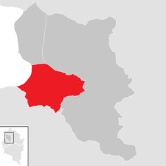
Дорнбирн (Dornbirn District, Bezirk Dornbirn)
 Hiking in Дорнбирн
Dornbirn District, located in the western part of Austria, is a beautiful region known for its stunning landscapes, diverse hiking trails, and outdoor activities. Situated at the northern edge of the Alps, it offers a mix of mountainous terrain, lush valleys, and scenic views of the Rhine Valley and Lake Constance.
Hiking Highlights in Dornbirn District:
-
Variety of Trails: The district offers a range of hiking trails suitable for all skill levels, from leisurely walks to challenging alpine hikes. Popular trails include the "Dornbirner Ach" path along the river and the more demanding walks up to the mountain peaks.
-
Karren Mountain: A prominent peak near Dornbirn, Karren can be reached via a well-marked hiking trail. The summit offers breathtaking panoramic views of the surrounding mountains and Lake Constance. There is also a cable car for those who prefer a less strenuous ascent.
-
Inatura: Although primarily a natural history museum, Inatura offers lovely nature trails nearby, where you can learn about the local flora and fauna while enjoying a hike.
-
Bodensee-Runde: The Bodensee (Lake Constance) circuit is a famous long-distance hiking route that runs around the lake, offering beautiful scenery and charming villages, with several access points in the Dornbirn area.
-
Schwarzer See: This picturesque mountain lake is a great hiking destination. The trail around it is a popular option for families and those looking for a scenic yet manageable route. The area is perfect for picnics and enjoying the peaceful surroundings.
-
Nature and Wildlife: The area boasts rich biodiversity, making it an excellent destination for nature lovers. While hiking, keep an eye out for local wildlife, including deer and various bird species.
-
Guided Hikes and Tours: If you're new to hiking or the area, consider joining a guided hike. Local guides can provide insights into the geography, geology, and history of the region.
Tips for Hiking in Dornbirn District:
- Weather: Always check the weather before heading out, as conditions can change rapidly in mountainous areas.
- Gear: Wear sturdy hiking boots and dress in layers to adjust to temperature changes throughout your hike.
- Maps and Signage: Many trails are well-marked, but it's always a good idea to carry a map or download a hiking app for navigation.
- Stay Hydrated: Bring plenty of water and snacks, especially for longer hikes.
- Respect Nature: Stay on marked paths, follow any local regulations, and leave no trace to protect the natural environment.
Dornbirn District is an excellent choice for hiking enthusiasts, offering a blend of natural beauty and well-maintained trails. Enjoy your hiking adventure there!
- Страна:

- Столица: Дорнбирн
- Код автомобильного номера: DO
- Координаты: 47° 25' 0" N, 9° 45' 0" E


- GPS треки (wikiloc): [Ссылка]
- Высота над уровнем моря: 956 м m
- Площадь: 172.37 кв.км
- Население: 86272
- Веб сайт: http://www.vorarlberg.at/bhdornbirn
- Википедия русская: wiki(ru)
- Википедия английская: wiki(en)
- Википедия национальная: wiki(de)
- Хранилище Wikidata: Wikidata: Q698581
- Катеория в википедии: [Ссылка]
- Карты в википедии: [Ссылка]
- код Freebase: [/m/06tm9b]
- код GeoNames: Альт: [2780740]
- код VIAF: Альт: [147749948]
- код GND: Альт: [4996733-2]
- идентификатор местоположения ArchINFORM: [14612]
- код LCNAF: Альт: [n80148149]
Включает регионы:


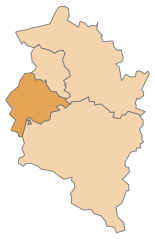
Дорнбирн
Hiking in Дорнбирн
Dornbirn, located in the Vorarlberg region of Austria, is a fantastic destination for hiking enthusiasts due to its stunning landscapes and proximity to the Alps. Here are some key highlights about hiking in and around Dornbirn:...
- Страна:
- Почтовый код: 6850
- Телефонный код: 05572
- Код автомобильного номера: DO
- Координаты: 47° 25' 0" N, 9° 45' 0" E
- GPS треки (wikiloc): [Ссылка]
- Высота над уровнем моря: 437 м m
- Площадь: 120.97 кв.км
- Население: 48067
- Веб сайт: [Ссылка]


Лустенау
Hiking in Лустенау
Lustenau, located in Austria near the border with Switzerland and Germany, offers a variety of beautiful hiking opportunities. The region is characterized by its stunning landscapes, including rolling hills, lush forests, and proximity to Lake Constance. Here are some highlights and tips for hiking in the Lustenau area:...
- Страна:
- Почтовый код: 6893; 6890
- Телефонный код: 05577
- Код автомобильного номера: DO
- Координаты: 47° 25' 38" N, 9° 40' 16" E
- GPS треки (wikiloc): [Ссылка]
- Высота над уровнем моря: 404 м m
- Площадь: 22.55 кв.км
- Население: 22821
- Веб сайт: [Ссылка]

Хоэнэмс
Hiking in Хоэнэмс
Hohenems is a charming town located in the Vorarlberg region of Austria, surrounded by the beautiful landscapes of the Alps. Hiking in and around Hohenems offers a variety of trails suitable for all skill levels, from easy walks to challenging mountain hikes. Here are some aspects to consider when hiking in this area:...
- Страна:
- Почтовый код: 6845
- Телефонный код: 05576
- Код автомобильного номера: DO
- Координаты: 47° 22' 0" N, 9° 40' 0" E
- GPS треки (wikiloc): [Ссылка]
- Высота над уровнем моря: 432 м m
- Площадь: 29.18 кв.км
- Население: 16317
- Веб сайт: [Ссылка]
Граничит с регионами:

Фельдкирх
Hiking in Фельдкирх
Feldkirch District, located in the western part of Austria, is known for its stunning landscapes, rich history, and diverse hiking trails. Nestled at the foot of the Alps and bordered by Switzerland and Liechtenstein, this area offers a wide range of hiking opportunities suitable for different skill levels....
- Страна:
- Столица: Фельдкирх
- Код автомобильного номера: FK
- Координаты: 47° 16' 44" N, 9° 39' 50" E
- GPS треки (wikiloc): [Ссылка]
- Высота над уровнем моря: 450 м m
- Площадь: 278.26 кв.км
- Население: 104048
- Веб сайт: [Ссылка]

Брегенц
Hiking in Брегенц
Bregenz District, located in the western part of Austria in the state of Vorarlberg, offers a variety of stunning hiking opportunities, thanks to its diverse landscapes that include lakes, mountains, and picturesque villages. Here are some highlights and tips for hiking in this beautiful region:...
- Страна:
- Столица: Брегенц
- Код автомобильного номера: B
- Координаты: 47° 24' 0" N, 10° 0' 0" E
- GPS треки (wikiloc): [Ссылка]
- Высота над уровнем моря: 771 м m
- Площадь: 863.34 кв.км
- Население: 131350
- Веб сайт: [Ссылка]