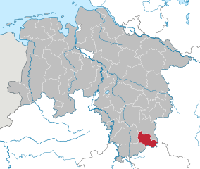
Айхсфельд (Eichsfeld, Landkreis Eichsfeld)

- район земли Тюрингия, Германия
 Hiking in Айхсфельд
Eichsfeld is a picturesque district located in the central part of Germany, primarily in the state of Thuringia, with some areas extending into Lower Saxony. This region is characterized by rolling hills, dense forests, and beautiful landscapes, making it an excellent destination for hiking enthusiasts.
Key Hiking Areas
-
Hainich National Park:
- This UNESCO World Heritage Site is home to extensive beech forests and diverse wildlife. The park offers numerous hiking trails, including the popular "Hainich Trail," which allows hikers to experience the unique flora and fauna of the region.
-
Thuringian Forest:
- Adjacent to Eichsfeld, this mountain range has alpine-like scenery and well-marked hiking paths, such as the famous Rennsteig Trail. Although the Rennsteig itself is mostly outside Eichsfeld, the surrounding areas offer plenty of access points.
-
Eichsfeld-Hainich Nature Park:
- The nature park features well-maintained trails that guide hikers through scenic landscapes, quaint villages, and historical sites. Trails vary in difficulty, providing options for all levels of hikers.
-
Mühlhausen:
- The historic town of Mühlhausen is a great starting point for various hiking paths. Trails from here can lead you to scenic viewpoints, historical ruins, and quaint countryside.
Hiking Trails
- Regional Trails: The Eichsfeld district has a network of regional hiking trails, many of which are well-marked. Look for the signposts indicating "Eichsfeld-Weg" or "Rundwanderweg" for circular routes.
- Long-Distance Trails: The "Lutherweg" and parts of the "Leiser Bergweg" provide opportunities for longer hikes that combine nature and cultural experiences.
Nature and Wildlife
Eichsfeld’s diverse ecosystems include forests, grasslands, and wetlands, which are home to various wildlife species. Birdwatching and observing butterflies can enhance your hiking experience.
Practical Tips
- Trail Conditions: Always check local trail conditions before heading out, particularly in wetter months when paths can become muddy.
- Weather: Be prepared for changing weather conditions, as the region can experience rapid shifts. Dress in layers and carry rain gear.
- Navigation: While many trails are well-marked, carrying a map or using a GPS app can be helpful, especially on more remote paths.
- Safety: Make sure to inform someone about your hiking plans, especially if venturing into less-traveled areas.
Conclusion
With its natural beauty and well-developed hiking infrastructure, Eichsfeld is a fantastic location for anyone looking to explore the German countryside on foot. Remember to respect nature, stay on marked paths, and always leave no trace. Enjoy your adventure in this beautiful region!
- Страна:

- Код автомобильного номера: WBS; HIG; EIC
- Координаты: 51° 19' 48" N, 10° 15' 0" E


- GPS треки (wikiloc): [Ссылка]
- Высота над уровнем моря: 438 м m
- Площадь: 943.07 кв.км
- Население: 101325
- Веб сайт: http://www.kreis-eic.de/
- Википедия русская: wiki(ru)
- Википедия английская: wiki(en)
- Википедия национальная: wiki(de)
- Хранилище Wikidata: Wikidata: Q7861
- Катеория в википедии: [Ссылка]
- Карты в википедии: [Ссылка]
- код Freebase: [/m/01m1j9]
- код GeoNames: Альт: [6547387]
- код BNF: [14543488g]
- код VIAF: Альт: [167784901]
- ID отношения в OpenStreetMap: [62500]
- код GND: Альт: [4413119-7]
- идентификатор местоположения ArchINFORM: [11066]
- код LCNAF: Альт: [n2002103036]
- код NUTS: [DEG06]
- код BabelNet: [01918821n]
- код района Германии: 16061
Граничит с регионами:

Остероде
Hiking in Остероде
Osterode, located in the Lower Saxony region of Germany, offers a variety of hiking opportunities, particularly given its picturesque landscapes and proximity to the Harz Mountains. Here are some key points to consider for hiking in the Osterode district:...
- Страна:
- Код автомобильного номера: OHA
- Координаты: 51° 40' 12" N, 10° 19' 48" E
- GPS треки (wikiloc): [Ссылка]
- Высота над уровнем моря: 505 м m
- Площадь: 636.00 кв.км
- Население: 75245
- Веб сайт: [Ссылка]