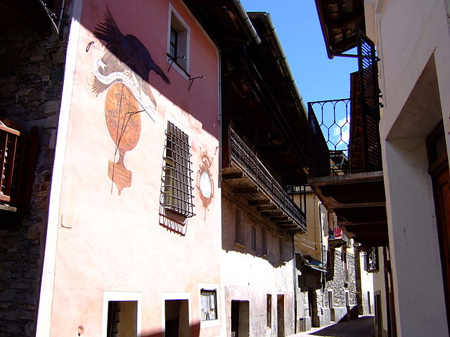
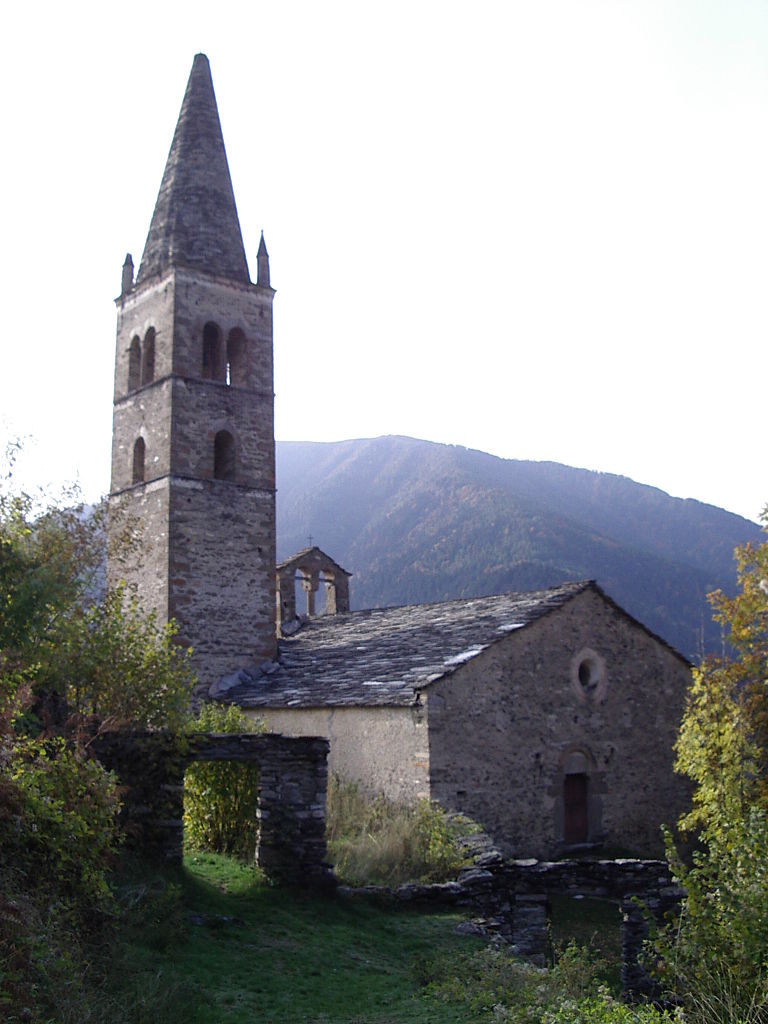
Эльва (Elva, Elva)
- коммуна Италии
 Hiking in Эльва
Elva, a picturesque village situated in the Piedmont region of Italy, is an excellent destination for hiking enthusiasts. Nestled in the Valle Maira, Elva offers stunning landscapes, diverse trails, and a rich cultural heritage. Here are some key points about hiking in and around Elva:
Trails and Scenery
-
Diverse Terrain: The region features a mix of alpine meadows, forests, rocky paths, and panoramic mountain views. Hikers can explore routes that vary in difficulty, from beginner-friendly paths to challenging mountain ascents.
-
Valle Maira Trails: Elva is part of the extensive Valle Maira hiking network, which includes several marked trails. The scenic routes often lead to breathtaking viewpoints, waterfalls, and charming alpine huts.
-
Signposted Trails: Trails are typically well-marked with signs indicating distances and difficulty levels. Maps are available at local tourist offices, or you may consider downloading GPS tracks for navigation.
Popular Hiking Routes
-
Elva - Lago di Elva: This trail takes you from the village to the beautiful Lago di Elva, offering stunning lake views surrounded by mountains. It's a moderate hike, perfect for a half-day adventure.
-
Sentiero del Fiume Maira: A lovely path that follows the Maira River, showcasing the area's natural beauty and diverse flora and fauna.
-
Monte Gendarme: For those looking for a more challenging hike, this trail leads to one of the surrounding peaks, providing breathtaking views of the entire valley and surrounding mountains.
Tips for Hiking in Elva
-
Season: The best time for hiking in Elva is typically from late spring to early autumn (May to September) when the weather is milder, and trails are more accessible.
-
Gear: Good hiking boots, trekking poles, and weather-appropriate clothing are essential. Even in summer, temperatures can vary, especially at higher altitudes.
-
Hydration and Snacks: Always carry enough water and some energy snacks, as some trails may have limited access to facilities.
-
Local Knowledge: If you're unfamiliar with the area or want expert advice, consider joining a guided hike. Local guides can provide insights into the area’s history, flora, and fauna.
Cultural Aspects
Elva is known for its rich traditions and local cuisine. After a day of hiking, you can enjoy delicious local dishes in one of the village’s restaurants, highlighting the flavors of Piedmont.
Hiking in Elva offers a combination of adventure, stunning scenery, and cultural experiences that can make for an unforgettable outdoor getaway. Whether you’re an experienced hiker or a beginner, you’ll find plenty to explore and enjoy in this beautiful part of Italy!
- Страна:

- Почтовый код: 12020
- Телефонный код: 0171
- Код автомобильного номера: CN
- Координаты: 44° 32' 0" N, 7° 5' 0" E


- GPS треки (wikiloc): [Ссылка]
- Высота над уровнем моря: 1637 м m
- Площадь: 26.22 кв.км
- Население: 94
- Веб сайт: http://www.comune.elva.cn.it/
- Википедия русская: wiki(ru)
- Википедия английская: wiki(en)
- Википедия национальная: wiki(it)
- Хранилище Wikidata: Wikidata: Q18208
- код Freebase: [/m/0gb9h2]
- код GeoNames: Альт: [6536068]
- ID отношения в OpenStreetMap: [43288]
- WOEID: [22745710]
- код темы Quora: [Elva]
- код ISTAT: 004083
- кадастровый код Италии: D401
Граничит с регионами:

Беллино
- коммуна Италии
Hiking in Беллино
Bellino is a picturesque village located in the Susa Valley of the Piedmont region in northern Italy. It’s known for its stunning landscapes, rich culture, and outdoor activities, making it a fantastic destination for hiking enthusiasts....
- Страна:
- Почтовый код: 12020
- Телефонный код: 0175
- Код автомобильного номера: CN
- Координаты: 44° 35' 0" N, 7° 2' 0" E
- GPS треки (wikiloc): [Ссылка]
- Высота над уровнем моря: 1576 м m
- Площадь: 62.07 кв.км
- Население: 103
- Веб сайт: [Ссылка]
Кастельдельфино
- коммуна Италии
Hiking in Кастельдельфино
Casteldelfino is a charming village located in the Piedmont region of Italy, specifically in the Susa Valley near the borders of France. This picturesque area offers various hiking opportunities for outdoor enthusiasts looking to explore the stunning natural landscapes of the Italian Alps....
- Страна:
- Почтовый код: 12020
- Телефонный код: 0175
- Код автомобильного номера: CN
- Координаты: 44° 35' 26" N, 7° 4' 15" E
- GPS треки (wikiloc): [Ссылка]
- Высота над уровнем моря: 1296 м m
- Площадь: 33.95 кв.км
- Население: 152
- Веб сайт: [Ссылка]
Праццо
- коммуна Италии
Hiking in Праццо
Prazzo is a charming alpine village located in the Piedmont region of Italy, near the French border. It is nestled within the beautiful natural landscape of the Valle Maira, which is known for its stunning scenery, rich biodiversity, and traditional culture....
- Страна:
- Почтовый код: 12028
- Телефонный код: 0171
- Код автомобильного номера: CN
- Координаты: 44° 29' 0" N, 7° 3' 0" E
- GPS треки (wikiloc): [Ссылка]
- Высота над уровнем моря: 1030 м m
- Площадь: 52.39 кв.км
- Население: 167
- Веб сайт: [Ссылка]

Сампере
- коммуна Италии
Hiking in Сампере
Sampeyre is a picturesque village located in the Piedmont region of Italy, specifically in the Cuneo province. It is nestled in the beautiful valleys of the upper Varaita, surrounded by the stunning peaks of the Maritime Alps. The area is a fantastic destination for hiking enthusiasts, offering a variety of trails that cater to different skill levels—from leisurely walks to more challenging treks....
- Страна:
- Почтовый код: 12020
- Телефонный код: 0175
- Код автомобильного номера: CN
- Координаты: 44° 35' 0" N, 7° 11' 0" E
- GPS треки (wikiloc): [Ссылка]
- Высота над уровнем моря: 998 м m
- Площадь: 98.91 кв.км
- Население: 1003
- Веб сайт: [Ссылка]
Строппо
- коммуна Италии
Hiking in Строппо
Stroppo is a charming hamlet located in the Piedmont region of Italy, nestled within the impressive Varaita Valley in the Cuneo province. The area offers a variety of hiking opportunities, ranging from easy walks to more challenging trails, making it ideal for both novice hikers and seasoned trekkers....
- Страна:
- Почтовый код: 12020
- Телефонный код: 0171
- Код автомобильного номера: CN
- Координаты: 44° 30' 0" N, 7° 8' 0" E
- GPS треки (wikiloc): [Ссылка]
- Высота над уровнем моря: 1087 м m
- Площадь: 28.1 кв.км
- Население: 106
- Веб сайт: [Ссылка]