
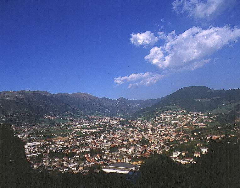
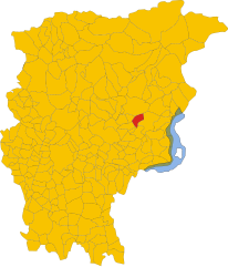
Эндине-Гаяно (Endine Gaiano, Endine Gaiano)
.svg)
- коммуна Италии
 Hiking in Эндине-Гаяно
Endine Gaiano is a lovely town located in the province of Bergamo in Italy, situated near the shores of Lake Endine. The area is known for its picturesque landscapes, charming villages, and outdoor recreational opportunities, making it a great destination for hiking enthusiasts.
Hiking Trails:
-
Lake Endine Loop: One of the most popular trails is the loop around Lake Endine, which offers stunning views of the water, local fauna, and flora. It's accessible for all skill levels, making it a family-friendly option.
-
Monte Misma: For more experienced hikers, the trails leading up to Monte Misma present a bit of a challenge. The ascent rewards hikers with panoramic views of the surrounding valleys, mountains, and Lake Endine.
-
Val Cavallina: There are numerous trails in the nearby Val Cavallina area, which is characterized by rolling hills, wooded areas, and quaint villages. This region offers a mix of easy and moderate trails that can cater to various hiking preferences.
Tips for Hiking in Endine Gaiano:
-
Weather: Check the weather forecast before heading out, as conditions can change quickly, especially in mountainous areas. The best time for hiking is typically in the spring and early autumn when temperatures are milder.
-
Equipment: Wear sturdy hiking shoes and bring sufficient water and snacks. A map or GPS device is also recommended, as some trails may not be well marked.
-
Wildlife: Keep an eye out for local wildlife, and remember to respect their habitats. Taking photographs is encouraged, but maintain a safe distance.
-
Local Culture: Take time to explore the small villages and sample local cuisine. The area is known for its rich food culture, including cheeses and wines from the region.
-
Leave No Trace: Always remember to carry out what you bring in. Leave the trails as you found them to preserve the natural beauty for others.
With beautiful landscapes and a variety of trails to choose from, Endine Gaiano is an excellent destination for hiking and connecting with nature. Whether you're new to hiking or an experienced adventurer, there's something for everyone in this beautiful part of Italy.
- Страна:

- Почтовый код: 24060
- Телефонный код: 035
- Код автомобильного номера: BG
- Координаты: 45° 47' 0" N, 9° 58' 0" E


- GPS треки (wikiloc): [Ссылка]
- Высота над уровнем моря: 400 м m
- Площадь: 21.07 кв.км
- Население: 3460
- Веб сайт: http://www.comune.endine-gaiano.bg.it
- Википедия русская: wiki(ru)
- Википедия английская: wiki(en)
- Википедия национальная: wiki(it)
- Хранилище Wikidata: Wikidata: Q101036
- Галерея изображений в википедии: [Ссылка]
- Катеория в википедии: [Ссылка]
- код Freebase: [/m/0gjb0s]
- код GeoNames: Альт: [6540177]
- ID отношения в OpenStreetMap: [46040]
- место в MusicBrainz: [8aa8d594-4b7c-45ce-8ae2-80496aac2521]
- UN/LOCODE: [ITEND]
- код ISTAT: 016093
- кадастровый код Италии: D406
Граничит с регионами:


Фонтено
- коммуна Италии
Hiking in Фонтено
Fonteno is a charming town located in the province of Bergamo in Italy, perched on the hills overlooking Lake Iseo. It offers a variety of hiking opportunities that cater to different skill levels and preferences. Here are some highlights and tips for hiking in the Fonteno area:...
- Страна:
- Почтовый код: 24060
- Телефонный код: 035
- Код автомобильного номера: BG
- Координаты: 45° 46' 0" N, 10° 1' 0" E
- GPS треки (wikiloc): [Ссылка]
- Высота над уровнем моря: 606 м m
- Площадь: 10.93 кв.км
- Население: 583
- Веб сайт: [Ссылка]

Гандино
- коммуна Италии
Hiking in Гандино
Gandino is a charming village located in the province of Bergamo, Lombardy, Italy. Nestled in the Seriana Valley and surrounded by stunning mountain landscapes, it offers a variety of hiking opportunities for outdoor enthusiasts. Here are some key aspects to consider when hiking in Gandino:...
- Страна:
- Почтовый код: 24024
- Телефонный код: 035
- Код автомобильного номера: BG
- Координаты: 45° 48' 42" N, 9° 54' 11" E
- GPS треки (wikiloc): [Ссылка]
- Высота над уровнем моря: 553 м m
- Площадь: 29.03 кв.км
- Население: 5390
- Веб сайт: [Ссылка]


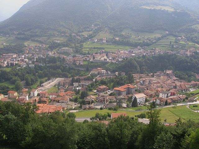
Монастероло-дель-Кастелло
- коммуна Италии
Hiking in Монастероло-дель-Кастелло
Monasterolo del Castello is a beautiful village located in the province of Bergamo in northern Italy, nestled in the foothills of the Alps and near the shores of Lake Endine. This scenic area offers a range of hiking opportunities suitable for various skill levels, providing stunning views of the lake, surrounding mountains, and lush landscapes....
- Страна:
- Почтовый код: 24060
- Телефонный код: 035
- Код автомобильного номера: BG
- Координаты: 45° 46' 0" N, 9° 56' 0" E
- GPS треки (wikiloc): [Ссылка]
- Высота над уровнем моря: 365 м m
- Площадь: 8.75 кв.км
- Население: 1147
- Веб сайт: [Ссылка]

Ранцанико
- коммуна Италии
Hiking in Ранцанико
Ranzanico is a small town located in the province of Bergamo in the Lombardy region of Italy. Nestled near the shores of Lake Endine and surrounded by the picturesque landscapes of the Italian Alps, Ranzanico offers various hiking opportunities that cater to different skill levels....
- Страна:
- Почтовый код: 24060
- Телефонный код: 035
- Код автомобильного номера: BG
- Координаты: 45° 47' 0" N, 9° 56' 0" E
- GPS треки (wikiloc): [Ссылка]
- Высота над уровнем моря: 519 м m
- Площадь: 7.21 кв.км
- Население: 1230
- Веб сайт: [Ссылка]


Сольто-Коллина
- коммуна Италии
Hiking in Сольто-Коллина
Solto Collina is a charming destination located near Lake Iseo in Italy, offering a variety of hiking opportunities amidst beautiful landscapes, lush greenery, and panoramic views of the lake and surrounding mountains....
- Страна:
- Почтовый код: 24060
- Телефонный код: 035
- Код автомобильного номера: BG
- Координаты: 45° 47' 0" N, 10° 1' 0" E
- GPS треки (wikiloc): [Ссылка]
- Высота над уровнем моря: 449 м m
- Площадь: 11.76 кв.км
- Население: 1799
- Веб сайт: [Ссылка]

Совере
- коммуна Италии
Hiking in Совере
Sovere, located in the Province of Bergamo in northern Italy, is surrounded by beautiful landscapes and offers a variety of hiking opportunities. Nestled in the foothills of the Alps and near Lake Iseo, the area features diverse terrain ranging from gentle hills to more challenging mountain trails....
- Страна:
- Почтовый код: 24060
- Телефонный код: 035
- Код автомобильного номера: BG
- Координаты: 45° 49' 0" N, 10° 2' 0" E
- GPS треки (wikiloc): [Ссылка]
- Высота над уровнем моря: 479 м m
- Площадь: 18.02 кв.км
- Население: 5319
- Веб сайт: [Ссылка]