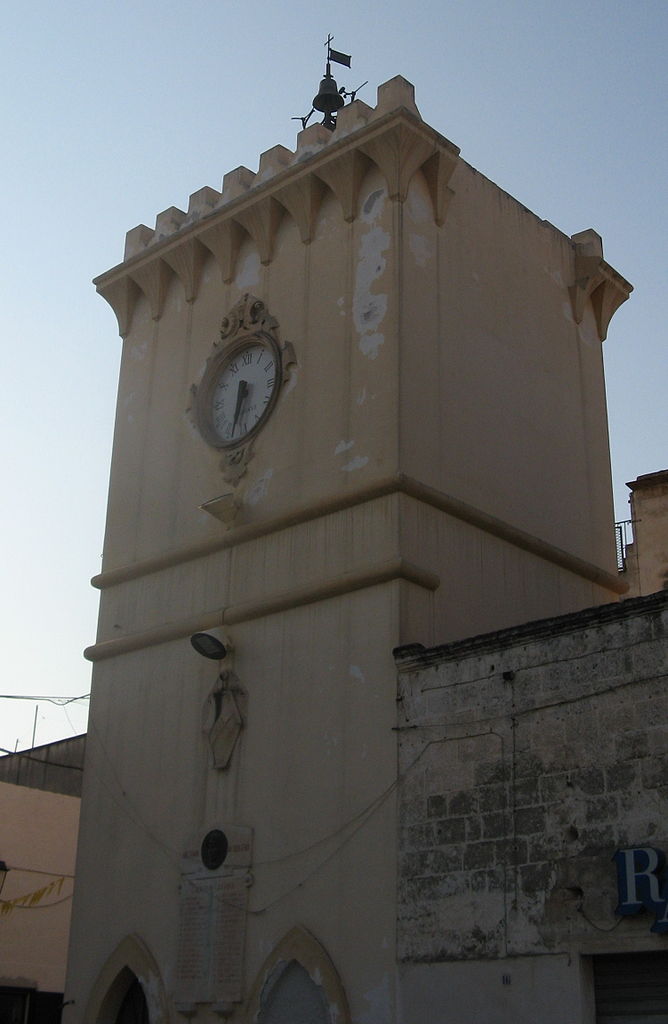
Эркье (Erchie, Erchie)
.svg)
- коммуна Италии
 Hiking in Эркье
Erchie is a picturesque village located on the Amalfi Coast in Italy, nestled between the mountains and the sea. It offers stunning views, charming landscapes, and opportunities for hiking enthusiasts.
Hiking Opportunities:
-
Path of the Gods (Sentiero degli Dei):
- This is one of the most famous hiking trails in the Amalfi Coast, stretching from Bomerano to Nocelle. Although it doesn't start directly in Erchie, it's easily accessible from nearby areas. The trail offers breathtaking views of the coastline and is moderately challenging.
-
Valle delle Ferriere:
- Another nearby hiking opportunity is the Valle delle Ferriere, a natural reserve located above Amalfi. The trail takes you through lush vegetation and leads to waterfalls and ancient ruins.
-
Local Trails:
- Erchie itself has several local paths that descend toward the sea or wind through the nearby hills. These trails provide a more peaceful experience, allowing hikers to explore the beautiful Mediterranean flora and fauna.
Tips for Hiking in Erchie:
- Footwear: Wear comfortable and sturdy hiking boots, as some trails can be rocky and steep.
- Hydration: Carry enough water, especially during the hotter months, as some trails may not have sources of water.
- Weather: Check the weather forecast before heading out, due to the potential for sudden changes in conditions.
- Route Maps: Consider downloading maps or using a hiking app, as some trails may not be well-marked.
- Local Guidance: If you're unsure about trails, consider hiring a local guide for an enhanced experience.
Additional Activities:
Erchie’s beautiful beaches and charming community also offer opportunities for relaxation and exploration after a hike. Make sure to enjoy some local Italian cuisine at a nearby trattoria and take in the stunning coastal views.
Whether you are an experienced hiker or just looking for a scenic walk, Erchie and the surrounding Amalfi Coast provide ample opportunities to immerse yourself in nature and the stunning landscapes of this UNESCO World Heritage site.
- Страна:

- Почтовый код: 72020
- Телефонный код: 0831
- Код автомобильного номера: BR
- Координаты: 40° 26' 10" N, 17° 44' 10" E


- GPS треки (wikiloc): [Ссылка]
- Высота над уровнем моря: 68 м m
- Площадь: 44.63 кв.км
- Население: 8671
- Веб сайт: http://www.comune.erchie.br.it
- Википедия русская: wiki(ru)
- Википедия английская: wiki(en)
- Википедия национальная: wiki(it)
- Хранилище Wikidata: Wikidata: Q51864
- Катеория в википедии: [Ссылка]
- код Freebase: [/m/0f5l10]
- код GeoNames: Альт: [6537574]
- код VIAF: Альт: [130461610]
- ID отношения в OpenStreetMap: [40484]
- место в MusicBrainz: [a745fc39-b646-44ce-bd1e-f530543a84c6]
- UN/LOCODE: [ITEER]
- код Цифрового атласа Римской империи: [29211]
- код Pleiades: [442577]
- код ISTAT: 074006
- кадастровый код Италии: D422
Граничит с регионами:


Ория
- коммуна Италии
Hiking in Ория
Oria, located in the Apulia region of Italy, is a charming town rich in history and surrounded by beautiful landscapes ideal for hiking enthusiasts. While Oria itself is known for its historical architecture, including the majestic castle and ancient churches, the surrounding countryside offers a variety of trails showcasing the natural beauty of the region....
- Страна:
- Почтовый код: 72024
- Телефонный код: 0831
- Код автомобильного номера: BR
- Координаты: 40° 30' 0" N, 17° 38' 0" E
- GPS треки (wikiloc): [Ссылка]
- Высота над уровнем моря: 83 м m
- Площадь: 83.67 кв.км
- Население: 15094
- Веб сайт: [Ссылка]
Сан-Панкрацио-Салентино
- коммуна Италии
Hiking in Сан-Панкрацио-Салентино
San Pancrazio Salentino, located in the Puglia region of Italy, offers a unique landscape for hiking enthusiasts. The area is characterized by its charming countryside, olive groves, and a mix of rolling hills and flatlands. While it may not be as well-known for hiking as some other Italian regions, there are several trails and routes you can explore....
- Страна:
- Почтовый код: 72026
- Телефонный код: 0831
- Код автомобильного номера: BR
- Координаты: 40° 25' 0" N, 17° 50' 0" E
- GPS треки (wikiloc): [Ссылка]
- Высота над уровнем моря: 62 м m
- Площадь: 56.68 кв.км
- Население: 9882
- Веб сайт: [Ссылка]


Торре-Санта-Сузанна
- коммуна Италии
Hiking in Торре-Санта-Сузанна
Torre Santa Susanna is a charming town located in the Apulia region of southern Italy, known for its rich history and beautiful landscapes. While it may not be a globally recognized hiking destination, there are opportunities for outdoor enthusiasts to explore the surrounding countryside and enjoy the natural beauty of the area. Here are some highlights and considerations for hiking in and around Torre Santa Susanna:...
- Страна:
- Почтовый код: 72028
- Телефонный код: 0831
- Код автомобильного номера: BR
- Координаты: 40° 28' 0" N, 17° 44' 0" E
- GPS треки (wikiloc): [Ссылка]
- Высота над уровнем моря: 72 м m
- Площадь: 55.77 кв.км
- Население: 10510
- Веб сайт: [Ссылка]

Аветрана
- коммуна Италии
Hiking in Аветрана
Avetrana, a small town in the Puglia region of Italy, is not particularly known for hiking in the traditional sense, as it is primarily an agricultural area with beautiful countryside landscapes. However, it can serve as a great starting point for exploring the natural beauty and hiking opportunities in the surrounding region....
- Страна:
- Почтовый код: 74020
- Телефонный код: 099
- Код автомобильного номера: TA
- Координаты: 40° 21' 14" N, 17° 44' 9" E
- GPS треки (wikiloc): [Ссылка]
- Высота над уровнем моря: 62 м m
- Площадь: 73.23 кв.км
- Население: 6604
- Веб сайт: [Ссылка]


Мандурия
- коммуна Италии
Hiking in Мандурия
Manduria, located in the Apulia region of Italy, is known for its rich history, beautiful landscapes, and notable wine production, particularly the robust Primitivo wine. While Manduria itself may not be a renowned hiking destination like some of the larger national parks or mountainous areas in Italy, there are still opportunities to enjoy the natural beauty of the region through various trails and outdoor activities....
- Страна:
- Почтовый код: 74024
- Телефонный код: 099
- Код автомобильного номера: TA
- Координаты: 40° 24' 10" N, 17° 38' 3" E
- GPS треки (wikiloc): [Ссылка]
- Высота над уровнем моря: 79 м m
- Площадь: 180.41 кв.км
- Население: 31159
- Веб сайт: [Ссылка]