Фаджето-Ларио (Faggeto Lario, Faggeto Lario)
.svg)
- коммуна Италии
 Hiking in Фаджето-Ларио
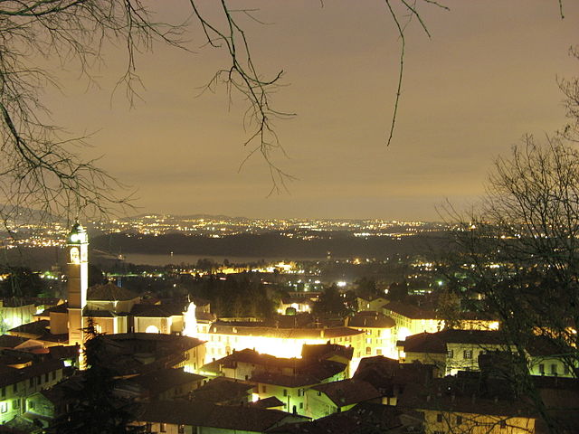
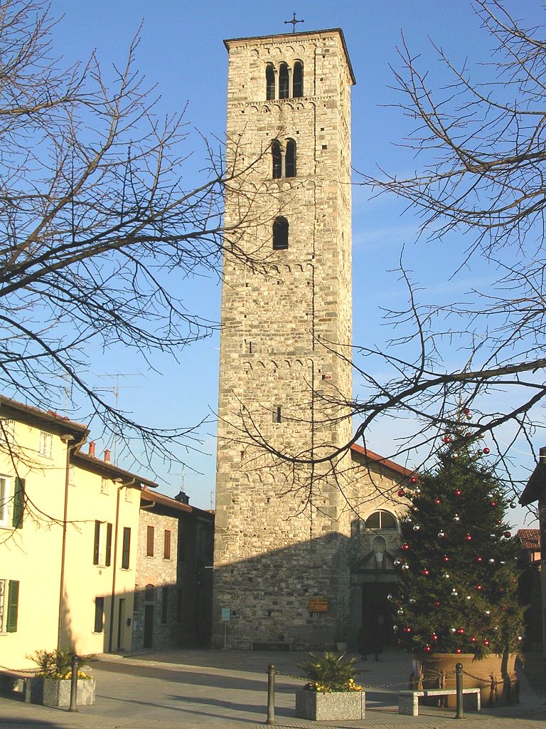
Faggeto Lario, located along the eastern shore of Lake Como in Italy, is a picturesque village surrounded by stunning landscapes, making it a great destination for hiking enthusiasts. The area offers a variety of hiking trails that cater to different skill levels, from easy walks to more challenging hikes.
Highlights of Hiking in Faggeto Lario:
-
Scenic Views: The trails often provide breathtaking views of Lake Como, surrounding mountains, and charming villages. The landscape is diverse, with lush forests, rocky terrains, and panoramic lake vistas.
-
Trail Network: There are several well-marked trails in the area. For example, the Sentiero del Viandante, which is a historical trail stretching from Abbadia Lariana to Colico, runs nearby and offers sections that can be accessed from Faggeto Lario.
-
Nature and Flora: The region is rich in biodiversity, featuring various plant species and wildlife. As you hike, you may encounter chestnut forests, olive groves, and unique Mediterranean flora.
-
Cultural Exploration: Hiking in Faggeto Lario also provides opportunities to explore ancient paths, historical sites, and local villages. You may come across old churches, farmhouses, and remnants of ancient trade routes.
-
Accessibility: Many trails are accessible from the village center, making it convenient for day hikes. The terrain can range from easy to moderate, making it suitable for families and more seasoned hikers alike.
Recommended Hikes:
-
Sentiero dei Koronki: A relatively easy trail that showcases beautiful views of the lake and surrounding hills. It's suitable for families and offers a great introduction to the area's natural beauty.
-
Monte Preaola: For a more challenging hike, consider the trail leading up to Monte Preaola. This hike rewards you with spectacular views from the summit.
-
Walks to Nec populous Tinera: Shorter hikes that lead to quiet spots with views of the lake—ideal for picnicking or just relaxing in nature.
Tips for Hiking in Faggeto Lario:
-
Preparation: Carry sufficient water, snacks, and a map of the trails. A hiking app can also be useful for navigation.
-
Footwear: Wear sturdy hiking boots or shoes with good grip, as trails can be steep and uneven in places.
-
Weather: Be mindful of the weather conditions and check forecasts before heading out, as they can change rapidly in mountainous regions.
-
Local Advice: Don’t hesitate to ask locals for recommendations on trails or hidden gems in the area.
Hiking in Faggeto Lario can be a rewarding experience, blending outdoor adventure with stunning natural beauty and cultural richness. Enjoy your hikes!
- Страна:

- Почтовый код: 22020
- Телефонный код: 031
- Код автомобильного номера: CO
- Координаты: 45° 51' 0" N, 9° 10' 0" E


- GPS треки (wikiloc): [Ссылка]
- Высота над уровнем моря: 533 м m
- Площадь: 17.52 кв.км
- Население: 1213
- Веб сайт: http://www.comune.faggetolario.co.it
- Википедия русская: wiki(ru)
- Википедия английская: wiki(en)
- Википедия национальная: wiki(it)
- Хранилище Wikidata: Wikidata: Q47335
- Катеория в википедии: [Ссылка]
- код Freebase: [/m/0gj048]
- код GeoNames: Альт: [6542535]
- ID отношения в OpenStreetMap: [46291]
- код ISTAT: 013098
- кадастровый код Италии: D462
Граничит с регионами:

Альбавилла
- коммуна Италии
Hiking in Альбавилла
Albabilla, located in the region of Lombardy in Italy, is a charming area near the foothills of the Alps. It offers various opportunities for hiking enthusiasts, featuring scenic trails that navigate through beautiful landscapes....
- Страна:
- Почтовый код: 22031
- Телефонный код: 031
- Код автомобильного номера: CO
- Координаты: 45° 48' 0" N, 9° 11' 0" E
- GPS треки (wikiloc): [Ссылка]
- Высота над уровнем моря: 427 м m
- Площадь: 10.38 кв.км
- Население: 6361
- Веб сайт: [Ссылка]
Альбезе-кон-Кассано
- коммуна Италии
Hiking in Альбезе-кон-Кассано
Albese con Cassano, located in the Lombardy region of Italy, is surrounded by beautiful landscapes that include hills, forests, and scenic views of the nearby mountains. While it may not be as famous for hiking as some other areas of Italy, there are still opportunities for outdoor enthusiasts to explore the local environment....
- Страна:
- Почтовый код: 22032
- Телефонный код: 031
- Код автомобильного номера: CO
- Координаты: 45° 48' 0" N, 9° 10' 0" E
- GPS треки (wikiloc): [Ссылка]
- Высота над уровнем моря: 402 м m
- Площадь: 7.95 кв.км
- Население: 4251
- Веб сайт: [Ссылка]


Блевио
- коммуна Италии
Hiking in Блевио
Blevio is a charming village located on the eastern shore of Lake Como in Italy, offering stunning views and a unique hiking experience. The terrain around Blevio is quite varied, with hills, forests, and beautiful lake vistas, making it an ideal spot for both leisurely walks and more challenging hikes. Here are some key points to consider if you’re planning a hiking trip in Blevio:...
- Страна:
- Почтовый код: 22020
- Телефонный код: 031
- Код автомобильного номера: CO
- Координаты: 45° 50' 0" N, 9° 6' 0" E
- GPS треки (wikiloc): [Ссылка]
- Высота над уровнем моря: 231 м m
- Площадь: 5.47 кв.км
- Население: 1182
- Веб сайт: [Ссылка]
Кальо
- коммуна Италии
Hiking in Кальо
Caglio, located in the Italian region of Lombardy, is a charming destination for hiking enthusiasts. Nestled in the hills of the Triangolo Lariano, it offers a picturesque landscape with lush forests, meadows, and panoramic views that are characteristic of the area....
- Страна:
- Почтовый код: 22030
- Телефонный код: 031
- Код автомобильного номера: CO
- Координаты: 45° 52' 0" N, 9° 14' 0" E
- GPS треки (wikiloc): [Ссылка]
- Высота над уровнем моря: 800 м m
- Площадь: 6.52 кв.км
- Население: 454
- Веб сайт: [Ссылка]
Карате-Урио
- коммуна Италии
Hiking in Карате-Урио
Carate Urio is a picturesque village located on the western shore of Lake Como in Italy. It's known for its stunning views, charming atmosphere, and access to scenic hiking trails. Here are some highlights and recommendations for hiking in the Carate Urio area:...
- Страна:
- Почтовый код: 22010
- Телефонный код: 031
- Код автомобильного номера: CO
- Координаты: 45° 52' 0" N, 9° 7' 0" E
- GPS треки (wikiloc): [Ссылка]
- Высота над уровнем моря: 199 м m
- Площадь: 6.94 кв.км
- Население: 1170
- Веб сайт: [Ссылка]
Казлино-д’Эрба
- коммуна Италии
Hiking in Казлино-д’Эрба
Caslino d'Erba is a charming village located in the province of Como, Italy, and it serves as a gateway to great hiking opportunities in the surrounding area, particularly in the scenic region of the Italian Alps. Here's what you need to know about hiking in and around Caslino d'Erba:...
- Страна:
- Почтовый код: 22030
- Телефонный код: 031
- Код автомобильного номера: CO
- Координаты: 45° 50' 0" N, 9° 14' 0" E
- GPS треки (wikiloc): [Ссылка]
- Высота над уровнем моря: 461 м m
- Площадь: 6.89 кв.км
- Население: 1676
- Веб сайт: [Ссылка]

Эрба
- коммуна Италии
Hiking in Эрба
Erba, located in the province of Como in Lombardy, is an excellent destination for hiking enthusiasts. Surrounded by the picturesque landscapes of the Pre-Alps, the area offers a variety of trails suitable for all skill levels, from leisurely walks to more challenging hikes....
- Страна:
- Почтовый код: 22036
- Телефонный код: 031
- Код автомобильного номера: CO
- Координаты: 45° 49' 0" N, 9° 13' 0" E
- GPS треки (wikiloc): [Ссылка]
- Высота над уровнем моря: 320 м m
- Площадь: 17.80 кв.км
- Население: 16346
- Веб сайт: [Ссылка]


Лальо
- коммуна Италии
Hiking in Лальо
Laglio, a picturesque village located on the western shore of Lake Como in Italy, offers a unique hiking experience with stunning views of the lake and surrounding mountains. Here are some highlights and tips for hiking in and around Laglio:...
- Страна:
- Почтовый код: 22010
- Телефонный код: 031
- Код автомобильного номера: CO
- Координаты: 45° 53' 0" N, 9° 8' 0" E
- GPS треки (wikiloc): [Ссылка]
- Высота над уровнем моря: 200 м m
- Площадь: 6.2 кв.км
- Население: 894
- Веб сайт: [Ссылка]


Торно
- коммуна Италии
Hiking in Торно
Torno, located along the western shore of Lake Como in Lombardy, Italy, is a charming village that offers several opportunities for hiking and enjoying the stunning natural beauty of the area. Here’s what you need to know about hiking in Torno:...
- Страна:
- Почтовый код: 22020
- Телефонный код: 031
- Код автомобильного номера: CO
- Координаты: 45° 51' 0" N, 9° 7' 0" E
- GPS треки (wikiloc): [Ссылка]
- Высота над уровнем моря: 225 м m
- Площадь: 7.53 кв.км
- Население: 1137
- Веб сайт: [Ссылка]
Тавернерио
- коммуна Италии
Hiking in Тавернерио
Tavernerio is a charming municipality located near the city of Como in Italy, nestled in the foothills of the Alps. It offers a variety of hiking opportunities with stunning views of Lake Como and the surrounding mountains. Here are some key highlights for hikers interested in exploring the area:...
- Страна:
- Почтовый код: 22038
- Телефонный код: 031
- Код автомобильного номера: CO
- Координаты: 45° 48' 0" N, 9° 9' 0" E
- GPS треки (wikiloc): [Ссылка]
- Высота над уровнем моря: 460 м m
- Площадь: 11.91 кв.км
- Население: 5804
- Веб сайт: [Ссылка]
Нессо
- коммуна Италии
Hiking in Нессо
Nesso is a charming village located on the western shore of Lake Como in Italy. Known for its picturesque scenery and historical architecture, Nesso is also a great starting point for various hiking trails that offer stunning views of the lake and the surrounding mountains....
- Страна:
- Почтовый код: 22020
- Телефонный код: 031
- Код автомобильного номера: CO
- Координаты: 45° 55' 0" N, 9° 10' 0" E
- GPS треки (wikiloc): [Ссылка]
- Высота над уровнем моря: 300 м m
- Площадь: 15.03 кв.км
- Население: 1227
- Веб сайт: [Ссылка]
Поньяна-Ларио
- коммуна Италии
Hiking in Поньяна-Ларио
Pognana Lario is a charming village situated on the eastern shore of Lake Como in Italy, known for its stunning views and scenic hiking trails. Here’s what you can expect when hiking in and around Pognana Lario:...
- Страна:
- Почтовый код: 22020
- Телефонный код: 031
- Код автомобильного номера: CO
- Координаты: 45° 53' 0" N, 9° 9' 0" E
- GPS треки (wikiloc): [Ссылка]
- Высота над уровнем моря: 307 м m
- Площадь: 5.07 кв.км
- Население: 685
- Веб сайт: [Ссылка]