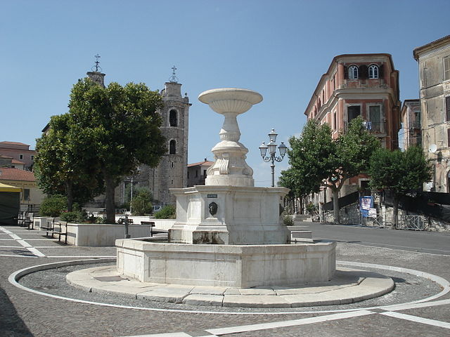
Фальватерра (Falvaterra, Falvaterra)
.svg)
- коммуна Италии
 Hiking in Фальватерра
Falvaterra is a charming town in the province of Frosinone, situated in the Lazio region of Italy. It's surrounded by the beautiful landscapes of the Aurunci Mountains and offers a variety of hiking opportunities that vary in difficulty. Here's what you should know about hiking in the Falvaterra area:
Key Hiking Areas and Trails:
-
Caves of Falvaterra (Grotte di Falvaterra):
- These impressive limestone caves are just outside the town and feature interesting geological formations. The area around the caves can be explored through designated trails, offering a mix of hiking and caving experiences.
-
Monti Aurunci Natural Park:
- Nearby, Monti Aurunci National Park provides a spectacular backdrop for hikes. The park features numerous trails that lead through dense forests, past rocky outcrops, and to stunning viewpoints overlooking the surrounding valleys and hills.
- Popular trails include paths leading to Mount Petrella and Mount Faito.
-
Historical and Cultural Trails:
- Many trails in the region not only offer natural beauty but also historical significance. You may come across ancient ruins, old trattorias, and local churches along the way.
Hiking Considerations:
-
Difficulty Levels: Trails range from easy walks suitable for families to more challenging hikes that require a good level of fitness and experience. Always check the trail difficulty and prepare accordingly.
-
Weather: The best time for hiking in Falvaterra is from spring to early autumn (April to October). Summer can get hot, so early morning or late afternoon hikes are advisable.
-
Equipment: Good hiking boots, plenty of water, a map, and snacks are essential. Depending on the season, layering is important due to fluctuating temperatures.
-
Local Guidance: Consider hiring a local guide if you're unfamiliar with the area. This can enhance your experience and ensure safety.
Wildlife and Flora:
- The region is rich in biodiversity, with chances to see various wildlife such as deer, wild boar, and numerous bird species. Plant life varies greatly from alpine flora to Mediterranean vegetation.
Cultural Experiences:
- After your hikes, take the opportunity to explore Falvaterra itself. The town has traditional Italian charm, with quaint streets, local eateries serving delicious cuisine, and warm, welcoming residents.
Safety Tips:
- Always inform someone of your hiking plans, especially if you’re going onto less-traveled paths.
- Pay attention to trail markers, and if you're new to hiking, consider using popular trails that are well-marked.
Hiking in Falvaterra can be a rewarding experience, blending natural beauty with cultural richness. Enjoy your adventure!
- Страна:

- Почтовый код: 03020
- Телефонный код: 0775
- Код автомобильного номера: FR
- Координаты: 41° 30' 17" N, 13° 31' 26" E


- GPS треки (wikiloc): [Ссылка]
- Высота над уровнем моря: 279 м m
- Площадь: 12.73 кв.км
- Население: 548
- Веб сайт: http://www.comunedifalvaterra.com
- Википедия русская: wiki(ru)
- Википедия английская: wiki(en)
- Википедия национальная: wiki(it)
- Хранилище Wikidata: Wikidata: Q116828
- Катеория в википедии: [Ссылка]
- код Freebase: [/m/0gmwy6]
- код GeoNames: Альт: [6536984]
- код VIAF: Альт: [233902169]
- ID отношения в OpenStreetMap: [41339]
- WOEID: [715273]
- код TGN: [7047507]
- код Цифрового атласа Римской империи: [22562]
- код Pleiades: [432825]
- код ISTAT: 060032
- кадастровый код Италии: D483
Граничит с регионами:

Арсе
- коммуна Италии
Hiking in Арсе
Hiking in Arce, a charming town in the Lazio region of Italy, offers a blend of stunning natural landscapes, historical sites, and local culture. Situated in the province of Frosinone, Arce is surrounded by the picturesque Aurunci Mountains and is not far from the beautiful landscapes of the Ciociaria area....
- Страна:
- Почтовый код: 03032
- Телефонный код: 0776
- Код автомобильного номера: FR
- Координаты: 41° 35' 0" N, 13° 35' 0" E
- GPS треки (wikiloc): [Ссылка]
- Высота над уровнем моря: 247 м m
- Площадь: 39.52 кв.км
- Население: 5670
- Веб сайт: [Ссылка]
Кастро-дей-Вольши
- коммуна Италии
Hiking in Кастро-дей-Вольши
Castro dei Volsci is a charming village located in the province of Frosinone, in the Lazio region of Italy. Surrounded by the scenic landscapes of the Aurunci mountains, this area offers a range of hiking opportunities for both beginners and experienced hikers....
- Страна:
- Почтовый код: 03020
- Телефонный код: 0775
- Код автомобильного номера: FR
- Координаты: 41° 31' 0" N, 13° 24' 0" E
- GPS треки (wikiloc): [Ссылка]
- Высота над уровнем моря: 385 м m
- Площадь: 58.45 кв.км
- Население: 4740
- Веб сайт: [Ссылка]
Чепрано
- коммуна Италии
Hiking in Чепрано
Ceprano is a picturesque town located in the province of Frosinone, Italy, known for its scenic landscapes and historical significance. It sits near the confluence of the Liri and Fibreno rivers, offering beautiful natural surroundings that are great for hiking enthusiasts....
- Страна:
- Почтовый код: 03024
- Телефонный код: 0775
- Код автомобильного номера: FR
- Координаты: 41° 33' 0" N, 13° 31' 0" E
- GPS треки (wikiloc): [Ссылка]
- Высота над уровнем моря: 105 м m
- Площадь: 38.03 кв.км
- Население: 8823
- Веб сайт: [Ссылка]
Пастена
- коммуна Италии
Hiking in Пастена
Pastena is a charming town located in the province of Frosinone, in the Lazio region of Italy. It's renowned for its stunning natural landscapes and rich history, making it an excellent destination for hiking enthusiasts. Here are some highlights about hiking in and around Pastena:...
- Страна:
- Почтовый код: 03020
- Телефонный код: 0776
- Код автомобильного номера: FR
- Координаты: 41° 28' 6" N, 13° 29' 28" E
- GPS треки (wikiloc): [Ссылка]
- Высота над уровнем моря: 318 м m
- Площадь: 42.16 кв.км
- Население: 1424
- Веб сайт: [Ссылка]
Сан-Джованни-Инкарико
- коммуна Италии
Hiking in Сан-Джованни-Инкарико
San Giovanni Incarico is a charming town located in the province of Frosinone, in the Lazio region of Italy. It offers beautiful landscapes and a blend of cultural and natural experiences for hikers. Here are some highlights and tips for hiking in and around San Giovanni Incarico:...
- Страна:
- Почтовый код: 03028
- Телефонный код: 0776
- Код автомобильного номера: FR
- Координаты: 41° 30' 0" N, 13° 33' 0" E
- GPS треки (wikiloc): [Ссылка]
- Высота над уровнем моря: 200 м m
- Площадь: 24.71 кв.км
- Население: 3291
- Веб сайт: [Ссылка]