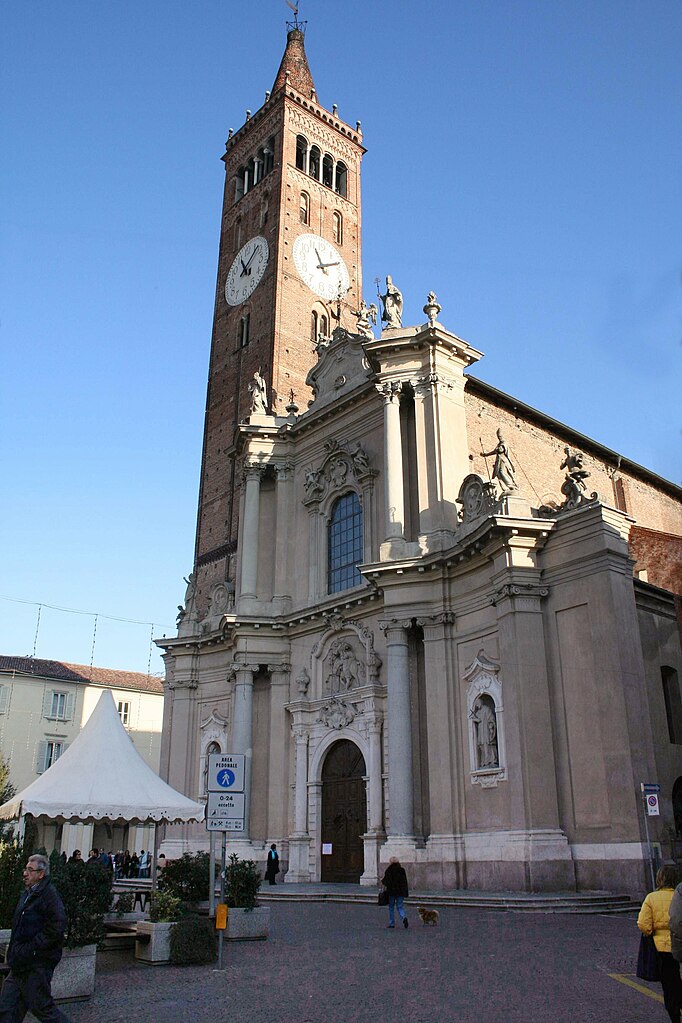
Фара-Джера-д'Адда (Fara Gera d'Adda, Fara Gera d'Adda)
.svg)
- коммуна Италии
 Hiking in Фара-Джера-д'Адда
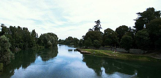
Fara Gera d'Adda is a charming town located in the Lombardy region of Italy, near the Adda River. While it may not be as well-known as some larger hiking destinations, it offers a variety of outdoor activities and scenic trails that can be appealing to hikers.
Hiking Trails and Areas
-
Naviglio della Martesana: This canal path is a popular spot for walking and cycling. It runs alongside the Martesana Canal, offering picturesque scenery including lush vegetation and peaceful waters. Portions of this trail can be accessed near Fara Gera d'Adda.
-
Parco Adda Nord: A bit further from Fara Gera d'Adda (about 10-15 km), this regional park boasts several walking trails that let you explore the landscape around the Adda River. You can enjoy views of the river, historical sites, and diverse wildlife.
-
Local Nature Paths: The area around Fara Gera d'Adda has small nature paths that can lead you through the countryside, offering a more intimate hiking experience. These trails often pass through vineyards and agricultural land, providing a taste of local life.
Best Time to Hike
- The best times to hike in this region are during the spring (April to June) and fall (September to November) when temperatures are mild and the scenery is particularly beautiful.
Tips for Hiking in Fara Gera d'Adda
- Hiking Gear: Wear comfortable hiking shoes, dress in layers, and consider weather conditions before heading out.
- Stay Hydrated: Bring enough water, especially on longer hikes.
- Trail Maps: Though many paths are well-marked, having a map or GPS app can help you navigate more confidently.
- Respect Nature: Follow local guidelines regarding wildlife and plant life, and practice Leave No Trace principles.
Additional Activities
Aside from hiking, you might enjoy cycling along the waterways, fishing in the river, or simply taking in the tranquil scenery of the area. Local cuisine is also worth exploring, with many trattorias offering delicious Lombardian dishes.
In conclusion, while Fara Gera d'Adda might not be a major hiking hotspot, it does provide lovely trails and a peaceful environment for those looking to escape into nature. Happy hiking!
- Страна:

- Почтовый код: 24045
- Телефонный код: 0363
- Код автомобильного номера: BG
- Координаты: 45° 33' 0" N, 9° 32' 0" E


- GPS треки (wikiloc): [Ссылка]
- Высота над уровнем моря: 131 м m
- Площадь: 10.79 кв.км
- Население: 8043
- Веб сайт: http://www.comune.farageradadda.bg.it
- Википедия русская: wiki(ru)
- Википедия английская: wiki(en)
- Википедия национальная: wiki(it)
- Хранилище Wikidata: Wikidata: Q101042
- Галерея изображений в википедии: [Ссылка]
- Катеория в википедии: [Ссылка]
- код Freebase: [/m/0gjb1w]
- код GeoNames: Альт: [6541563]
- код VIAF: Альт: [132977013]
- ID отношения в OpenStreetMap: [45313]
- UN/LOCODE: [ITFGD]
- код ISTAT: 016096
- кадастровый код Италии: D490
Граничит с регионами:


Каноника-д'Адда
- коммуна Италии
Hiking in Каноника-д'Адда
Canonica d'Adda is a picturesque town located in the Lombardy region of Italy, along the banks of the Adda River. It offers a number of beautiful trails and scenic vistas for hiking enthusiasts. Here’s what you should know about hiking in this area:...
- Страна:
- Почтовый код: 24040
- Телефонный код: 02
- Код автомобильного номера: BG
- Координаты: 45° 34' 31" N, 9° 32' 20" E
- GPS треки (wikiloc): [Ссылка]
- Высота над уровнем моря: 99 м m
- Площадь: 3.21 кв.км
- Население: 4504
- Веб сайт: [Ссылка]


Понтироло-Нуово
- коммуна Италии
Hiking in Понтироло-Нуово
Pontirolo Nuovo, a small town in the Lombardy region of Italy, is not specifically known as a hiking destination, but it is surrounded by a countryside that offers some opportunities for walking and outdoor activities. Here are some suggestions and information relevant to hiking in and around Pontirolo Nuovo:...
- Страна:
- Почтовый код: 24040
- Телефонный код: 0363
- Код автомобильного номера: BG
- Координаты: 45° 34' 9" N, 9° 34' 2" E
- GPS треки (wikiloc): [Ссылка]
- Высота над уровнем моря: 155 м m
- Площадь: 11.1 кв.км
- Население: 4983
- Веб сайт: [Ссылка]

Тревильо
- коммуна Италии
Hiking in Тревильо
Treviglio is located in the Lombardy region of northern Italy, not far from Milan. While Treviglio itself may not be a major hiking destination, it serves as a good base for accessing nearby natural areas and hiking trails in the surrounding region....
- Страна:
- Почтовый код: 24047
- Телефонный код: 0363
- Код автомобильного номера: BG
- Координаты: 45° 31' 17" N, 9° 35' 34" E
- GPS треки (wikiloc): [Ссылка]
- Высота над уровнем моря: 125 м m
- Площадь: 32.22 кв.км
- Население: 29815
- Веб сайт: [Ссылка]

Ваприо-д'Адда
- коммуна Италии
Hiking in Ваприо-д'Адда
Vaprio d'Adda is a charming town located in the Lombardy region of Italy, situated along the Adda River. It's an excellent destination for hiking enthusiasts due to its picturesque landscapes and natural beauty. Here are some key points about hiking in the area:...
- Страна:
- Почтовый код: 20069
- Телефонный код: 02
- Код автомобильного номера: MI
- Координаты: 45° 34' 0" N, 9° 32' 0" E
- GPS треки (wikiloc): [Ссылка]
- Высота над уровнем моря: 161 м m
- Площадь: 7.15 кв.км
- Население: 8972
- Веб сайт: [Ссылка]


Кассано д’Адда
- коммуна Италии
Hiking in Кассано д’Адда
Cassano d'Adda is a charming town located in the Lombardy region of Italy, nestled along the Adda River. It's not only a picturesque area with historical significance but also offers some lovely opportunities for hiking and outdoor activities....
- Страна:
- Почтовый код: 20062
- Телефонный код: 0363
- Код автомобильного номера: MI
- Координаты: 45° 32' 0" N, 9° 31' 0" E
- GPS треки (wikiloc): [Ссылка]
- Высота над уровнем моря: 133 м m
- Площадь: 18.6 кв.км
- Население: 18911
- Веб сайт: [Ссылка]