Фласан-сюр-Исоль (Flassans-sur-Issole, Flassans-sur-Issole)

- коммуна во Франции
 Hiking in Фласан-сюр-Исоль
Flassans-sur-Issole is a charming commune located in the Var department in the Provence-Alpes-Côte d'Azur region of southeastern France. It is surrounded by picturesque landscapes, making it an excellent destination for hiking enthusiasts.
Hiking Trails and Areas
-
Local Trails: There are several marked hiking trails around Flassans-sur-Issole that offer various levels of difficulty. Many of these trails take you through beautiful vineyards, olive groves, and forests, showcasing the region's natural beauty.
-
Le Sentier des Fées: This is a popular trail that provides scenic views and a chance to explore the local flora and fauna. The trail takes you through forests and along the Issole River, offering a serene hiking experience.
-
Nearby Natural Parks: The proximity of Flassans-sur-Issole to the Sainte-Baume and the Verdon Natural Parks means you can also easily access more extensive hiking routes with varying levels of difficulty, from short walks to multi-day treks.
What to Expect
- Scenic Views: The region features rolling hills, vineyards, and olive trees, with stunning views of the surrounding countryside.
- Wildlife: Hikers may encounter a variety of local wildlife and unique plant species along the trails.
- Cultural Experience: The area is rich in history and culture, so you may come across ancient ruins, charming villages, and local markets.
Tips for Hiking in Flassans-sur-Issole
- Weather: Be mindful of weather conditions, especially in the warmer months when it can get quite hot. Early morning or late afternoon hikes are often more comfortable.
- Gear: Wear appropriate hiking gear, including sturdy shoes, and don’t forget sun protection and hydration supplies.
- Maps: Carry a detailed map or a GPS device, as some trails may not be well signposted.
Nearby Attractions
After a day of hiking, take some time to explore Flassans-sur-Issole itself, which boasts a relaxed atmosphere, local restaurants, and the chance to sample regional wines.
Overall, hiking in Flassans-sur-Issole can be a delightful experience for both beginners and seasoned hikers looking to explore the beauty of Provence.
- Страна:

- Почтовый код: 83340
- Координаты: 43° 22' 7" N, 6° 13' 16" E


- GPS треки (wikiloc): [Ссылка]
- Площадь: 43.68 кв.км
- Население: 3485
- Википедия русская: wiki(ru)
- Википедия английская: wiki(en)
- Википедия национальная: wiki(fr)
- Хранилище Wikidata: Wikidata: Q840276
- Катеория в википедии: [Ссылка]
- код Freebase: [/m/03qcs2z]
- код GeoNames: Альт: [3018389]
- номер SIREN: [218300572]
- код BNF: [15277884d]
- код VIAF: Альт: [148965372]
- код LCNAF: Альт: [nb2019001690]
- код тезауруса PACTOLS: [pcrtNRQi5Hp8QB]
- WOEID: [591053]
- код SUDOC: [050299409]
- код муниципалитета INSEE: 83057
Граничит с регионами:


Бриньоль
- коммуна во Франции
Hiking in Бриньоль
Brignoles, located in the Var department in southeastern France, is surrounded by beautiful landscapes that offer excellent opportunities for hiking and outdoor activities. Here are some highlights and tips for hiking around Brignoles:...
- Страна:
- Почтовый код: 83170
- Координаты: 43° 24' 21" N, 6° 3' 42" E
- GPS треки (wikiloc): [Ссылка]
- Площадь: 70.53 кв.км
- Население: 17093
- Веб сайт: [Ссылка]

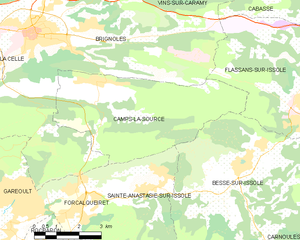
Кам-ла-Сурс
- коммуна во Франции
Hiking in Кам-ла-Сурс
Camps-la-Source, located in the Var department of southern France, is a charming little commune nestled in the heart of the Provence-Alpes-Côte d'Azur region. The area surrounding Camps-la-Source offers a variety of outdoor activities, including hiking, with several scenic trails suitable for different skill levels....
- Страна:
- Почтовый код: 83170
- Координаты: 43° 23' 11" N, 6° 5' 40" E
- GPS треки (wikiloc): [Ссылка]
- Площадь: 22.47 кв.км
- Население: 1851
- Веб сайт: [Ссылка]

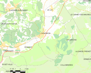
Гонфарон
- коммуна во Франции
Hiking in Гонфарон
Gonfaron, located in the Var department of the Provence-Alpes-Côte d'Azur region in southeastern France, offers some beautiful hiking opportunities. The surrounding landscapes feature a mix of forested areas, picturesque hills, and stunning views of the Provençal countryside....
- Страна:
- Почтовый код: 83590
- Координаты: 43° 19' 14" N, 6° 17' 21" E
- GPS треки (wikiloc): [Ссылка]
- Площадь: 40.42 кв.км
- Население: 4336
- Веб сайт: [Ссылка]

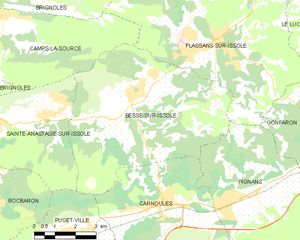
Бес-сюр-Исоль
- коммуна во Франции
Hiking in Бес-сюр-Исоль
Besse-sur-Issole is a charming village located in the Var department of the Provence-Alpes-Côte d'Azur region in France. Known for its beautiful landscapes, Besse-sur-Issole offers a variety of hiking trails that cater to different skill levels, making it an ideal spot for outdoor enthusiasts....
- Страна:
- Почтовый код: 83890
- Координаты: 43° 20' 55" N, 6° 10' 35" E
- GPS треки (wikiloc): [Ссылка]
- Площадь: 37.19 кв.км
- Население: 3049


Ле-Люк
- коммуна во Франции
Hiking in Ле-Люк
Le Luc, located in the Var department of the Provence-Alpes-Côte d'Azur region in southeastern France, offers a variety of hiking opportunities for outdoor enthusiasts. While Le Luc itself is a small town, it is surrounded by beautiful landscapes, vineyards, and natural parks that provide excellent hiking trails....
- Страна:
- Почтовый код: 83340
- Координаты: 43° 23' 41" N, 6° 18' 46" E
- GPS треки (wikiloc): [Ссылка]
- Площадь: 44.16 кв.км
- Население: 10821
- Веб сайт: [Ссылка]


Пиньян
- коммуна во Франции
Hiking in Пиньян
Pignans is a charming village located in the Var department of the Provence-Alpes-Côte d'Azur region in southeastern France. It's surrounded by stunning natural landscapes, including rolling hills, vineyards, forests, and the nearby foothills of the Massif des Maures, making it a great destination for hiking enthusiasts. Here are some highlights for hiking in and around Pignans:...
- Страна:
- Почтовый код: 83790
- Координаты: 43° 18' 2" N, 6° 13' 36" E
- GPS треки (wikiloc): [Ссылка]
- Площадь: 34.87 кв.км
- Население: 3896

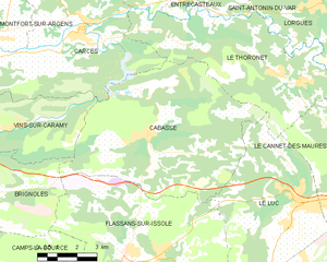
Кабас
- коммуна во Франции
Hiking in Кабас
Cabasse, a quaint village in the Var region of Provence-Alpes-Côte d'Azur in southeastern France, offers a variety of hiking opportunities amidst beautiful natural settings. Here are some highlights to consider if you're planning to hike in and around Cabasse:...
- Страна:
- Почтовый код: 83340
- Координаты: 43° 25' 34" N, 6° 13' 19" E
- GPS треки (wikiloc): [Ссылка]
- Площадь: 45.49 кв.км
- Население: 1918
- Веб сайт: [Ссылка]