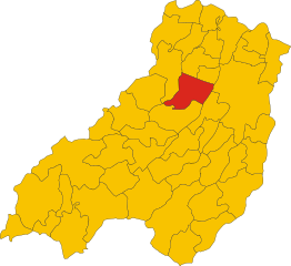
Фонтевиво (Fontevivo, Fontevivo)
.svg)
- коммуна Италии
 Hiking in Фонтевиво
Fontevivo is a charming location in Italy, nestled in the region of Emilia-Romagna, close to the city of Parma. While it's not as famous for hiking as some other regions in Italy (like the Dolomites or the Alps), it still offers some beautiful landscapes and trails for those looking to enjoy nature and the outdoors.
Hiking in Fontevivo: What to Expect
-
Scenic Trails: The area around Fontevivo features a mix of countryside, fields, and woodlands. The trails may range from easy to moderate in difficulty, making them suitable for hikers of various skill levels.
-
Historical Sites: Fontevivo is known for its historical significance, particularly the Fontevivo Abbey, which dates back to the 12th century. Hiking in this area can provide the opportunity to explore beautiful historical landmarks amidst natural scenery.
-
Flora and Fauna: The natural environment around Fontevivo can be rich with biodiversity. Depending on the season, you might see different flora blooming and, if you're lucky, encounter local wildlife.
-
Nearby Parks: While Fontevivo itself may not have an extensive network of hiking trails, there are natural parks and reserves in Emilia-Romagna that are worth exploring. Consider a day trip to nearby natural areas like Parco Nazionale dell'Appennino Tosco-Emiliano.
-
Best Seasons: The best times for hiking in this area are typically spring and fall, when the weather is mild and the scenery is particularly beautiful. Summers can be hot, while winters might bring colder temperatures.
-
Local Amenities: After a day of hiking, you may want to explore the local cuisine. Emilia-Romagna is famous for its culinary delights, so don’t miss the chance to enjoy some traditional dishes after your hiking adventures.
-
Preparation: As with any hiking trip, be sure to wear appropriate footwear, carry sufficient water, and check weather conditions before heading out. It can also be helpful to have maps or a GPS device since trails may not always be clearly marked.
If you are considering a hiking trip to Fontevivo, remember to check local resources or guides to get the latest information on trail conditions and accessibility. Enjoy your hike!
- Страна:

- Почтовый код: 43010
- Телефонный код: 0521
- Код автомобильного номера: PR
- Координаты: 44° 51' 0" N, 10° 10' 0" E


- GPS треки (wikiloc): [Ссылка]
- Высота над уровнем моря: 53 м m
- Площадь: 26 кв.км
- Население: 5615
- Веб сайт: http://www.comune.fontevivo.pr.it
- Википедия русская: wiki(ru)
- Википедия английская: wiki(en)
- Википедия национальная: wiki(it)
- Хранилище Wikidata: Wikidata: Q100819
- Катеория в википедии: [Ссылка]
- код Freebase: [/m/0gkdjp]
- код GeoNames: Альт: [6540409]
- код VIAF: Альт: [148077172]
- ID отношения в OpenStreetMap: [43703]
- код GND: Альт: [4569112-5]
- UN/LOCODE: [ITFVO]
- код ISTAT: 034016
- кадастровый код Италии: D685
Граничит с регионами:

Фонтанеллато
- коммуна Италии
Hiking in Фонтанеллато
Fontanellato, located in the Emilia-Romagna region of Italy, is a charming town known for its historic landmarks, particularly the Rocca Sanvitale, a stunning fortress that adds to the scenic beauty of the area. While Fontanellato itself is not primarily known as a hiking destination, there are several outdoor activities and walking routes in the surrounding countryside that can be explored....
- Страна:
- Почтовый код: 43012
- Телефонный код: 0521
- Код автомобильного номера: PR
- Координаты: 44° 52' 57" N, 10° 9' 21" E
- GPS треки (wikiloc): [Ссылка]
- Высота над уровнем моря: 45 м m
- Площадь: 53.98 кв.км
- Население: 7034
- Веб сайт: [Ссылка]

Ночето
- коммуна Италии
Hiking in Ночето
Noceto is a charming town in the province of Parma, located in the Emilia-Romagna region of Italy. While it may not be as widely recognized as some other hiking destinations in Italy, it offers some lovely trails and regional parks nearby, ideal for those looking to explore nature....
- Страна:
- Почтовый код: 43015
- Телефонный код: 0521
- Код автомобильного номера: PR
- Координаты: 44° 49' 0" N, 10° 11' 0" E
- GPS треки (wikiloc): [Ссылка]
- Высота над уровнем моря: 74 м m
- Площадь: 79.17 кв.км
- Население: 12993
- Веб сайт: [Ссылка]


Парма
- коммуна Италии
Hiking in Парма
Parma, located in northern Italy, is not just known for its rich culinary heritage, but it also offers beautiful hiking opportunities in its surroundings. The region is characterized by rolling hills, lush landscapes, and a variety of trails suitable for different levels of hikers....
- Страна:
- Почтовый код: 43121–43126
- Телефонный код: 0521
- Код автомобильного номера: PR
- Координаты: 44° 48' 5" N, 10° 19' 41" E
- GPS треки (wikiloc): [Ссылка]
- Высота над уровнем моря: 55 м m
- Площадь: 260.6 кв.км
- Население: 194417
- Веб сайт: [Ссылка]