
Франкфурт-на-Одере (Frankfurt (Oder), Frankfurt (Oder))

- город в Бранденбурге, Германия
 Hiking in Франкфурт-на-Одере
Frankfurt (Oder), located in eastern Germany near the Polish border, offers some unique hiking opportunities amidst its picturesque landscapes and rich cultural heritage. While the city itself may not be as renowned for hiking as some other German cities, there are several trails and areas worth exploring in and around the region.
Hiking Opportunities:
-
Oder River Path (Oder-Neiße Cycle Route):
- This scenic route runs along the Oder River and is not only fantastic for cyclists but also for hikers. You can enjoy the serene views of the river, lush greenery, and occasional historical landmarks. The trail stretches from the Czech border to the Baltic Sea.
-
Nature Reserves:
- Biosphärenreservat Spreewald: While not directly in Frankfurt (Oder), this UNESCO biosphere reserve is within a short drive and offers extensive hiking routes through picturesque wetlands, forests, and charming villages.
-
Local Trails:
- There are several local paths that can be explored, often leading through forests and fields surrounding the city. Make sure to check local maps or visitor centers for detailed trail information.
-
Regional Parks:
- The nearby Märkische Heimatpark and Kleinmachnow offer trails where visitors can experience local wildlife and tranquil landscapes, great for a day hike.
Tips for Hiking in Frankfurt (Oder):
- Gear Up: Ensure you have sturdy footwear, especially if you're venturing onto less maintained trails.
- Local Maps: Obtain local trail maps or apps, which often provide insights on distance, difficulty, and points of interest.
- Weather Preparedness: Check the weather before heading out, as conditions can change rapidly.
- Bring Supplies: Always carry water, snacks, and a first-aid kit. Depending on the season, consider insect repellent and sunblock.
Cultural Touchpoints:
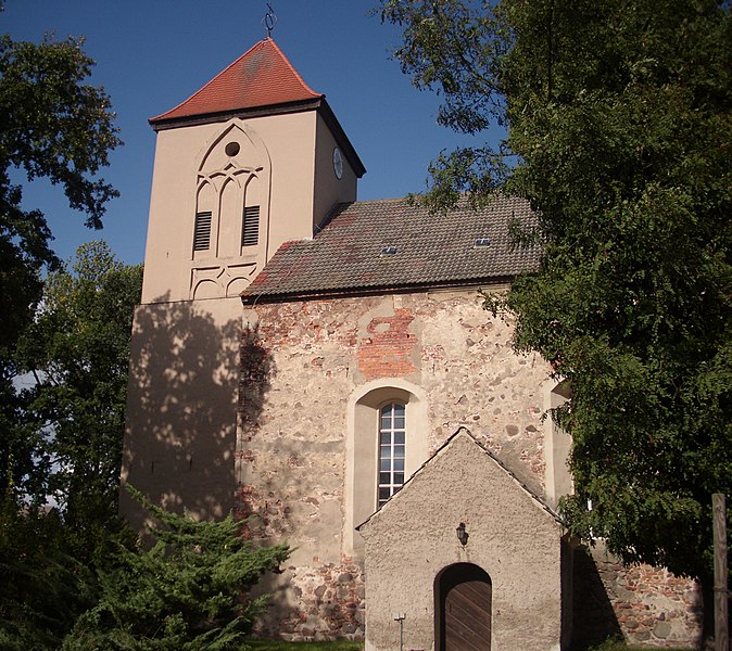
In addition to the natural beauty, take some time to explore Frankfurt (Oder) itself. The city has a rich history, with attractions like the St. Mary's Church and the Kleist Museum, which can be rewarding additions to your hiking trip.
Whether you're looking for a leisurely stroll or a more ambitious hike, Frankfurt (Oder) and its surroundings provide a delightful experience for nature lovers and outdoor enthusiasts. Happy hiking!
- Страна:

- Почтовый код: 15236; 15234; 15232; 15230
- Телефонный код: 033605; 0335
- Код автомобильного номера: FF
- Координаты: 52° 21' 0" N, 14° 33' 0" E


- GPS треки (wikiloc): [Ссылка]
- Высота над уровнем моря: 40 м m
- Площадь: 147610000 кв.км
- Население: 58018
- Веб сайт: https://www.frankfurt-oder.de/
- Википедия русская: wiki(ru)
- Википедия английская: wiki(en)
- Википедия национальная: wiki(de)
- Хранилище Wikidata: Wikidata: Q4024
- Галерея изображений в википедии: [Ссылка]
- Катеория в википедии: [Ссылка]
- Карты в википедии: [Ссылка]
- код Freebase: [/m/0p828]
- код GeoNames: Альт: [2925535]
- код BNF: [11974031j]
- код VIAF: Альт: [123166527]
- ID отношения в OpenStreetMap: [62523]
- код GND: Альт: [4018122-4]
- идентификатор местоположения ArchINFORM: [296]
- код LCNAF: Альт: [n96122011]
- код тезауруса PACTOLS: [pcrtjllY3RFIIs]
- место в MusicBrainz: [2d60f848-38f8-4d8a-a976-8629145695f8]
- код темы Quora: [Frankfurt-an-Der-Oder]
- код SUDOC: [027750485]
- код в энциклопедии «Британника онлайн»: [place/Frankfurt-an-der-Oder]
- код в Большой каталанской энциклопедии: [0028098]
- код в Encyclopædia Universalis: [francfort-sur-l-oder]
- код Historical Gazetteer: [FRAURTJO72GI]
- EMLO location ID: [ac34b2d3-2e59-4d94-8271-3d4a35781117]
- код места в Facebook: [112564855427248]
- код ISNI: Альт: [0000 0001 2033 6247]
- код NLI: [000187641]
- код NUTS: [DE403]
- Nomisma ID: [frankfurt_oder]
- Image Archive, Herder Institute: [Q4024]
- идентификатор муниципалитетов в Германии: 12053000
- код района Германии: 12053
Включает регионы:


Neuberesinchen
Hiking in Neuberesinchen
Neuberesinchen is a small village located in Germany, near the city of Frankfurt (Oder) in the state of Brandenburg. While the village itself may not be a well-known hiking destination, the surrounding areas can provide opportunities for outdoor enthusiasts to explore nature....
- Страна:
- Телефонный код: 0335
- Координаты: 52° 19' 20" N, 14° 32' 11" E
- GPS треки (wikiloc): [Ссылка]

Lichtenberg
Hiking in Lichtenberg
Lichtenberg, located near Frankfurt (Oder) in Brandenburg, Germany, offers a variety of hiking opportunities suited for different skill levels. While it's not as well-known for extensive hiking trails as some other German regions, it has a tranquil countryside that can be appealing for those seeking nature walks and scenic routes. Here are some key features and suggestions for hiking in this area:...
- Страна:
- Почтовый код: 15234
- Телефонный код: 0335
- Координаты: 52° 18' 39" N, 14° 26' 46" E
- GPS треки (wikiloc): [Ссылка]
- Высота над уровнем моря: 98 м m
Lossow
- страница значений
Hiking in Lossow
Lossow, located near the city of Frankfurt, Germany, is a charming area to explore for hiking enthusiasts. The surrounding countryside offers a mix of scenic nature, picturesque views, and well-marked trails. Here are some highlights about hiking in Lossow:...

Güldendorf
Hiking in Güldendorf
Güldendorf is a small village in Germany, nestled in picturesque surroundings that can provide a rich experience for hiking enthusiasts. The area is known for its natural beauty, with scenic landscapes, forests, and potentially charming trails that cater to various skill levels. Here are some general tips for hiking in Güldendorf:...
- Страна:
- Почтовый код: 15236
- Телефонный код: 0335
- Координаты: 52° 18' 43" N, 14° 32' 33" E
- GPS треки (wikiloc): [Ссылка]
- Высота над уровнем моря: 55 м m
- Площадь: 2.8 кв.км

Pagram
Hiking in Pagram
Pagram, depending on the context, could be a reference to a specific location or a typographical error for a different area. However, if you meant "Pagram" as a potential hiking destination, it could be beneficial for me to clarify what you were referring to, as there isn't a well-known hiking destination by that name in widely recognized hiking areas....
- Страна:
- Почтовый код: 15234
- Телефонный код: 0335
- Координаты: 52° 19' 30" N, 14° 27' 33" E
- GPS треки (wikiloc): [Ссылка]

Markendorf
Hiking in Markendorf
Markendorf, located near Frankfurt (Oder) in Germany, offers a charming setting for outdoor enthusiasts, including hikers. The area is characterized by its natural beauty, featuring green landscapes, forests, and agricultural fields. Here are some aspects to consider when planning a hiking experience in this region:...
- Страна:
- Почтовый код: 15236
- Телефонный код: 0335
- Координаты: 52° 17' 43" N, 14° 28' 16" E
- GPS треки (wikiloc): [Ссылка]
- Высота над уровнем моря: 89 м m
Hohenwalde
Hiking in Hohenwalde
Hohenwalde is a picturesque area nestled in Germany, known for its beautiful landscapes and outdoor activities, especially hiking. While Hohenwalde may not be as well-known as some of Germany's major hiking destinations, it offers serene trails and lush surroundings that can be a delight for both novice and experienced hikers....
- Страна:
- Почтовый код: 15234
- Телефонный код: 0335
- Координаты: 52° 17' 2" N, 14° 26' 5" E
- GPS треки (wikiloc): [Ссылка]
- Высота над уровнем моря: 85 м m


Розенгартен
Hiking in Розенгартен
The Rosengarten in Baden-Württemberg, Germany, is a beautiful region known for its stunning landscapes, diverse trails, and rich natural beauty. While the term "Rosengarten" can refer to various gardens, in a hiking context, it typically points to areas that may include rose gardens or beautiful landscapes....
- Страна:
- Почтовый код: 74538
- Телефонный код: 0791
- Код автомобильного номера: SHA
- Координаты: 49° 4' 4" N, 9° 43' 36" E
- GPS треки (wikiloc): [Ссылка]
- Высота над уровнем моря: 370 м m
- Площадь: 31.01 кв.км
- Население: 5067
- Веб сайт: [Ссылка]
Kliestow
Hiking in Kliestow
Kleistow, while not a widely recognized hiking destination, may refer to a local area where hiking opportunities exist, possibly in Central or Eastern Europe. Here are some general tips and insights for hiking in lesser-known areas like Kleistow:...
- Страна:
- Почтовый код: 15234
- Телефонный код: 0335
- Координаты: 52° 22' 3" N, 14° 30' 51" E
- GPS треки (wikiloc): [Ссылка]
- Высота над уровнем моря: 54 м m
- Площадь: 1.2 кв.км
Booßen
Hiking in Booßen
Booßen, a district of the city of Cottbus in Germany, offers various hiking opportunities, particularly because of its picturesque surroundings and scenic landscapes. While it may not be internationally renowned for hiking, it still provides a charming environment for nature enthusiasts....
- Страна:
- Почтовый код: 15234
- Телефонный код: 033605
- Координаты: 52° 22' 16" N, 14° 28' 22" E
- GPS треки (wikiloc): [Ссылка]
- Высота над уровнем моря: 77 м m
- Площадь: 2.7 кв.км
Граничит с регионами:


Одер-Шпре
Hiking in Одер-Шпре
The Oder-Spree region in Germany offers a variety of hiking opportunities set in a picturesque landscape of lakes, rivers, and forests. Here are some key points about hiking in this area:...
- Страна:
- Столица: Бесков
- Код автомобильного номера: LOS
- Координаты: 52° 13' 0" N, 14° 17' 0" E
- GPS треки (wikiloc): [Ссылка]
- Высота над уровнем моря: 60 м m
- Площадь: 2242.00 кв.км
- Население: 177047
- Веб сайт: [Ссылка]
Меркиш-Одерланд
Hiking in Меркиш-Одерланд
Märkisch-Oderland, located in the state of Brandenburg, Germany, offers a diverse and captivating environment for hiking enthusiasts. The region is characterized by its scenic landscapes, which include forests, lakes, rivers, and rolling hills....
- Страна:
- Код автомобильного номера: SRB; SEE; MOL; FRW
- Координаты: 52° 38' 0" N, 14° 8' 0" E
- GPS треки (wikiloc): [Ссылка]
- Высота над уровнем моря: 9 м m
- Площадь: 2127.99 кв.км
- Население: 186925
- Веб сайт: [Ссылка]