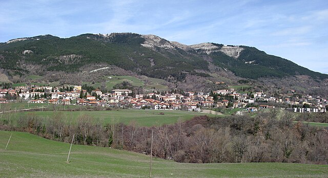
Фронтино (Frontino, Marche, Frontino)
.svg)
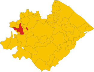
- коммуна Италии
 Hiking in Фронтино
Frontino, located in the Marche region of Italy, is a hidden gem for hikers and outdoor enthusiasts. Nestled in the Apennine Mountains, it offers a variety of trails that showcase the stunning natural beauty of the area, including forests, hills, and panoramic views of the surrounding landscape.
Hiking Trails
-
Monte Pincio: This trail takes you to the summit of Monte Pincio, where you can enjoy breathtaking views of the Marche countryside. The hike is moderately challenging, making it suitable for those with some hiking experience.
-
Gola del Furlo: A nearby nature reserve that features dramatic gorges and cliffs along the Candigliano River. The area offers several trails ranging from easy walks to more strenuous hikes.
-
Sentiero dei Faggi: This trail winds through beautiful beech forests. It is perfect for those looking for a peaceful hike surrounded by nature.
-
Viewpoints and Historical Sites: Along the trails, you can discover historic sites such as old ruins and churches, providing insight into the local culture and history.
Best Times to Hike
The best hiking periods are typically during spring (April to June) and early autumn (September to October). During these times, the weather is generally mild and pleasant for outdoor activities. Summer can be hot, while winter may bring snow to higher elevations, making some trails inaccessible.
Preparation and Tips
- Gear: Make sure to wear comfortable hiking boots, carry a good backpack, and bring water and snacks. A map or a GPS device is also recommended for navigating the trails.
- Local Regulations: Be aware of local regulations and guidelines, especially regarding wildlife and trail markers.
- Language: While many locals speak some English, learning a few basic Italian phrases can enhance your experience.
Overall, hiking in Frontino offers a wonderful opportunity to explore Italy's natural beauty away from the crowds, making it an unforgettable experience for any outdoor lover.
- Страна:

- Почтовый код: 61020
- Телефонный код: 0722
- Код автомобильного номера: PU
- Координаты: 43° 45' 52" N, 12° 22' 41" E


- GPS треки (wikiloc): [Ссылка]
- Высота над уровнем моря: 519 м m
- Площадь: 10.37 кв.км
- Население: 279
- Веб сайт: http://www.comune.frontino.pu.it/
- Википедия русская: wiki(ru)
- Википедия английская: wiki(en)
- Википедия национальная: wiki(it)
- Хранилище Wikidata: Wikidata: Q206927
- Катеория в википедии: [Ссылка]
- код Freebase: [/m/02q_2vp]
- код GeoNames: Альт: [6536763]
- код VIAF: Альт: [129938627]
- ID отношения в OpenStreetMap: [42623]
- код ISTAT: 041017
- кадастровый код Италии: D807
Граничит с регионами:

Карпенья
- коммуна Италии
Hiking in Карпенья
Hiking in Carpegna, Italy, offers a wonderful experience for outdoor enthusiasts, thanks to its stunning landscapes, rich biodiversity, and cultural heritage. Carpegna is located in the Marche region, nestled in the Apennine Mountains, making it a fantastic destination for hiking....
- Страна:
- Почтовый код: 61021
- Телефонный код: 0722
- Код автомобильного номера: PU
- Координаты: 43° 46' 54" N, 12° 20' 12" E
- GPS треки (wikiloc): [Ссылка]
- Высота над уровнем моря: 748 м m
- Площадь: 28.94 кв.км
- Население: 1689
- Веб сайт: [Ссылка]

Пьяндимелето
- коммуна Италии
Hiking in Пьяндимелето
Piandimeleto is a charming village located in the Marche region of Italy, and it offers beautiful hiking opportunities set against the backdrop of rolling hills, lush forests, and stunning landscapes. Here’s an overview of what to expect when hiking in and around Piandimeleto:...
- Страна:
- Почтовый код: 61026
- Телефонный код: 0722
- Код автомобильного номера: PU
- Координаты: 43° 43' 27" N, 12° 24' 46" E
- GPS треки (wikiloc): [Ссылка]
- Высота над уровнем моря: 319 м m
- Площадь: 39.9 кв.км
- Население: 2137
- Веб сайт: [Ссылка]


Пьетраруббия
- коммуна Италии
Hiking in Пьетраруббия
Pietrarubbia is a small village located in the Marche region of Italy, surrounded by beautiful landscapes, rolling hills, and rich natural beauty, making it an attractive destination for hiking enthusiasts. Here’s what you can expect when hiking in and around Pietrarubbia:...
- Страна:
- Почтовый код: 61020
- Телефонный код: 0722
- Код автомобильного номера: PU
- Координаты: 43° 48' 16" N, 12° 22' 38" E
- GPS треки (wikiloc): [Ссылка]
- Высота над уровнем моря: 572 м m
- Площадь: 13.29 кв.км
- Население: 668
- Веб сайт: [Ссылка]