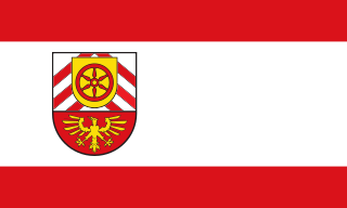
Гютерсло (Gütersloh, Kreis Gütersloh)
Gütersloh district in North Rhine-Westphalia, Germany, offers a variety of hiking opportunities set against a picturesque backdrop of nature and charming landscapes. Here are some highlights for hiking in this area:
1.
- Teutoburg Forest: This range is just southwest of Gütersloh and offers numerous trails through dense forests, hills, and valleys. The trails are well-marked and cater to all skill levels.
- Niederrheinische Höhenweg: This long-distance hiking trail connects various landscapes and features rolling hills, forests, and farmland, providing a taste of the local flora and fauna.
2.
- Gütersloh City Parks: The city itself has beautiful parks such as the Stadtpark, where visitors can enjoy easier walking paths amidst landscaped gardens.
- Nature Reserves: Nearby nature reserves like the "Brockhagen Moor" offer hiking paths that allow you to explore diverse ecosystems and view unique wildlife.
3.
- Historical Trails: Many hiking routes also incorporate local history, taking you to historical sites such as old churches, castles, and traditional villages.
- The Ems River Path: This scenic route follows the Ems river, showcasing picturesque views and the opportunity to spot wildlife.
4.
- Trail Conditions: Always check the current conditions of the trails, especially after rain, as some paths may become muddy.
- Maps and Guides: Utilize local maps and guides available at visitor centers for detailed information on trail lengths and difficulty levels.
- Hydration and Gear: Carry sufficient water and snacks, wear appropriate hiking gear, and check the weather forecast before heading out.
5.
- Throughout the year, there may be organized hiking events or festivals in the district. These are great opportunities to meet fellow hikers and explore new trails.
Overall, Gütersloh district is a wonderful location for hikers of all levels, blending natural beauty with a touch of local culture and history. Enjoy your hike!
- Страна:

- Код автомобильного номера: GT
- Координаты: 51° 55' 0" N, 8° 20' 0" E


- GPS треки (wikiloc): [Ссылка]
- Высота над уровнем моря: 70 м m
- Веб сайт: http://www.kreis-guetersloh.de/
- Википедия русская: wiki(ru)
- Википедия английская: wiki(en)
- Википедия национальная: wiki(de)
- Хранилище Wikidata: Wikidata: Q6218
- Галерея изображений в википедии: [Ссылка]
- Катеория в википедии: [Ссылка]
- Карты в википедии: [Ссылка]
- код Freebase: [/m/01b2_d]
- код GeoNames: Альт: [3221127]
- код VIAF: Альт: [126661404]
- ID отношения в OpenStreetMap: [62379]
- код GND: Альт: [4022488-0]
- идентификатор местоположения ArchINFORM: [2436]
- код LCNAF: Альт: [n79141901]
- код TGN: [7076824]
- код NLI: [000977588]
- код NUTS: [DEA42]
- код района Германии: 05754
Граничит с регионами:

Билефельд
- город в Германии
Bielefeld, located in North Rhine-Westphalia, Germany, offers a variety of hiking opportunities for outdoor enthusiasts. The region is characterized by diverse landscapes, including forests, hills, and meadows, making it perfect for both casual walkers and serious hikers....
- Страна:

- Почтовый код: 33647; 33619; 33617; 33615; 33613; 33611; 33609; 33607; 33605; 33604; 33602; 33501
- Телефонный код: 0521; 05209; 05206; 05205; 05202; 05208; 05203
- Код автомобильного номера: BI
- Координаты: 52° 1' 0" N, 8° 32' 0" E


- GPS треки (wikiloc): [Ссылка]
- Высота над уровнем моря: 118 м m
- Площадь: 258.82 кв.км
- Население: 333451
- Веб сайт: [Ссылка]
Варендорф
- район в Германии
Warendorf, located in the North Rhine-Westphalia region of Germany, is known for its picturesque landscapes, charming villages, and lush countryside, making it a delightful destination for hiking enthusiasts....
- Страна:

- Код автомобильного номера: WAF
- Координаты: 51° 55' 12" N, 7° 55' 12" E


- GPS треки (wikiloc): [Ссылка]
- Высота над уровнем моря: 65 м m
- Веб сайт: [Ссылка]


Оснабрюк
Osnabrück district, located in Lower Saxony, Germany, offers a variety of hiking opportunities that cater to different skill levels and preferences. The region is characterized by its rolling hills, lush forests, and picturesque landscapes, making it an appealing destination for outdoor enthusiasts....
- Страна:

- Столица: Оснабрюк
- Код автомобильного номера: OS
- Координаты: 52° 19' 48" N, 8° 10' 12" E


- GPS треки (wikiloc): [Ссылка]
- Высота над уровнем моря: 57 м m
- Площадь: 2122.00 кв.км
- Население: 354807
- Веб сайт: [Ссылка]
Зост
Soest is a district located in North Rhine-Westphalia, Germany, known for its scenic landscapes, historical sites, and outdoor recreational opportunities. Hiking in the Soest area can be a delightful experience due to its diverse terrain, including forests, hills, and waterways....
- Страна:

- Код автомобильного номера: SO
- Координаты: 51° 34' 48" N, 8° 15' 0" E


- GPS треки (wikiloc): [Ссылка]
- Высота над уровнем моря: 137 м m
- Веб сайт: [Ссылка]
Падерборн
Paderborn, located in North Rhine-Westphalia, Germany, offers a variety of hiking opportunities, combining natural beauty with cultural landmarks. The region is characterized by its mix of forests, parks, and scenic countryside, making it a pleasant destination for both casual walkers and more experienced hikers....
- Страна:

- Код автомобильного номера: PB
- Координаты: 51° 42' 36" N, 8° 44' 24" E


- GPS треки (wikiloc): [Ссылка]
- Высота над уровнем моря: 221 м m
- Площадь: 1246.8 кв.км
- Веб сайт: [Ссылка]


Липпе
Lippe, located in North Rhine-Westphalia, Germany, is known for its picturesque landscapes, historical sites, and diverse hiking opportunities. Here are some key points to consider if you’re planning a hiking trip in the Lippe district:...
- Страна:

- Код автомобильного номера: LIP
- Координаты: 52° 0' 0" N, 8° 55' 0" E


- GPS треки (wikiloc): [Ссылка]
- Высота над уровнем моря: 129 м m
- Веб сайт: [Ссылка]
Херфорд
Herford district, located in North Rhine-Westphalia, Germany, offers a variety of hiking opportunities amid beautiful landscapes, charming towns, and scenic nature trails. Here are some highlights that you can expect when hiking in this region:...
- Страна:

- Код автомобильного номера: HF
- Координаты: 52° 10' 0" N, 8° 35' 0" E


- GPS треки (wikiloc): [Ссылка]
- Высота над уровнем моря: 59 м m
- Веб сайт: [Ссылка]


