Галло-Матезе (Gallo Matese, Gallo Matese)
.svg)
- коммуна Италии
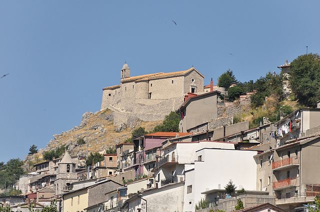
 Hiking in Галло-Матезе
Gallo Matese is a beautiful area in the Campania region of Italy, known for its stunning natural landscapes and rich biodiversity. Located in the Matese Regional Park, it offers a variety of hiking trails that cater to different skill levels, from easy walks to more challenging treks.
Key Trails and Features:
-
Scenic Views: The area is characterized by rolling hills, dense forests, and expansive meadows, making for breathtaking views. From higher altitudes, you can often see the surrounding Apennine mountains and valleys.
-
Wildlife: Gallo Matese is home to diverse flora and fauna, including various bird species, deer, and other wildlife. Hiking here often brings opportunities for wildlife spotting.
-
Historical Sites: Along the trails, you may encounter ancient ruins, churches, and other historical sites that reflect the rich cultural heritage of the region.
-
Trail Difficulty: There are trails suitable for both beginners and experienced hikers. Some popular and recommended trails include:
- Monte Miletto: This is the highest peak in the area, offering a more strenuous hike with rewarding panoramic views at the summit.
- Valle delle Ferriere: This trail provides an easier option with picturesque landscapes and the chance to explore waterfalls and lush scenery.
-
Best Time to Hike: The best seasons for hiking in Gallo Matese are spring and autumn when the weather is mild, and the hills are bursting with wildflowers or autumn foliage. Summer can be quite hot, while winter may bring snow to higher elevations.
-
Safety and Preparation: As with any hiking adventure, it’s essential to prepare adequately. Bring plenty of water, wear good hiking shoes, and check the weather forecast. It’s also wise to inform someone of your hiking plans.
-
Local Culture: Take the time to explore local villages and taste traditional cuisine, such as handmade pasta and local cheeses, which can greatly enrich your hiking experience.
Gallo Matese is a fantastic hiking destination that combines natural beauty with cultural exploration. Whether you're an experienced hiker or just looking for a leisurely stroll in nature, you'll find trails that suit your interests and abilities. Be sure to enjoy the peaceful surroundings and stunning Italian landscapes!
- Страна:

- Почтовый код: 81010
- Телефонный код: 0823
- Код автомобильного номера: CE
- Координаты: 41° 28' 0" N, 14° 13' 0" E


- GPS треки (wikiloc): [Ссылка]
- Высота над уровнем моря: 875 м m
- Площадь: 31.13 кв.км
- Население: 537
- Веб сайт: http://www.comune.gallomatese.ce.it/
- Википедия русская: wiki(ru)
- Википедия английская: wiki(en)
- Википедия национальная: wiki(it)
- Хранилище Wikidata: Wikidata: Q58617
- Катеория в википедии: [Ссылка]
- код Freebase: [/m/0gmzpz]
- код GeoNames: Альт: [6542184]
- код VIAF: Альт: [247427292]
- ID отношения в OpenStreetMap: [41311]
- код ISTAT: 061038
- кадастровый код Италии: D884
Граничит с регионами:
Лонгано
- коммуна Италии
Hiking in Лонгано
Longano is a charming village located in the province of Isernia, in the Molise region of Italy. Known for its picturesque landscapes and mountainous surroundings, it offers a variety of hiking opportunities for both beginner and experienced hikers....
- Страна:
- Почтовый код: 86090
- Телефонный код: 0865
- Код автомобильного номера: IS
- Координаты: 41° 31' 0" N, 14° 15' 0" E
- GPS треки (wikiloc): [Ссылка]
- Высота над уровнем моря: 700 м m
- Площадь: 27.38 кв.км
- Население: 680
- Веб сайт: [Ссылка]


Монтеродуни
- коммуна Италии
Hiking in Монтеродуни
Monteroduni, a charming village in the Molise region of Italy, offers opportunities for hikers to explore beautiful landscapes, rich history, and local culture. The surrounding areas feature rolling hills, lush forests, and panoramic views that are perfect for both leisurely walks and more challenging hikes....
- Страна:
- Почтовый код: 86075
- Телефонный код: 0865
- Код автомобильного номера: IS
- Координаты: 41° 31' 0" N, 14° 10' 0" E
- GPS треки (wikiloc): [Ссылка]
- Высота над уровнем моря: 476 м m
- Площадь: 37.22 кв.км
- Население: 2135
- Веб сайт: [Ссылка]
Роккамандольфи
- коммуна Италии
Hiking in Роккамандольфи
Roccamandolfi, located in the Molise region of Italy, is a fantastic destination for hiking enthusiasts. Nestled in the Apennine Mountains, this area offers a blend of stunning natural landscapes, rich history, and a tranquil environment, making it ideal for both novice and experienced hikers....
- Страна:
- Почтовый код: 86092
- Телефонный код: 0865
- Код автомобильного номера: IS
- Координаты: 41° 30' 0" N, 14° 21' 0" E
- GPS треки (wikiloc): [Ссылка]
- Высота над уровнем моря: 850 м m
- Площадь: 53.67 кв.км
- Население: 937
- Веб сайт: [Ссылка]
Каприати-а-Вольтурно
- коммуна Италии
Hiking in Каприати-а-Вольтурно
Capriati a Volturno is a small village located in the province of Isernia in the Molise region of Italy. The area is known for its beautiful natural surroundings, making it a fantastic destination for hiking enthusiasts. Here are some highlights of hiking in and around Capriati a Volturno:...
- Страна:
- Почтовый код: 81014
- Телефонный код: 0823
- Код автомобильного номера: CE
- Координаты: 41° 28' 4" N, 14° 8' 48" E
- GPS треки (wikiloc): [Ссылка]
- Высота над уровнем моря: 226 м m
- Площадь: 18.39 кв.км
- Население: 1538
- Веб сайт: [Ссылка]
Фонтегрека
- коммуна Италии
Hiking in Фонтегрека
Fontegreca, located in the Campania region of Italy, offers a variety of hiking opportunities amid its beautiful natural landscapes and charming villages. Here are some highlights and tips for hiking in Fontegreca:...
- Страна:
- Почтовый код: 81010
- Телефонный код: 0823
- Код автомобильного номера: CE
- Координаты: 41° 27' 0" N, 14° 11' 0" E
- GPS треки (wikiloc): [Ссылка]
- Высота над уровнем моря: 320 м m
- Площадь: 9.71 кв.км
- Население: 792
- Веб сайт: [Ссылка]
Летино
- коммуна Италии
Hiking in Летино
Letino is a charming village located in the Campania region of Italy, surrounded by beautiful natural landscapes, making it a great location for hiking enthusiasts. Nestled in the hills of the Matese Regional Park, Letino offers a variety of trails that cater to different skill levels, from easy walks to more challenging hikes....
- Страна:
- Почтовый код: 81010
- Телефонный код: 0823
- Код автомобильного номера: CE
- Координаты: 41° 27' 0" N, 14° 15' 0" E
- GPS треки (wikiloc): [Ссылка]
- Высота над уровнем моря: 1050 м m
- Площадь: 31.59 кв.км
- Население: 703
- Веб сайт: [Ссылка]
Прата-Саннита
- коммуна Италии
Hiking in Прата-Саннита
Prata Sannita is a picturesque village located in the province of Benevento, Campania, Italy. Nestled in the foothills of the Apennines, it's surrounded by beautiful natural landscapes, making it a great destination for hiking enthusiasts....
- Страна:
- Почтовый код: 81010
- Телефонный код: 0823
- Код автомобильного номера: CE
- Координаты: 41° 26' 0" N, 14° 12' 0" E
- GPS треки (wikiloc): [Ссылка]
- Высота над уровнем моря: 360 м m
- Площадь: 21.21 кв.км
- Население: 1463
- Веб сайт: [Ссылка]