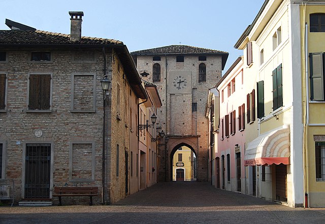
Гацольдо-дельй-ипполити (Gazoldo degli Ippoliti, Gazoldo degli Ippoliti)
.svg)
- коммуна Италии
 Hiking in Гацольдо-дельй-ипполити
Gazoldo degli Ippoliti is a charming town in the Lombardy region of Italy, surrounded by a picturesque landscape ideal for hiking. While the town itself might not be a major hiking destination, the surrounding countryside offers beautiful trails and scenic routes that are perfect for outdoor enthusiasts.
Hiking Trails:
-
Local Nature Paths: Explore local nature trails that wind through vineyards, forests, and along the banks of rivers. These trails often provide opportunities for birdwatching and experiencing the local flora and fauna.
-
Parco del Mincio: Just a short drive away, this park offers extensive trails along the Mincio River, with beautiful views, picnic areas, and diverse wildlife. It's an excellent option for a day hike.
-
Cultural and Historical Hikes: Combine your hiking experience with cultural heritage by exploring routes that lead to nearby historical sites, such as charming villages, ancient churches, and remnants of the region's rich history.
Tips for Hiking in the Area:
- Weather Considerations: Check the weather before heading out, as conditions can change. Spring and early fall are ideal for hiking in this region due to mild temperatures.
- Local Maps: Bring along a map of the area and familiarize yourself with trails before you go. Local tourism offices can provide useful resources.
- Respect the Environment: Follow the Leave No Trace principles by staying on marked trails, disposing of waste properly, and respecting wildlife.
Additional Activities:
In addition to hiking, you can explore local gastronomy in Gazoldo degli Ippoliti, known for its regional wines and cuisine, which can enhance your outdoor experience. Whether it’s a small vineyard tour or trying local dishes in town, it can make for a well-rounded adventure.
If you decide to hike in this area, be sure to enjoy the natural beauty and cultural richness Lombardy has to offer!
- Страна:

- Почтовый код: 46040
- Телефонный код: 0376
- Код автомобильного номера: MN
- Координаты: 45° 12' 0" N, 10° 35' 0" E


- GPS треки (wikiloc): [Ссылка]
- Высота над уровнем моря: 35 м m
- Площадь: 13.03 кв.км
- Население: 2970
- Веб сайт: http://www.comune.gazoldo.mn.it
- Википедия русская: wiki(ru)
- Википедия английская: wiki(en)
- Википедия национальная: wiki(it)
- Хранилище Wikidata: Wikidata: Q42349
- Катеория в википедии: [Ссылка]
- код Freebase: [/m/0gk007]
- код GeoNames: Альт: [6536590]
- код VIAF: Альт: [147426805]
- ID отношения в OpenStreetMap: [44401]
- UN/LOCODE: [ITZKI]
- код ISTAT: 020024
- кадастровый код Италии: D949
Граничит с регионами:


Кастеллуккьо
- коммуна Италии
Hiking in Кастеллуккьо
Castellucchio, located in the Lombardy region of Italy, is not as widely known for hiking as some other areas in the country, but it offers a unique experience for those looking to explore the Italian countryside. While it may not boast towering mountains, there are several trails and natural landscapes that can be enjoyable for hikers seeking a peaceful retreat....
- Страна:
- Почтовый код: 46014
- Телефонный код: 0376
- Код автомобильного номера: MN
- Координаты: 45° 9' 0" N, 10° 39' 0" E
- GPS треки (wikiloc): [Ссылка]
- Высота над уровнем моря: 26 м m
- Площадь: 46.34 кв.км
- Население: 5235
- Веб сайт: [Ссылка]


Родиго
- коммуна Италии
Hiking in Родиго
Rodigo is a small town in the Lombardy region of Italy, known for its historical architecture and charming countryside. While it's not a major hiking destination like the nearby Alps or National Parks, there are still opportunities for hiking and enjoying nature in the surrounding areas....
- Страна:
- Почтовый код: 46040
- Телефонный код: 0376
- Код автомобильного номера: MN
- Координаты: 45° 12' 0" N, 10° 38' 0" E
- GPS треки (wikiloc): [Ссылка]
- Высота над уровнем моря: 31 м m
- Площадь: 41.61 кв.км
- Население: 5272
- Веб сайт: [Ссылка]


Пьюбега
- коммуна Италии
Hiking in Пьюбега
Piubega is a small municipality located in the Lombardy region of Italy, near Lake Garda and the surrounding hills. While it may not be as well-known as some of Italy's bigger tourist destinations, it offers a quaint atmosphere and natural beauty that can be appealing for hiking enthusiasts looking for off-the-beaten-path experiences....
- Страна:
- Почтовый код: 46040
- Телефонный код: 0376
- Код автомобильного номера: MN
- Координаты: 45° 14' 0" N, 10° 32' 0" E
- GPS треки (wikiloc): [Ссылка]
- Высота над уровнем моря: 40 м m
- Площадь: 16.59 кв.км
- Население: 1681
- Веб сайт: [Ссылка]

Черезара
- коммуна Италии
Hiking in Черезара
Ceresara is a charming village located in the Lombardy region of Italy, near the banks of the Po River. While it may not be as well-known as some of Italy’s more famous hiking destinations, the surrounding areas offer a variety of trails and natural landscapes for outdoor enthusiasts to explore....
- Страна:
- Почтовый код: 46040
- Телефонный код: 0376
- Код автомобильного номера: MN
- Координаты: 45° 15' 44" N, 10° 34' 10" E
- GPS треки (wikiloc): [Ссылка]
- Высота над уровнем моря: 44 м m
- Площадь: 37.31 кв.км
- Население: 2609
- Веб сайт: [Ссылка]


Редондеско
- коммуна Италии
Hiking in Редондеско
It appears that "Redondesco" may not be a widely recognized hiking destination or location as of my last update. It might refer to a specific area, park, or perhaps a locality within a broader region. To give you the best information, could you clarify whether it's a city, village, or a geographic feature?...
- Страна:
- Почтовый код: 46010
- Телефонный код: 0376
- Код автомобильного номера: MN
- Координаты: 45° 10' 0" N, 10° 31' 0" E
- GPS треки (wikiloc): [Ссылка]
- Высота над уровнем моря: 31 м m
- Площадь: 19.04 кв.км
- Население: 1268
- Веб сайт: [Ссылка]


Маркария
- коммуна Италии
Hiking in Маркария
Marcaria is a small town located in the Lombardy region of Italy. While it may not be a well-known hiking destination, it is surrounded by beautiful landscapes and natural areas that can provide a pleasant experience for hikers....
- Страна:
- Почтовый код: 46010
- Телефонный код: 0376
- Код автомобильного номера: MN
- Координаты: 45° 7' 0" N, 10° 32' 0" E
- GPS треки (wikiloc): [Ссылка]
- Высота над уровнем моря: 25 м m
- Площадь: 89.79 кв.км
- Население: 6591
- Веб сайт: [Ссылка]