Джела (Gela, Gela)
- коммуна в Италии
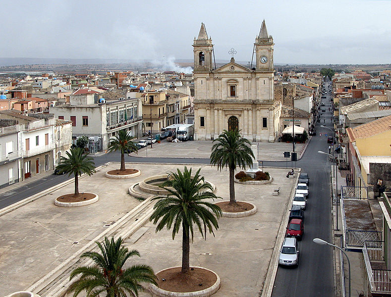
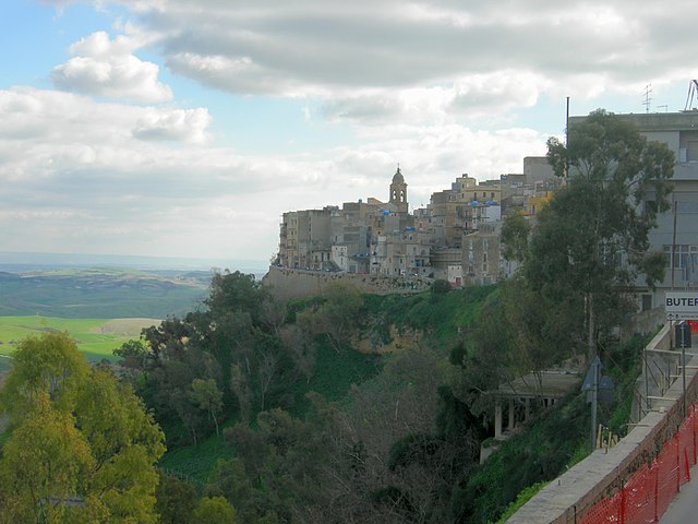
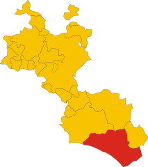
Gela, located on the southern coast of Sicily, Italy, offers various hiking opportunities that showcase its stunning natural landscapes and rich cultural history. Here are some highlights regarding hiking in the region:
Trails and Areas
-
Monti Iblei: This mountain range southeast of Gela boasts beautiful trails, including paths through dense Mediterranean forests and along rocky outcrops with sweeping views of the surrounding countryside.
-
Cava del Carbone: This area is known for its impressive limestone canyon with well-marked hiking trails. The scenery features unique rock formations and diverse flora and fauna.
-
Natural Reserves: Nearby, the Riserva Naturale Orientata Macchia Foresta di Cava Grande offers various trails where hikers can explore dense forests, steep cliffs, and panoramic views. The reserve is a haven for those interested in nature and wildlife.
-
Coastal Hikes: The coastline around Gela presents opportunities for coastal hiking. Trails along the cliffs provide picturesque views of the sea, especially at sunset.
Tips for Hiking in Gela
-
Weather: Check the local weather conditions before heading out, as temperatures can vary significantly depending on the season. Spring and fall are generally the most comfortable seasons for hiking.
-
Preparation: Bring plenty of water, especially in the summer, and wear appropriate footwear and clothing for hiking.
-
Trail Maps: Having a physical map or a reliable GPS app is important, as some trails may not be well marked.
-
Local Guides: Consider hiring a local guide for a more informative experience, especially if you're unfamiliar with the area or want to learn more about the local history and ecology.
Cultural Integration
While hiking, you may encounter ancient ruins, such as Greek or Roman sites, reflecting Gela's rich history. Take time to explore these areas and understand the cultural significance they hold.
Wildlife Watching
Gela and its surrounding areas also offer opportunities for birdwatching and observing local wildlife, particularly in the protected areas.
Hiking in Gela can be a rewarding experience, combining physical activity with stunning views and cultural exploration. Enjoy your adventures in this beautiful part of Sicily!
- Страна:

- Почтовый код: 93012
- Телефонный код: 0933
- Код автомобильного номера: CL
- Координаты: 37° 4' 0" N, 14° 15' 0" E


- GPS треки (wikiloc): [Ссылка]
- Высота над уровнем моря: 46 м m
- Площадь: 279.07 кв.км
- Население: 75522
- Веб сайт: http://www.comune.gela.cl.it
- Википедия русская: wiki(ru)
- Википедия английская: wiki(en)
- Википедия национальная: wiki(it)
- Хранилище Wikidata: Wikidata: Q39971
- Галерея изображений в википедии: [Ссылка]
- Катеория в википедии: [Ссылка]
- Карты в википедии: [Ссылка]
- код Freebase: [/m/0402mg]
- код GeoNames: Альт: [6541964]
- код VIAF: Альт: [153681408]
- ID отношения в OpenStreetMap: [39177]
- код GND: Альт: [4092775-1]
- идентификатор местоположения ArchINFORM: [1056]
- код LCNAF: Альт: [n85341123]
- место в MusicBrainz: [4484ed5b-011a-4731-b039-c2f6a5c54c5e]
- WOEID: [716067]
- код темы Quora: [Gela-Italy]
- UN/LOCODE: [ITGEA]
- Nomisma ID: [gela]
- код ISTAT: 085007
- кадастровый код Италии: D960
- код US National Archives: 10044858
Граничит с регионами:


Акате
- коммуна в Италии
Acate is a charming town located in the province of Ragusa in Sicily, Italy. While it may not be as renowned for hiking as some other regions, there are still opportunities to explore the natural beauty and surroundings of Acate. Here are some things to consider when hiking in and around Acate:...
- Страна:

- Почтовый код: 97011
- Телефонный код: 0932
- Код автомобильного номера: RG
- Координаты: 37° 1' 31" N, 14° 29' 33" E


- GPS треки (wikiloc): [Ссылка]
- Высота над уровнем моря: 199 м m
- Площадь: 102.47 кв.км
- Население: 11325
- Веб сайт: [Ссылка]


Бутера
- коммуна в Италии
Butera, located in the province of Caltanissetta in Sicily, Italy, offers a unique and beautiful setting for hiking enthusiasts. The area is characterized by its rugged landscapes, historical sites, and natural beauty. Here are some key points about hiking in and around Butera:...
- Страна:

- Почтовый код: 93011
- Телефонный код: 0934
- Код автомобильного номера: CL
- Координаты: 37° 11' 0" N, 14° 11' 0" E


- GPS треки (wikiloc): [Ссылка]
- Высота над уровнем моря: 402 м m
- Площадь: 295 кв.км
- Население: 4620
- Веб сайт: [Ссылка]


Маццарино
- коммуна в Италии
Mazzarino, located in the province of Caltanissetta in Sicily, offers hikers a unique blend of historical sites and natural beauty. While the area might not be as well-known for hiking as some other parts of Sicily, it provides opportunities for those looking to explore the Sicilian countryside....
- Страна:

- Почтовый код: 93013
- Телефонный код: 0934
- Код автомобильного номера: CL
- Координаты: 37° 18' 0" N, 14° 12' 0" E


- GPS треки (wikiloc): [Ссылка]
- Высота над уровнем моря: 553 м m
- Площадь: 295.59 кв.км
- Население: 11842
- Веб сайт: [Ссылка]


Нишеми
- коммуна в Италии
Niscemi, located in the province of Caltanissetta in Sicily, Italy, is a beautiful destination for hiking enthusiasts. The area boasts a diverse landscape, featuring hills, forests, and agricultural lands, with a rich variety of flora and fauna. Here are some key points to consider for hiking in Niscemi:...
- Страна:

- Почтовый код: 93015
- Телефонный код: 0933
- Код автомобильного номера: CL
- Координаты: 37° 9' 0" N, 14° 23' 0" E


- GPS треки (wikiloc): [Ссылка]
- Высота над уровнем моря: 332 м m
- Площадь: 96.82 кв.км
- Население: 26946
- Веб сайт: [Ссылка]


Кальтаджироне
- коммуна в Италии
Caltagirone, located in Sicily, Italy, is known for its rich history, stunning architecture, and beautiful landscapes. While it is primarily recognized for its ceramics and Baroque architecture, it also offers several hiking opportunities that allow visitors to explore the natural beauty of the surrounding area....
- Страна:

- Почтовый код: 95041
- Телефонный код: 0933
- Код автомобильного номера: CT
- Координаты: 37° 14' 0" N, 14° 31' 0" E


- GPS треки (wikiloc): [Ссылка]
- Высота над уровнем моря: 608 м m
- Площадь: 383.38 кв.км
- Население: 38295
- Веб сайт: [Ссылка]

