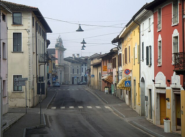
Готтоленго (Gottolengo, Gottolengo)
.svg)
- коммуна Италии
 Hiking in Готтоленго
Gottolengo is a small town in the Lombardy region of Italy, located in the province of Brescia. While it may not be as famous for hiking as some of the larger national parks or mountains in the area, there are still opportunities to enjoy the beautiful Italian countryside through walking and exploring the scenic surroundings.
Hiking Opportunities near Gottolengo:
-
Local Trails: The area around Gottolengo offers several local trails that allow you to explore the countryside. These paths may take you through fields, vineyards, and quaint villages, providing a true taste of rural Italy.
-
Parco Regionale dell'Oglio Sud: A short drive from Gottolengo will bring you to the Oglio Sud Regional Park. This park features numerous trails along the Oglio River, with options for both leisurely walks and more vigorous hikes. The park is home to diverse wildlife and several picturesque spots for picnicking.
-
Lakes and Nature Reserves: Consider hiking around areas like Lake Iseo or the nearby Nature Reserves, where you can enjoy beautiful water views, forested areas, and more developed walking paths.
-
Proximity to Larger Areas: If you’re willing to travel a bit farther, the Alps and other notable hiking destinations are within reach. The Val Camonica and the Adamello-Brenta Nature Park are popular for more challenging hikes.
Tips for Hiking in Gottolengo:
- Maps and Navigation: Make sure to have a reliable map or GPS device, as some trails might not be well-marked.
- Weather Considerations: Check the weather before heading out and dress in layers, as it can vary throughout the day, especially in spring and fall.
- Local Knowledge: Connecting with local hiking groups may provide additional insights into hidden trails and points of interest.
- Respect Nature: Always follow Leave No Trace principles to preserve the area's natural beauty.
While Gottolengo itself may not be a hiking hotspot, it serves as a wonderful base from which to explore the natural beauty of the surrounding Lombardy region. Enjoy your hiking adventures!
- Страна:

- Почтовый код: 25023
- Телефонный код: 030
- Код автомобильного номера: BS
- Координаты: 45° 17' 34" N, 10° 16' 24" E


- GPS треки (wikiloc): [Ссылка]
- Высота над уровнем моря: 53 м m
- Площадь: 29.28 кв.км
- Население: 5184
- Веб сайт: http://www.gottolengo.com
- Википедия русская: wiki(ru)
- Википедия английская: wiki(en)
- Википедия национальная: wiki(it)
- Хранилище Wikidata: Wikidata: Q104643
- Катеория в википедии: [Ссылка]
- код Freebase: [/m/043pfh]
- код GeoNames: Альт: [6540186]
- код VIAF: Альт: [247870253]
- ID отношения в OpenStreetMap: [44634]
- идентификатор местоположения ArchINFORM: [6859]
- UN/LOCODE: [ITGTL]
- код ISTAT: 017080
- кадастровый код Италии: E116
Граничит с регионами:
Гамбара
- коммуна Италии
Hiking in Гамбара
Gambara is a small town located in the Lombardy region of Italy, known for its picturesque countryside, charming landscapes, and proximity to various natural areas suitable for hiking. While Gambara itself may not have extensive hiking trails, it serves as a great gateway to explore the surrounding areas that offer beautiful hiking experiences....
- Страна:
- Почтовый код: 25020
- Телефонный код: 030
- Код автомобильного номера: BS
- Координаты: 45° 15' 22" N, 10° 17' 40" E
- GPS треки (wikiloc): [Ссылка]
- Высота над уровнем моря: 51 м m
- Площадь: 31.59 кв.км
- Население: 4743
- Веб сайт: [Ссылка]

Геди
- коммуна Италии
Hiking in Геди
Ghedi, located in the Lombardy region of northern Italy, is primarily known for its agricultural landscape rather than extensive hiking trails. However, the surrounding areas, such as the nearby hills and nature reserves, offer opportunities for outdoor activities including hiking....
- Страна:
- Почтовый код: 25016
- Телефонный код: 030
- Код автомобильного номера: BS
- Координаты: 45° 24' 7" N, 10° 16' 49" E
- GPS треки (wikiloc): [Ссылка]
- Высота над уровнем моря: 85 м m
- Площадь: 60 кв.км
- Население: 18828
- Веб сайт: [Ссылка]

Изорелла
- коммуна Италии
Hiking in Изорелла
Isorella is a charming municipality located in the Lombardy region of Italy, known for its picturesque landscapes and tranquil natural settings. While it may not be as widely known for hiking as some other regions in Italy, there are definitely some opportunities for outdoor activities....
- Страна:
- Почтовый код: 25010
- Телефонный код: 030
- Код автомобильного номера: BS
- Координаты: 45° 18' 33" N, 10° 19' 24" E
- GPS треки (wikiloc): [Ссылка]
- Высота над уровнем моря: 56 м m
- Площадь: 15.33 кв.км
- Население: 4077
- Веб сайт: [Ссылка]

Лено
- город в Италии
Hiking in Лено
Leno, a small town in Lombardy, Italy, is situated in a picturesque region known for its beautiful countryside and proximity to larger nature areas. While Leno itself may not offer extensive hiking trails directly within the town, it serves as a gateway to several scenic hiking opportunities in the surrounding areas....
- Страна:
- Почтовый код: 25024
- Телефонный код: 030
- Код автомобильного номера: BS
- Координаты: 45° 22' 13" N, 10° 13' 0" E
- GPS треки (wikiloc): [Ссылка]
- Высота над уровнем моря: 66 м m
- Площадь: 58.45 кв.км
- Население: 14322
- Веб сайт: [Ссылка]
Павоне-дель-Мелла
- коммуна Италии
Hiking in Павоне-дель-Мелла
Pavone del Mella is a charming municipality located in the Lombardy region of Italy, in the province of Brescia. While it may not be as well-known for hiking as some of the more prominent areas in Italy, there are still opportunities for hiking and enjoying the beautiful natural surroundings....
- Страна:
- Почтовый код: 25020
- Телефонный код: 030
- Код автомобильного номера: BS
- Координаты: 45° 18' 3" N, 10° 12' 31" E
- GPS треки (wikiloc): [Ссылка]
- Высота над уровнем моря: 54 м m
- Площадь: 11.61 кв.км
- Население: 2801
- Веб сайт: [Ссылка]

Пральбоино
- коммуна Италии
Hiking in Пральбоино
Pralboino is a small town located in the Lombardy region of Italy. While it may not be as well-known as some of the larger towns in the area, it offers opportunities for hiking and outdoor activities. Here are some insights about hiking in and around Pralboino:...
- Страна:
- Почтовый код: 25020
- Телефонный код: 030
- Код автомобильного номера: BS
- Координаты: 45° 16' 6" N, 10° 13' 6" E
- GPS треки (wikiloc): [Ссылка]
- Высота над уровнем моря: 47 м m
- Площадь: 17.16 кв.км
- Население: 2938
- Веб сайт: [Ссылка]