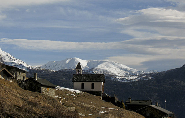
Грозотто (Grosotto, Grosotto)
.svg)
- коммуна Италии
 Hiking in Грозотто
Grosotto, located in the Valtellina valley of northern Italy, is a fantastic destination for hiking enthusiasts. Surrounded by stunning landscapes, this area offers a variety of trails that cater to all levels of hikers, from beginners to experienced mountaineers.
Highlights of Hiking in Grosotto:
-
Diverse Terrain: The region is characterized by a mix of valleys, forests, and alpine meadows, as well as impressive rock formations and panoramic viewpoints. You can experience both gentle walks and challenging climbs.
-
Scenic Trails: Trails in Grosotto often lead to breathtaking views of the surrounding mountains, including the Rhaetian Alps. Popular routes may include paths through the Val di Sonvico and the Val Grosotto, where you can enjoy lush nature and possibly spot local wildlife.
-
Cultural Experience: Aside from natural beauty, Grosotto is rich in history and culture. You might encounter ancient churches, traditional farms, and historical villages along the hiking routes, giving you a glimpse of local life.
-
Accessibility: Many hiking trails are well-marked and accessible from the town, making it easy for hikers to find their way. Some paths may be suitable for families, while others are more demanding and intended for seasoned hikers.
-
Seasonal Beauty: Each season offers a unique experience—spring brings blooming wildflowers, summer offers lush green scenery, autumn showcases vibrant foliage, and winter provides opportunities for snowshoeing and winter hiking.
Recommended Tips:
- Proper Gear: Ensure you have suitable hiking shoes, weather-appropriate clothing, and enough water and snacks for your hike.
- Check Weather Conditions: Weather can change rapidly in the mountains, so check forecasts before heading out.
- Plan Your Route: Research the trails ahead of time. Consider using local maps or hiking apps to help you stay on track.
- Stay Safe: Inform someone of your hiking plans, especially if you’re tackling more remote trails.
Local Tips:
- Visit Local Tourist Information: They can provide up-to-date information on trail conditions and any events that may be taking place during your visit.
- Try Local Cuisine: After your hike, indulge in local dishes at trattorias or restaurants in Grosotto to experience the flavor of the region.
Whether you are a casual walker or a serious hiker, Grosotto has something to offer everyone. Enjoy your hiking adventures in this beautiful part of Italy!
- Страна:

- Почтовый код: 23034
- Телефонный код: 0342
- Код автомобильного номера: SO
- Координаты: 46° 17' 0" N, 10° 16' 0" E


- GPS треки (wikiloc): [Ссылка]
- Высота над уровнем моря: 610 м m
- Площадь: 53.12 кв.км
- Население: 1624
- Веб сайт: http://www.comune.grosotto.so.it/
- Википедия русская: wiki(ru)
- Википедия английская: wiki(en)
- Википедия национальная: wiki(it)
- Хранилище Wikidata: Wikidata: Q40889
- Катеория в википедии: [Ссылка]
- код Freebase: [/m/0gj35h]
- код GeoNames: Альт: [6536126]
- код VIAF: Альт: [238797868]
- ID отношения в OpenStreetMap: [47087]
- WOEID: [716427]
- UN/LOCODE: [ITOOT]
- код ISTAT: 014034
- кадастровый код Италии: E201
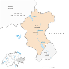
Граничит с регионами:

Монно
- коммуна Италии
Hiking in Монно
Monno, located in the province of Brescia in Italy, is an excellent destination for hiking enthusiasts. Nestled in the beautiful landscape of the Lombardy region, it offers a variety of trails suitable for different skill levels, from leisurely walks to more challenging hikes....
- Страна:
- Почтовый код: 25040
- Телефонный код: 0364
- Код автомобильного номера: BS
- Координаты: 46° 12' 48" N, 10° 20' 26" E
- GPS треки (wikiloc): [Ссылка]
- Высота над уровнем моря: 1066 м m
- Площадь: 31.03 кв.км
- Население: 540
- Веб сайт: [Ссылка]
Маццо-ди-Вальтеллина
- коммуна Италии
Hiking in Маццо-ди-Вальтеллина
Mazzo di Valtellina, located in the Valtellina valley in the Lombardy region of northern Italy, offers a stunning backdrop for hiking enthusiasts. The region is known for its majestic alpine scenery, rich biodiversity, and well-marked trails that cater to hikers of all skill levels. Here’s a guide to hiking in this beautiful area:...
- Страна:
- Почтовый код: 23030
- Телефонный код: 0342
- Код автомобильного номера: SO
- Координаты: 46° 15' 0" N, 10° 15' 0" E
- GPS треки (wikiloc): [Ссылка]
- Высота над уровнем моря: 552 м m
- Площадь: 15.32 кв.км
- Население: 999
- Веб сайт: [Ссылка]

Вервио
- коммуна Италии
Hiking in Вервио
Vervio is a charming village located in the Valtellina region of northern Italy, which offers beautiful hiking opportunities amidst stunning alpine scenery. Here are some key points about hiking in and around Vervio:...
- Страна:
- Почтовый код: 23030
- Телефонный код: 0342
- Код автомобильного номера: SO
- Координаты: 46° 15' 0" N, 10° 14' 0" E
- GPS треки (wikiloc): [Ссылка]
- Высота над уровнем моря: 549 м m
- Площадь: 12.41 кв.км
- Население: 209
- Веб сайт: [Ссылка]


Грозьо
- коммуна Италии
Hiking in Грозьо
Grosio, located in the Valtellina valley of northern Italy, is a wonderful destination for hiking enthusiasts. Surrounded by the stunning Rhaetian Alps, the area offers a variety of trails that cater to different skill levels, from casual walkers to experienced hikers....
- Страна:
- Почтовый код: 23033
- Телефонный код: 0342
- Код автомобильного номера: SO
- Координаты: 46° 18' 0" N, 10° 17' 0" E
- GPS треки (wikiloc): [Ссылка]
- Высота над уровнем моря: 656 м m
- Площадь: 126.92 кв.км
- Население: 4431
- Веб сайт: [Ссылка]


Брусио
Hiking in Брусио
Brusio, located in the Graubünden region of Switzerland, offers stunning landscapes and a variety of hiking trails suitable for different skill levels. Here are some highlights and tips for hiking in and around Brusio:...
- Страна:

- Почтовый код: 7743; 7748; 7747; 7744
- Телефонный код: 081
- Код автомобильного номера: GR
- Координаты: 46° 15' 20" N, 10° 7' 8" E
- GPS треки (wikiloc): [Ссылка]
- Высота над уровнем моря: 1042 м m
- Площадь: 46.29 кв.км
- Население: 1135
- Веб сайт: [Ссылка]
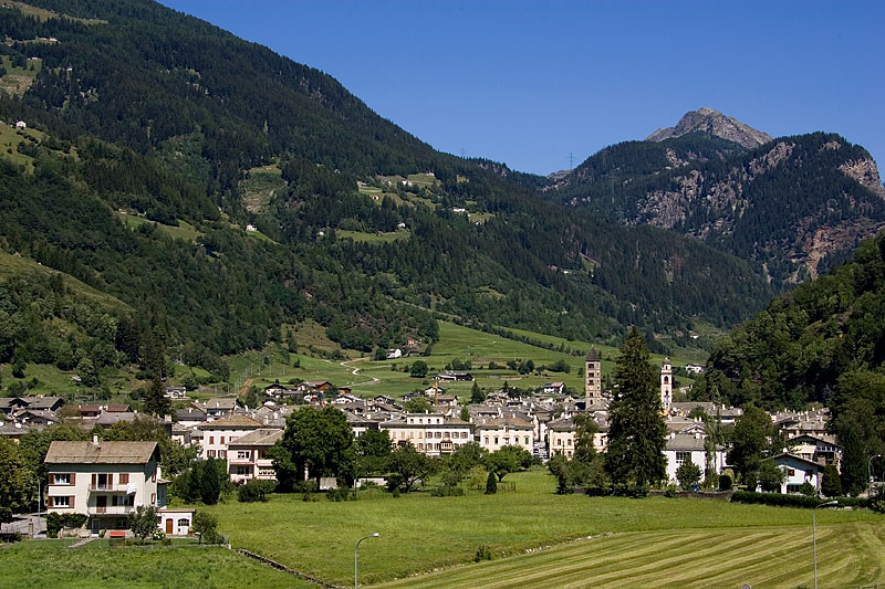
Поскьяво
Hiking in Поскьяво
Poschiavo is a picturesque valley located in the eastern part of Switzerland, with stunning landscapes that make it an excellent destination for hiking enthusiasts. The valley is part of the canton of Graubünden and is known for its blend of Swiss and Italian cultures, reflected in its charming villages and local cuisine....
- Страна:
- Почтовый код: 7742; 7746; 7741; 7710; 7745
- Телефонный код: 081
- Код автомобильного номера: GR
- Координаты: 46° 20' 0" N, 10° 2' 59" E
- GPS треки (wikiloc): [Ссылка]
- Высота над уровнем моря: 1014 м m
- Площадь: 191.01 кв.км
- Население: 3516
- Веб сайт: [Ссылка]