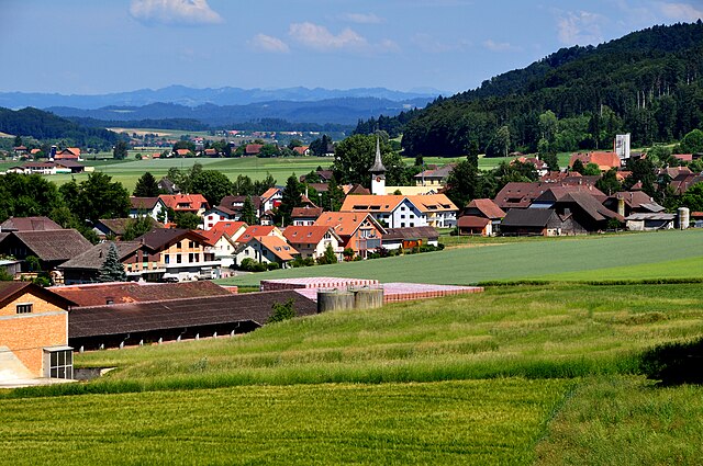
Гроссаффольтерн (Grossaffoltern, Grossaffoltern)

 Hiking in Гроссаффольтерн
Grossaffoltern, located in the Canton of Bern, Switzerland, offers a delightful variety of hiking opportunities set against the backdrop of lush landscapes, rolling hills, and charming rural scenery. While not as mountainous as some regions in Switzerland, Grossaffoltern provides a serene hiking experience that's perfect for families, casual walkers, and those looking to enjoy nature.
Hiking Trails
-
Easy Family Trails: There are several easy trails suitable for families. These paths often wind through picturesque farmlands and forests, providing an opportunity to see local wildlife and plants.
-
Scenic Loop Trails: The area features various loop trails that allow you to explore the scenic beauty of the region. Some popular routes may lead you through vineyards and fields, showcasing the agricultural heritage of the area.
-
Nature Walks: For those who want a more immersive experience in nature, there are paths that take you through forests and along water bodies, allowing hikers to connect with the tranquility of the surrounding environment.
Tips for Hiking in Grossaffoltern
- Trail Maps: It's advisable to pickup a local trail map or use a hiking app to navigate the trails easily.
- Pack Essentials: Always carry water, snacks, and a first-aid kit. Depending on the season, you may also need sun protection or appropriate clothing for cooler weather.
- Weather Awareness: The weather can change rapidly, so check the forecast before heading out and be prepared for varying conditions.
- Respect Nature: Stay on marked trails, make sure to leave no trace, and be mindful of local wildlife.
Accessibility
Grossaffoltern is typically accessible by public transport and has some parking areas if you choose to drive. This makes it easy to reach the starting points of various hiking trails.
Nearby Attractions
If you're planning a hike in Grossaffoltern, consider combining it with visits to nearby attractions such as local farms, historical sites, or a trip into the city of Bern, which is not too far away.
Overall, hiking in Grossaffoltern is a fantastic way to enjoy Switzerland's beautiful countryside, whether you’re seeking a leisurely stroll or a more active outdoor adventure.
- Страна:

- Почтовый код: 3257, 3262
- Телефонный код: 032
- Код автомобильного номера: BE
- Координаты: 47° 4' 8" N, 7° 21' 23" E


- GPS треки (wikiloc): [Ссылка]
- Высота над уровнем моря: 550 м m
- Площадь: 15.06 кв.км
- Население: 3032
- Веб сайт: http://www.grossaffoltern.ch
- Википедия русская: wiki(ru)
- Википедия английская: wiki(en)
- Википедия национальная: wiki(de)
- Хранилище Wikidata: Wikidata: Q65921
- Катеория в википедии: [Ссылка]
- код Freebase: [/m/02_dz5]
- код GeoNames: Альт: [7285988]
- код VIAF: Альт: [241214594]
- ID отношения в OpenStreetMap: [1682458]
- код GND: Альт: [4591477-1]
- идентификатор HDS: [174]
- код швейцарского муниципалитета: [0303]
Граничит с регионами:

Шюпфен
Hiking in Шюпфен
Schüpfen, located in the Canton of Bern in Switzerland, offers a variety of hiking opportunities in a picturesque setting. Although it is a small municipality, its surroundings feature beautiful landscapes, rolling hills, and scenic views typical of the Swiss countryside....
- Страна:
- Почтовый код: 3054
- Телефонный код: 031
- Код автомобильного номера: BE
- Координаты: 47° 2' 9" N, 7° 22' 29" E
- GPS треки (wikiloc): [Ссылка]
- Высота над уровнем моря: 540 м m
- Площадь: 19.83 кв.км
- Население: 3752
- Веб сайт: [Ссылка]


Зеедорф
- община в Швейцарии, Берн
Hiking in Зеедорф
Seedorf, located in the Canton of Bern, Switzerland, is a delightful destination for hiking enthusiasts. Nestled at the foot of the Alps and surrounded by picturesque landscapes, it offers various trails suitable for different skill levels....
- Страна:
- Почтовый код: 3268; 3035; 3266; 3267
- Телефонный код: 032
- Код автомобильного номера: BE
- Координаты: 47° 1' 38" N, 7° 18' 48" E
- GPS треки (wikiloc): [Ссылка]
- Высота над уровнем моря: 602 м m
- Площадь: 20.9 кв.км
- Население: 3113
- Веб сайт: [Ссылка]


Рапперсвиль
Hiking in Рапперсвиль
Rapperswil, located on the shores of Lake Zurich, isn't in Bern, but it is in the canton of Zurich, which is relatively close to Bern in Switzerland. It's known for its scenic beauty, rich history, and being a gateway to various hiking routes, as it’s surrounded by stunning landscapes and hills....
- Страна:
- Почтовый код: 3251, 3255, 3256
- Телефонный код: 031
- Код автомобильного номера: BE
- Координаты: 47° 3' 47" N, 7° 24' 36" E
- GPS треки (wikiloc): [Ссылка]
- Высота над уровнем моря: 521 м m
- Площадь: 20.40 кв.км
- Население: 2659
- Веб сайт: [Ссылка]


Дисбах-Бюрен
Hiking in Дисбах-Бюрен
Diessbach bei Büren, located in the Canton of Bern in Switzerland, offers a charming and picturesque setting for hiking enthusiasts. This region, characterized by beautiful landscapes, rolling hills, and serene natural surroundings, is perfect for both beginners and experienced hikers....
- Страна:
- Почтовый код: 3264
- Телефонный код: 032
- Код автомобильного номера: BE
- Координаты: 47° 6' 34" N, 7° 21' 45" E
- GPS треки (wikiloc): [Ссылка]
- Высота над уровнем моря: 491 м m
- Площадь: 6.3 кв.км
- Население: 990
- Веб сайт: [Ссылка]


Лис
Hiking in Лис
Lyss, located in the Canton of Bern, Switzerland, is a charming town that serves as a gateway to some fantastic hiking opportunities in the surrounding areas. Here are some highlights and tips for hiking in and around Lyss:...
- Страна:
- Почтовый код: 3250
- Телефонный код: 032
- Код автомобильного номера: BE
- Координаты: 47° 4' 36" N, 7° 19' 0" E
- GPS треки (wikiloc): [Ссылка]
- Высота над уровнем моря: 473 м m
- Площадь: 14.82 кв.км
- Население: 14887
- Веб сайт: [Ссылка]


Венги
- населённый пункт в Швейцарии
Hiking in Венги
Wengi, often associated with picturesque landscapes and scenic trails, is a remarkable destination for hikers. While I don't have specific contemporary data about "Wengi," I can provide a general overview of what to expect when hiking in locations that might share similar characteristics....
- Страна:
- Почтовый код: 3251
- Телефонный код: 032
- Код автомобильного номера: BE
- Координаты: 47° 5' 10" N, 7° 23' 43" E
- GPS треки (wikiloc): [Ссылка]
- Высота над уровнем моря: 474 м m
- Площадь: 7.1 кв.км
- Население: 617
- Веб сайт: [Ссылка]