Хергац (Hergatz, Hergatz)

- коммуна в Германии, в земле Бавария
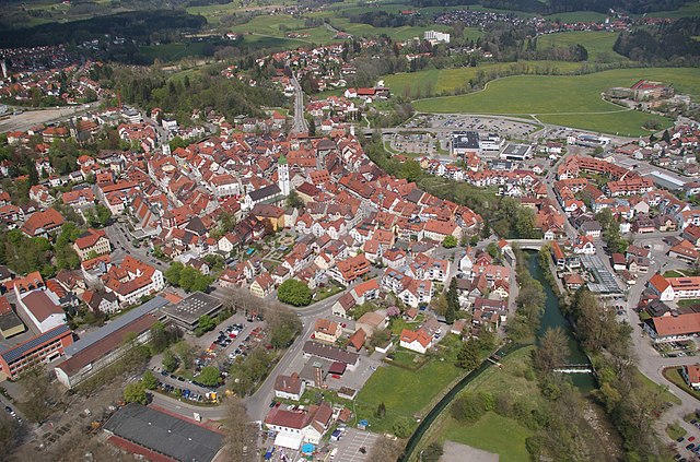
 Hiking in Хергац
Hergatz is a small town located in Bavaria, Germany, and is surrounded by beautiful natural landscapes making it a lovely spot for hiking enthusiasts. Here are some key points about hiking in and around Hergatz:
Trails and Routes
-
Local Trails: Hergatz is connected to various hiking trails that offer a mix of difficulty levels. You can find well-marked paths that range from leisurely walks to more challenging hikes.
-
Scenic Views: The trails often lead through picturesque landscapes, including forests, meadows, and hills, providing beautiful views of the surrounding area.
-
Lake Constance: A short distance from Hergatz, Lake Constance (Bodensee) offers additional hiking opportunities along its shores, with routes that provide views of the lake and the Alpine backdrop.
-
Allgäu Region: Hergatz is in proximity to the Allgäu region, known for its stunning mountain trails, such as those around Oberstaufen or the Buchenberger Wald. You can reach higher elevations with breathtaking panoramas of the Bavarian Alps.
Best Seasons for Hiking
- Spring (March to May): Ideal for mild weather and blooming flora.
- Summer (June to August): Great for long hikes, though be cautious of the heat and carry enough water.
- Fall (September to November): Enjoy vibrant autumn foliage on the trails.
- Winter (December to February): Some trails may be open for winter hiking, but snowshoes or crampons may be necessary.
Essential Tips
- Plan Your Route: Before heading out, check maps and choose trails that match your fitness level.
- Stay Hydrated and Pack Supplies: Bring enough water, snacks, and a first aid kit when hiking.
- Dress Appropriately: Wear suitable hiking shoes and clothing for the season and trail conditions.
- Local Regulations: Always respect local wildlife and nature, and adhere to any posted path rules.
Resources
- Local Hiking Groups: Consider joining local hiking clubs or groups; they often organize trips and can provide guided experiences.
- Maps and Apps: Use hiking apps or maps for navigation, especially for more remote trails.
Hiking in Hergatz can be a delightful experience, combining physical activity with the natural beauty of Bavaria. Whether you're a beginner or an experienced hiker, there's something for everyone to enjoy in this picturesque area!
- Страна:

- Почтовый код: 88145
- Телефонный код: 08385
- Код автомобильного номера: LI
- Координаты: 47° 39' 0" N, 9° 50' 0" E


- GPS треки (wikiloc): [Ссылка]
- Высота над уровнем моря: 600 м m
- Площадь: 18.81 кв.км
- Население: 2158
- Веб сайт: http://www.hergatz.de
- Википедия русская: wiki(ru)
- Википедия английская: wiki(en)
- Википедия национальная: wiki(de)
- Хранилище Wikidata: Wikidata: Q513492
- Катеория в википедии: [Ссылка]
- код Freebase: [/m/02q4g_3]
- код GeoNames: Альт: [2906115]
- код VIAF: Альт: [243164198]
- ID отношения в OpenStreetMap: [959840]
- код GND: Альт: [4353685-2]
- идентификатор местоположения ArchINFORM: [11152]
- WOEID: [659235]
- код Historical Gazetteer: [HERATZJN47VP]
- Bavarikon ID: [ODB_A00000722]
- идентификатор муниципалитетов в Германии: 09776131
Граничит с регионами:

Ванген-им-Алльгой
Hiking in Ванген-им-Алльгой
Wangen im Allgäu is a beautiful town located in the Allgäu region of Bavaria, Germany. This area is known for its picturesque landscapes, rolling hills, and lush forests, making it an excellent spot for hiking enthusiasts....
- Почтовый код: 88239
- Телефонный код: 07522
- Код автомобильного номера: RV
- Координаты: 47° 41' 9" N, 9° 50' 3" E
- GPS треки (wikiloc): [Ссылка]
- Высота над уровнем моря: 556 м m
- Площадь: 101.29 кв.км
- Население: 26679
- Веб сайт: [Ссылка]


Хергенсвайлер
Hiking in Хергенсвайлер
Hergensweiler is a quaint village located in the southern region of Germany, near Lake Constance and the Swiss border. The surrounding area is known for its beautiful natural landscapes, making it a great destination for hiking enthusiasts. Here are some highlights about hiking in and around Hergensweiler:...
- Страна:
- Почтовый код: 88138
- Телефонный код: 08388
- Код автомобильного номера: LI
- Координаты: 47° 37' 0" N, 9° 46' 0" E
- GPS треки (wikiloc): [Ссылка]
- Высота над уровнем моря: 520 м m
- Площадь: 12.09 кв.км
- Население: 1391
- Веб сайт: [Ссылка]