Хильпольтштайн (Hilpoltstein, Hilpoltstein)

 Hiking in Хильпольтштайн
Hilpoltstein is a charming town located in Bavaria, Germany, and is surrounded by beautiful natural landscapes that are ideal for hiking enthusiasts. Here are some key aspects of hiking in and around Hilpoltstein:
Trails and Routes
- Local Trails: There are several well-marked hiking trails in the area, ranging from easy walks to more challenging routes. These trails often take you through scenic forests, fields, and along the nearby rivers.
- Franconian Lake District: Close to Hilpoltstein, this area offers fantastic hiking opportunities with picturesque views of lakes and rolling hills. There are many well-established walking paths here.
- Natural Park Altmühltal: A bit further afield, this park provides stunning hiking opportunities, with numerous designated trails that showcase the region's geological features and historical sites.
Scenic Highlights
- Beautiful Landscapes: The region boasts a variety of landscapes, including forests, meadows, and farmland, often with panoramic views of the surrounding countryside.
- Historical Sites: While hiking, you may come across historical landmarks, including castles and ancient ruins, that add cultural interest to your outdoor experience.
Preparation and Safety
- Weather: Always check the weather conditions before heading out as they can change rapidly. Appropriate clothing and gear are essential.
- Trail Difficulty: Make sure to choose trails suitable for your fitness level. Many local trails have varying degrees of difficulty, so it’s possible to find a hike that suits your abilities.
Amenities
- Access to Facilities: Hilpoltstein has local shops, cafes, and restaurants right in town, providing options for refreshment and supplies before or after your hike.
- Tourist Information: Local tourist offices can provide maps and advise on the best hiking routes based on your interests and experience level.
Conclusion
Hiking in Hilpoltstein offers a combination of natural beauty, historical intrigue, and a peaceful environment. Whether you’re an experienced hiker or someone looking to enjoy a leisurely walk, the area around this lovely Bavarian town has a lot to offer. Just make sure to take the time to appreciate the scenery and enjoy the journey!
- Страна:

- Почтовый код: 91161
- Телефонный код: 09174
- Координаты: 49° 11' 0" N, 11° 11' 0" E


- GPS треки (wikiloc): [Ссылка]
- Высота над уровнем моря: 380 м m
- Площадь: 91.42 кв.км
- Население: 10127
- Веб сайт: http://www.hilpoltstein.de
- Википедия русская: wiki(ru)
- Википедия английская: wiki(en)
- Википедия национальная: wiki(de)
- Хранилище Wikidata: Wikidata: Q521132
- Катеория в википедии: [Ссылка]
- Карты в википедии: [Ссылка]
- код Freebase: [/m/0dsq4d]
- код GeoNames: Альт: [2904638]
- код VIAF: Альт: [136680816]
- ID отношения в OpenStreetMap: [158545]
- код GND: Альт: [4024918-9]
- идентификатор местоположения ArchINFORM: [12003]
- код LCNAF: Альт: [nr2004031091]
- место в MusicBrainz: [c873e660-3a89-4f7c-8517-550bd02e2edb]
- WOEID: [659980]
- код Historical Gazetteer: [HILEI1JN59OE]
- Bavarikon ID: [ODB_A00000186]
- код NKC: [ge894057]
- идентификатор муниципалитетов в Германии: 09576127
Граничит с регионами:

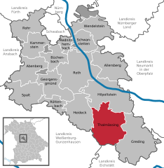
Тальмессинг
Hiking in Тальмессинг
Thalmässing is a charming municipality located in Bavaria, Germany, offering a variety of hiking opportunities that cater to different skill levels and interests. The area is characterized by its picturesque landscapes, wooded hills, fertile fields, and quaint villages, making it a great destination for nature lovers and outdoor enthusiasts....
- Страна:
- Почтовый код: 91177
- Телефонный код: 09173
- Код автомобильного номера: RH
- Координаты: 49° 5' 0" N, 11° 13' 0" E
- GPS треки (wikiloc): [Ссылка]
- Высота над уровнем моря: 418 м m
- Площадь: 80.57 кв.км
- Население: 5010
- Веб сайт: [Ссылка]

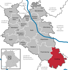
Грединг
Hiking in Грединг
Greding, located in Bavaria, Germany, offers a variety of hiking opportunities amidst picturesque landscapes, rich history, and nature. Here are some highlights you can expect when hiking in and around Greding:...
- Страна:
- Почтовый код: 91171
- Телефонный код: 08463
- Код автомобильного номера: RH
- Координаты: 49° 3' 7" N, 11° 21' 38" E
- GPS треки (wikiloc): [Ссылка]
- Высота над уровнем моря: 397 м m
- Площадь: 103.8 кв.км
- Население: 6366
- Веб сайт: [Ссылка]