Изола-дель-Пьяно (Isola del Piano, Isola del Piano)

- коммуна Италии
 Hiking in Изола-дель-Пьяно
Isola del Piano is a charming village in Italy's Marche region, surrounded by beautiful landscapes ideal for hiking enthusiasts. The area is characterized by rolling hills, lush greenery, and stunning views of the Apennine Mountains. Here’s what you can expect when hiking in Isola del Piano:
Trails and Routes
-
Local Trails: The region offers various marked trails that range from easy walks to challenging hikes. Many trails take you through vineyards, olive groves, and picturesque countryside.
-
Monte San Vicino: A popular destination nearby, this mountain has multiple paths that offer stunning panoramic views. There are trails suitable for all skill levels.
-
Parco Regionale del Conero: A bit farther away, this regional park is known for its breathtaking cliffs and coastal scenery. It features trails that lead to hidden beaches and lush forests.
Wildlife and Flora
As you hike, you might encounter diverse wildlife, including various bird species, deer, and other small mammals. The region's flora includes Mediterranean plants, creating a vibrant landscape.
Best Time to Hike
The ideal times for hiking in Isola del Piano are spring (April to June) and autumn (September to October) when the weather is mild, and the landscapes are particularly beautiful with blooming flowers or vibrant fall colors.
Preparation Tips
- Footwear: Wear sturdy hiking boots with good traction.
- Water and Snacks: Carry plenty of water and light snacks, especially on longer hikes.
- Map/GPS: While many trails are marked, having a map or GPS could be beneficial.
- Local Guides: Consider hiring a local guide for the best experience, as they can share knowledge about the area’s history, flora, and fauna.
Cultural Experience
Take time to explore Isola del Piano itself. The village offers opportunities to experience local cuisine and culture, making it a well-rounded hiking trip.
Overall, hiking in Isola del Piano provides a unique blend of outdoor adventure and cultural immersion, making it a rewarding experience for nature lovers and hikers alike.
- Страна:

- Почтовый код: 61030
- Телефонный код: 0721
- Код автомобильного номера: PU
- Координаты: 43° 44' 14" N, 12° 46' 59" E


- GPS треки (wikiloc): [Ссылка]
- Высота над уровнем моря: 210 м m
- Площадь: 23.3 кв.км
- Население: 600
- Веб сайт: http://www.comune.isola-del-piano.ps.it/
- Википедия русская: wiki(ru)
- Википедия английская: wiki(en)
- Википедия национальная: wiki(it)
- Хранилище Wikidata: Wikidata: Q207025
- Катеория в википедии: [Ссылка]
- код Freebase: [/m/0gl48w]
- код GeoNames: Альт: [6538494]
- ID отношения в OpenStreetMap: [42600]
- WOEID: [716706]
- UN/LOCODE: [ITZKQ]
- код ISTAT: 041021
- кадастровый код Италии: E351
Граничит с регионами:


Фоссомброне
- коммуна Италии
Hiking in Фоссомброне
Fossombrone, located in the Marche region of Italy, is a great destination for hiking enthusiasts. Nestled in the Cesano River valley and surrounded by the beautiful Apennine mountains, Fossombrone offers a variety of trails suitable for different skill levels, showcasing stunning landscapes, rich biodiversity, and historic sites....
- Страна:
- Почтовый код: 61034
- Телефонный код: 0721
- Код автомобильного номера: PU
- Координаты: 43° 41' 20" N, 12° 48' 22" E
- GPS треки (wikiloc): [Ссылка]
- Высота над уровнем моря: 118 м m
- Площадь: 106.88 кв.км
- Население: 9454
- Веб сайт: [Ссылка]
Монтефельчино
- коммуна Италии
Hiking in Монтефельчино
Montefelcino, located in the Marche region of Italy, is a picturesque area known for its scenic landscapes and rich history. While it may not be as widely recognized as some other hiking destinations in Italy, it offers a range of hiking opportunities for both novice and experienced hikers....
- Страна:
- Почтовый код: 61030
- Телефонный код: 0721
- Код автомобильного номера: PU
- Координаты: 43° 44' 4" N, 12° 49' 59" E
- GPS треки (wikiloc): [Ссылка]
- Высота над уровнем моря: 260 м m
- Площадь: 39.01 кв.км
- Население: 2627
- Веб сайт: [Ссылка]
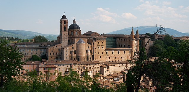

Урбино
- город в Италии
Hiking in Урбино
Urbino, a historic city in the Marche region of Italy, is surrounded by beautiful landscapes and offers various hiking opportunities for outdoor enthusiasts. Here are some key points about hiking in and around Urbino:...
- Страна:
- Почтовый код: 61029
- Телефонный код: 0722
- Код автомобильного номера: PU
- Координаты: 43° 43' 31" N, 12° 38' 14" E
- GPS треки (wikiloc): [Ссылка]
- Высота над уровнем моря: 451 м m
- Площадь: 226.5 кв.км
- Население: 14558
- Веб сайт: [Ссылка]