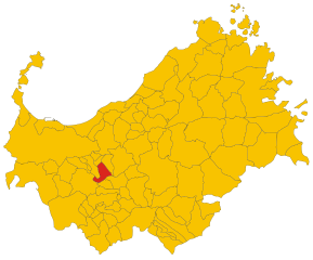
Иттири (Ittiri, Ittiri)
- коммуна Италии
Ittiri is a charming town located in the Sardinia region of Italy, known for its beautiful landscapes and rich cultural heritage. While it may not be as widely recognized for hiking as some of the major national parks in Sardinia, there are still plenty of opportunities for enjoyable walks and hikes in the surrounding areas.
Hiking Opportunities in Ittiri:
-
Scenic Trails: The countryside around Ittiri offers a variety of trails that can take you through rolling hills, olive groves, and vineyards. These paths often provide stunning views of the surrounding landscape.
-
Local Nature Parks: Nearby natural areas, such as the Monte Eccoci or Mount Bitorredo, offer hiking opportunities with different levels of difficulty. These locations also provide chances to spot local wildlife and enjoy the flora.
-
Cultural and Historical Sites: Hiking in and around Ittiri can also lead to discovering ancient ruins, churches, and other historical landmarks, enriching your experience with cultural insights.
-
The Temo River: Following the paths alongside the Temo River, which flows near the area, can offer a serene hiking experience, with the added bonus of potential picnic spots along the way.
-
Guided Tours: Consider joining a guided hiking tour if you want an in-depth exploration of the area's natural and cultural history. Local guides can provide valuable insights and ensure you hit the best spots.
Tips for Hiking in Ittiri:
-
Safety First: Always inform someone of your hiking plans and check the weather before you go. Carry sufficient water, snacks, a map, or a GPS device.
-
Appropriate Gear: Wear comfortable hiking shoes, dress in layers, and bring sun protection, especially in summer when the temperatures can be high.
-
Respect Nature: Follow the Leave No Trace principles by staying on marked trails, avoiding littering, and being mindful of local wildlife.
-
Local Events: Check if there are any local hiking or nature events taking place during your visit. Community events can provide a unique experience and a chance to meet locals.
Whether you're looking for a peaceful walk through nature or a more vigorous hike, Ittiri and its surroundings offer varied landscapes that can cater to different preferences and skill levels. Happy hiking!
- Страна:

- Почтовый код: 07044
- Телефонный код: 079
- Код автомобильного номера: SS
- Координаты: 40° 35' 27" N, 8° 34' 10" E


- GPS треки (wikiloc): [Ссылка]
- Высота над уровнем моря: 400 м m
- Площадь: 111.46 кв.км
- Население: 8541
- Веб сайт: http://www.comune.ittiri.net
- Википедия русская: wiki(ru)
- Википедия английская: wiki(en)
- Википедия национальная: wiki(it)
- Хранилище Wikidata: Wikidata: Q390865
- Катеория в википедии: [Ссылка]
- код Freebase: [/m/0gqt7x]
- код GeoNames: Альт: [6539228]
- код VIAF: Альт: [147937114]
- ID отношения в OpenStreetMap: [40589]
- идентификатор местоположения ArchINFORM: [45291]
- место в MusicBrainz: [9babf935-2a01-453e-a72e-dc5c755b079f]
- код темы Quora: [Ittiri]
- код TGN: [1044977]
- код ISTAT: 090033
- кадастровый код Италии: E377
Граничит с регионами:


Бессуде
- коммуна Италии
Bessude is a small village located in the region of Sardinia, Italy. While it may not be one of the most famous hiking destinations, the surrounding area offers beautiful landscapes, rich cultural heritage, and a variety of trails that cater to different skill levels....
- Страна:

- Почтовый код: 07040
- Телефонный код: 079
- Код автомобильного номера: SS
- Координаты: 40° 33' 11" N, 8° 43' 47" E


- GPS треки (wikiloc): [Ссылка]
- Высота над уровнем моря: 447 м m
- Площадь: 26.79 кв.км
- Население: 410
- Веб сайт: [Ссылка]


Банари
- коммуна Италии
It seems there may be a typo in your question regarding "Banari." If you meant "Banff," I can certainly provide information on hiking in Banff National Park. If you meant a different location, could you please clarify?...
- Страна:

- Почтовый код: 07040
- Телефонный код: 079
- Код автомобильного номера: SS
- Координаты: 40° 34' 15" N, 8° 41' 56" E


- GPS треки (wikiloc): [Ссылка]
- Высота над уровнем моря: 419 м m
- Площадь: 21.25 кв.км
- Население: 569
- Веб сайт: [Ссылка]


Флоринас
- коммуна Италии
Florina, located in the northwestern part of Greece, is an excellent destination for hiking enthusiasts. The region is known for its stunning natural beauty, including mountainous landscapes, dense forests, and diverse flora and fauna. Here are some highlights and considerations for hiking in Florina:...
- Страна:

- Почтовый код: 07030
- Телефонный код: 079
- Код автомобильного номера: SS
- Координаты: 40° 39' 0" N, 8° 40' 0" E


- GPS треки (wikiloc): [Ссылка]
- Высота над уровнем моря: 417 м m
- Площадь: 36.06 кв.км
- Население: 1507
- Веб сайт: [Ссылка]


Осси
- коммуна Италии
Ossi is a small town located in the northern part of Sardinia, Italy. While it may not be as well-known as some of the larger towns in the region, it offers access to beautiful hiking opportunities and the stunning natural landscapes that Sardinia is famous for....
- Страна:

- Почтовый код: 07045
- Телефонный код: 079
- Код автомобильного номера: SS
- Координаты: 40° 40' 29" N, 8° 35' 32" E


- GPS треки (wikiloc): [Ссылка]
- Высота над уровнем моря: 322 м m
- Площадь: 30.09 кв.км
- Население: 5762
- Веб сайт: [Ссылка]


Путифигари
- коммуна Италии
Putifigari, located in the Gallura region of Sardinia, Italy, is renowned for its stunning landscapes and rich natural beauty, making it a wonderful destination for hiking enthusiasts. The area is characterized by rugged terrain, granite rock formations, dense Mediterranean vegetation, and breathtaking views of the surrounding hills and coastline....
- Страна:

- Почтовый код: 07040
- Телефонный код: 079
- Код автомобильного номера: SS
- Координаты: 40° 33' 41" N, 8° 27' 37" E


- GPS треки (wikiloc): [Ссылка]
- Высота над уровнем моря: 267 м m
- Площадь: 53.1 кв.км
- Население: 719
- Веб сайт: [Ссылка]


Тьези
- коммуна Италии
Thiesi, located in Sardinia, Italy, is a charming village that offers various hiking opportunities amidst picturesque landscapes. The surrounding areas boast beautiful natural scenery, historical sites, and a rich cultural heritage, making it an appealing destination for hikers of all levels....
- Страна:

- Почтовый код: 07047
- Телефонный код: 079
- Код автомобильного номера: SS
- Координаты: 40° 31' 30" N, 8° 42' 59" E


- GPS треки (wikiloc): [Ссылка]
- Высота над уровнем моря: 461 м m
- Площадь: 63.25 кв.км
- Население: 2936
- Веб сайт: [Ссылка]


Ури
- коммуна Италии
Hiking in Uri, a small town in the region of Sardinia, Italy, can be a delightful experience for nature lovers and outdoor enthusiasts. While Uri itself is not predominantly known as a hiking destination, it serves as a good base for exploring the beautiful landscapes of nearby areas, including the surrounding hills, mountains, and coastline....
- Страна:

- Почтовый код: 07040
- Телефонный код: 079
- Код автомобильного номера: SS
- Координаты: 40° 38' 20" N, 8° 29' 17" E


- GPS треки (wikiloc): [Ссылка]
- Высота над уровнем моря: 150 м m
- Площадь: 56.81 кв.км
- Население: 2989
- Веб сайт: [Ссылка]


Узини
- коммуна Италии
Usini is a charming town located in the Sardinia region of Italy. While it may not be as widely known for hiking as some other areas, it can serve as a great base for exploring the natural landscapes of Sardinia. Here are some points to consider if you're planning to hike in and around Usini:...
- Страна:

- Почтовый код: 07049
- Телефонный код: 079
- Код автомобильного номера: SS
- Координаты: 40° 39' 48" N, 8° 32' 27" E


- GPS треки (wikiloc): [Ссылка]
- Высота над уровнем моря: 200 м m
- Площадь: 30.74 кв.км
- Население: 4362
- Веб сайт: [Ссылка]


Вилланова-Монтелеоне
- коммуна Италии
 Hiking in Вилланова-Монтелеоне
Villanova Monteleone is a charming village located in the northwest of Sardinia, Italy. It offers a unique blend of natural beauty, rich cultural heritage, and hiking opportunities that appeal to outdoor enthusiasts. Here are some key aspects to consider when hiking in this area:...
- Страна:

- Почтовый код: 07019
- Телефонный код: 079
- Код автомобильного номера: SS
- Координаты: 40° 30' 13" N, 8° 28' 14" E


- GPS треки (wikiloc): [Ссылка]
- Высота над уровнем моря: 567 м m
- Площадь: 202.68 кв.км
- Население: 2288
- Веб сайт: [Ссылка]
