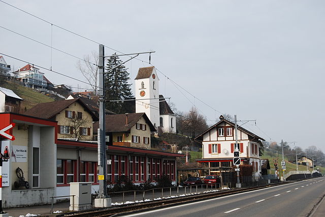
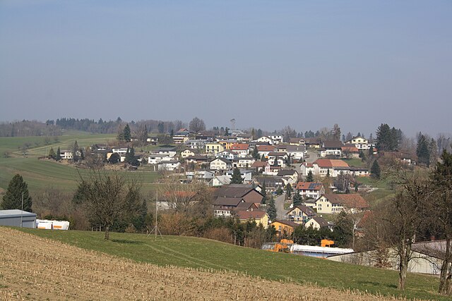
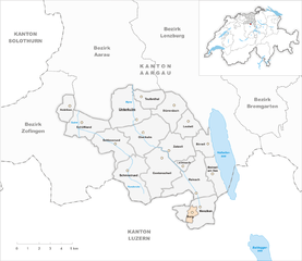
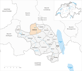
Кульм (Kulm District, Bezirk Kulm)

 Hiking in Кульм
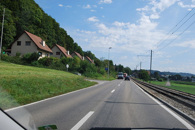
Kulm District, located in the heart of Switzerland, offers some spectacular hiking opportunities, thanks to its stunning landscapes and varied terrain. Here are some key features you should know if you’re considering hiking in this area:
Scenic Trails
-
Viewpoints: Numerous trails provide breathtaking views of the surrounding mountains, valleys, and lakes. Be sure to hike to popular viewpoints like the Kulm itself or surrounding ridges for panoramic photography.
-
Trail Variety: The district offers a mix of easy, moderate, and challenging trails. Whether you're a beginner or an experienced hiker, you’ll find routes that cater to all skill levels.
Nature and Flora
- Alpine Flora: You can encounter a wide range of alpine plants and wildflowers, especially in the summer months. This region is part of a beautiful ecosystem that supports diverse wildlife.
Well-Marked Trails
- The hiking trails in Kulm District are typically well-maintained and marked. Look for signs indicating the trail difficulty and time required to complete the hike. Familiarize yourself with the maps available in the area for better navigation.
Accessibility
- The trails can be accessed from various starting points, often linked to public transport. Check local bus or tram routes that can get you closer to your hiking destination without needing a car.
Local Amenities
- After a day of hiking, enjoy local Swiss cuisine at nearby restaurants and lodges. Some trails lead through charming villages where you can experience the culture and hospitality of the area.
Safety Considerations
- Always check the weather forecast before heading out, as mountain weather can change rapidly. Hike with appropriate gear, including sturdy shoes, plenty of water, and sun protection.
Recommendations
- Timing: Late spring to early autumn is typically the best time for hiking, with trails cleared of snow and wildflowers in bloom.
- Guided Tours: If you’re unfamiliar with the area, consider joining a guided hike to ensure you learn about the local ecology and ensure safety on the trails.
Whether you’re looking for a leisurely stroll or a challenging hike, Kulm District has something to offer every adventurer. Don’t forget to respect local wildlife and preserve the natural beauty by following Leave No Trace principles. Happy hiking!
- Страна:

- Столица: Унтеркульм
- Код автомобильного номера: AG
- Координаты: 47° 18' 0" N, 8° 6' 0" E


- GPS треки (wikiloc): [Ссылка]
- Высота над уровнем моря: 495 м m
- Площадь: 101.35 кв.км
- Википедия русская: wiki(ru)
- Википедия английская: wiki(en)
- Википедия национальная: wiki(de)
- Хранилище Wikidata: Wikidata: Q659715
- Катеория в википедии: [Ссылка]
- код Freebase: [/m/0dz8l5]
- код GeoNames: Альт: [6458772]
- идентификатор местоположения ArchINFORM: [43365]
- идентификатор HDS: [8518]
Включает регионы:

Биррвиль
Hiking in Биррвиль
Birrwil is a charming municipality located in the canton of Aargau in Switzerland, surrounded by beautiful landscapes that make it an appealing destination for hiking enthusiasts. Here are some highlights for hiking in and around Birrwil:...
- Страна:
- Почтовый код: 5708
- Телефонный код: 062
- Код автомобильного номера: AG
- Координаты: 47° 17' 28" N, 8° 11' 33" E
- GPS треки (wikiloc): [Ссылка]
- Высота над уровнем моря: 600 м m
- Площадь: 5.53 кв.км
- Население: 1172
- Веб сайт: [Ссылка]

Дюрренеш
Hiking in Дюрренеш
Dürrenäsch is a quaint village located in the Canton of Aargau, Switzerland, surrounded by beautiful natural landscapes that make it a delightful destination for hiking enthusiasts. Here are some insights about hiking in the area:...
- Страна:
- Почтовый код: 5724
- Телефонный код: 062
- Код автомобильного номера: AG
- Координаты: 47° 19' 6" N, 8° 9' 16" E
- GPS треки (wikiloc): [Ссылка]
- Высота над уровнем моря: 554 м m
- Площадь: 5.91 кв.км
- Население: 1237
- Веб сайт: [Ссылка]


Байнвиль-ам-Зе
Hiking in Байнвиль-ам-Зе
Beinwil am See, located in the Swiss canton of Aargau, is a picturesque village set along the shores of Lake Hallwil. The area is ideal for hiking, offering a mix of scenic views, natural landscapes, and cultural experiences. Here are some highlights and recommendations for hiking in and around Beinwil am See:...
- Страна:
- Почтовый код: 5712
- Телефонный код: 062
- Код автомобильного номера: AG
- Координаты: 47° 16' 4" N, 8° 12' 9" E
- GPS треки (wikiloc): [Ссылка]
- Высота над уровнем моря: 520 м m
- Площадь: 5.78 кв.км
- Население: 3174
- Веб сайт: [Ссылка]

Бург
- община в Швейцарии, Аргау
Hiking in Бург
Burg, a quaint municipality in the Aargau region of Switzerland, offers a variety of scenic hiking opportunities that cater to different skill levels. The area is known for its beautiful landscapes, rolling hills, and lush vineyards, making it a popular destination for outdoor enthusiasts....
- Страна:
- Почтовый код: 5736
- Телефонный код: 062
- Код автомобильного номера: AG
- Координаты: 47° 14' 14" N, 8° 10' 55" E
- GPS треки (wikiloc): [Ссылка]
- Высота над уровнем моря: 623 м m
- Площадь: 0.94 кв.км
- Население: 1026
- Веб сайт: [Ссылка]
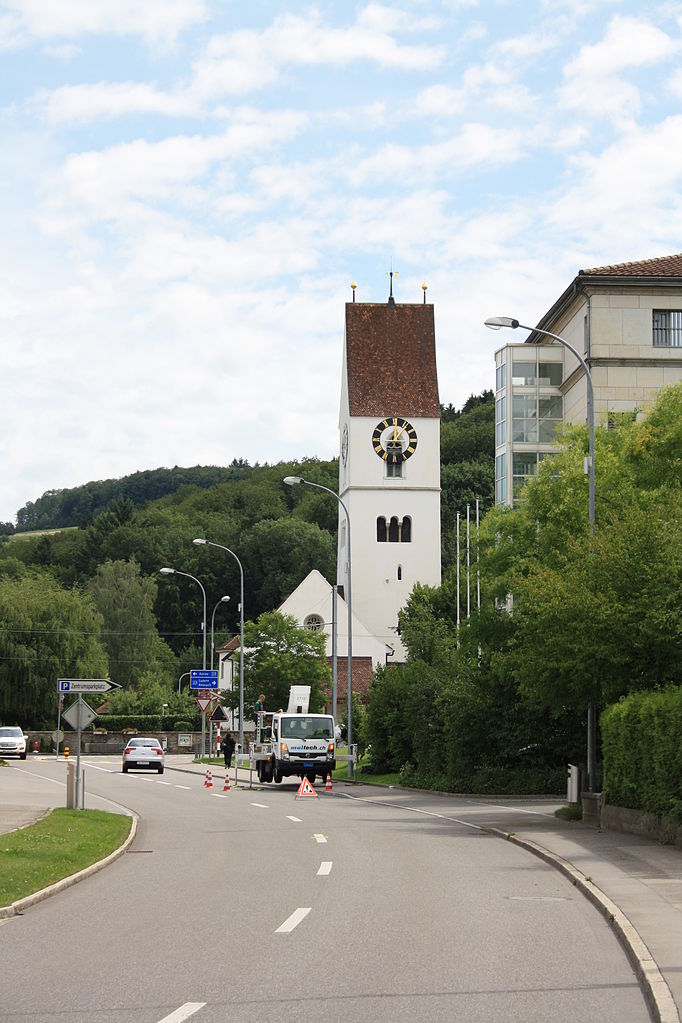
Унтеркульм
Hiking in Унтеркульм
Unterkulm is a charming village located in the canton of Aargau in Switzerland, surrounded by picturesque landscapes that are perfect for hiking. Here are some aspects of hiking in and around Unterkulm:...
- Страна:
- Почтовый код: 5726
- Телефонный код: 062
- Код автомобильного номера: AG
- Координаты: 47° 19' 8" N, 8° 6' 13" E
- GPS треки (wikiloc): [Ссылка]
- Высота над уровнем моря: 551 м m
- Площадь: 8.88 кв.км
- Население: 3071
- Веб сайт: [Ссылка]


Тойфенталь
Hiking in Тойфенталь
Teufenthal, located in Switzerland, is a beautiful area for hiking, known for its stunning natural scenery and diverse trails. The region is characterized by rolling hills, lush forests, and picturesque landscapes, making it an appealing destination for both novice and experienced hikers....
- Страна:
- Почтовый код: 5723
- Телефонный код: 062
- Код автомобильного номера: AG
- Координаты: 47° 19' 39" N, 8° 7' 47" E
- GPS треки (wikiloc): [Ссылка]
- Высота над уровнем моря: 499 м m
- Площадь: 3.57 кв.км
- Население: 1646
- Веб сайт: [Ссылка]


Цецвиль
Hiking in Цецвиль
Zetzwil, located in the Aargau region of Switzerland, offers a variety of scenic trails that are perfect for hiking enthusiasts. The area is characterized by its beautiful countryside, charming villages, and rolling hills, making it a great destination for both leisurely walks and more challenging hikes....
- Страна:
- Почтовый код: 5732
- Телефонный код: 062
- Код автомобильного номера: AG
- Координаты: 47° 17' 19" N, 8° 9' 10" E
- GPS треки (wikiloc): [Ссылка]
- Высота над уровнем моря: 512 м m
- Площадь: 5.81 кв.км
- Население: 1321
- Веб сайт: [Ссылка]


Шлосрюд
Hiking in Шлосрюд
Schlossrued is a charming village located in the Aargau region of Switzerland, nestled in the picturesque landscape of the Swiss countryside. Hiking in this area offers a wonderful combination of scenic beauty, natural landscapes, and cultural history. Here are some key points to consider if you're planning to hike in Schlossrued:...
- Страна:
- Почтовый код: 5044
- Телефонный код: 062
- Код автомобильного номера: AG
- Координаты: 47° 17' 25" N, 8° 5' 18" E
- GPS треки (wikiloc): [Ссылка]
- Высота над уровнем моря: 503 м m
- Площадь: 7.25 кв.км
- Население: 838
- Веб сайт: [Ссылка]


Менцикен
Hiking in Менцикен
Menziken is a charming municipality located in the canton of Aargau in Switzerland. Nestled amid picturesque landscapes, it offers delightful hiking opportunities for outdoor enthusiasts. Here are some highlights to consider when planning a hiking trip in Menziken:...
- Страна:
- Почтовый код: 5737
- Телефонный код: 062
- Код автомобильного номера: AG
- Координаты: 47° 14' 10" N, 8° 11' 11" E
- GPS треки (wikiloc): [Ссылка]
- Высота над уровнем моря: 566 м m
- Площадь: 6.38 кв.км
- Население: 6222
- Веб сайт: [Ссылка]


Гонтеншвиль
Hiking in Гонтеншвиль
Gontenschwil is a picturesque village located in the canton of Aargau in Switzerland, surrounded by stunning landscapes perfect for hiking enthusiasts. The region is characterized by rolling hills, lush forests, and scenic views of the Swiss countryside. Here are some key aspects to consider for hiking in Gontenschwil:...
- Страна:
- Почтовый код: 5728
- Телефонный код: 062
- Код автомобильного номера: AG
- Координаты: 47° 16' 17" N, 8° 8' 42" E
- GPS треки (wikiloc): [Ссылка]
- Высота над уровнем моря: 533 м m
- Площадь: 9.74 кв.км
- Население: 2119
- Веб сайт: [Ссылка]


Шёфтланд
Hiking in Шёфтланд
Schöftland is a charming municipality located in the canton of Aargau, Switzerland. Nestled amidst beautiful landscapes and rolling hills, it offers a delightful experience for hikers of all levels. Here are some details about hiking in the area:...
- Страна:
- Почтовый код: 5040
- Телефонный код: 062
- Код автомобильного номера: AG
- Координаты: 47° 18' 19" N, 8° 3' 10" E
- GPS треки (wikiloc): [Ссылка]
- Высота над уровнем моря: 466 м m
- Площадь: 6.28 кв.км
- Население: 4300
- Веб сайт: [Ссылка]


Оберкульм
Hiking in Оберкульм
Oberkulm, located in the canton of Aargau in Switzerland, is a quaint municipality that serves as a great base for hiking enthusiasts. The region is characterized by picturesque landscapes, rolling hills, forests, and farmland, which are perfect for various hiking trails....
- Страна:
- Почтовый код: 5727
- Телефонный код: 062
- Код автомобильного номера: AG
- Координаты: 47° 18' 0" N, 8° 7' 25" E
- GPS треки (wikiloc): [Ссылка]
- Высота над уровнем моря: 480 м m
- Площадь: 9.41 кв.км
- Население: 2730
- Веб сайт: [Ссылка]


Шмидрюд
Hiking in Шмидрюд
Schmiedrued is a picturesque municipality located in the Aargau canton of Switzerland, nestled in the heart of the Swiss landscape. Here are some highlights and tips for hiking in the area:...
- Страна:
- Почтовый код: 5046
- Телефонный код: 062
- Код автомобильного номера: AG
- Координаты: 47° 15' 50" N, 8° 6' 45" E
- GPS треки (wikiloc): [Ссылка]
- Высота над уровнем моря: 565 м m
- Площадь: 8.65 кв.км
- Население: 1166
- Веб сайт: [Ссылка]


Лойтвиль
Hiking in Лойтвиль
Leutwil is a charming municipality located in the Canton of Aargau, Switzerland. It offers some lovely hiking opportunities amidst beautiful Swiss countryside. Here’s a general overview of what you can expect when hiking in and around Leutwil:...
- Страна:
- Почтовый код: 5725
- Телефонный код: 062
- Код автомобильного номера: AG
- Координаты: 47° 18' 20" N, 8° 10' 26" E
- GPS треки (wikiloc): [Ссылка]
- Высота над уровнем моря: 623 м m
- Площадь: 3.75 кв.км
- Население: 762
- Веб сайт: [Ссылка]


Хольцикен
Hiking in Хольцикен
Holziken is a charming village in Switzerland, located in the canton of Aargau, known for its picturesque landscapes and numerous hiking opportunities. The area features lush green hills, forests, and stunning views of the surrounding countryside, making it an ideal destination for hikers of all skill levels....
- Страна:
- Почтовый код: 5043
- Телефонный код: 062
- Код автомобильного номера: AG
- Координаты: 47° 19' 19" N, 8° 2' 20" E
- GPS треки (wikiloc): [Ссылка]
- Высота над уровнем моря: 476 м m
- Площадь: 2.86 кв.км
- Население: 1341
- Веб сайт: [Ссылка]

Лаймбах
- община в Швейцарии, Аргау
Hiking in Лаймбах
Leimbach is a small municipality in the Aargau region of Switzerland, known for its beautiful natural landscapes and various hiking trails. The area offers opportunities for both casual walkers and more dedicated hikers....
- Страна:
- Почтовый код: 5733
- Телефонный код: 062
- Код автомобильного номера: AG
- Координаты: 47° 16' 30" N, 8° 10' 12" E
- GPS треки (wikiloc): [Ссылка]
- Высота над уровнем моря: 596 м m
- Площадь: 1.15 кв.км
- Население: 446
- Веб сайт: [Ссылка]


Райнах
Hiking in Райнах
Reinach, located in the Canton of Aargau, Switzerland, offers beautiful landscapes and a variety of hiking opportunities. Here are some highlights for hiking in the area:...
- Страна:
- Почтовый код: 5734
- Телефонный код: 062
- Код автомобильного номера: AG
- Координаты: 47° 15' 14" N, 8° 11' 0" E
- GPS треки (wikiloc): [Ссылка]
- Высота над уровнем моря: 527 м m
- Площадь: 9.48 кв.км
- Население: 8458
- Веб сайт: [Ссылка]