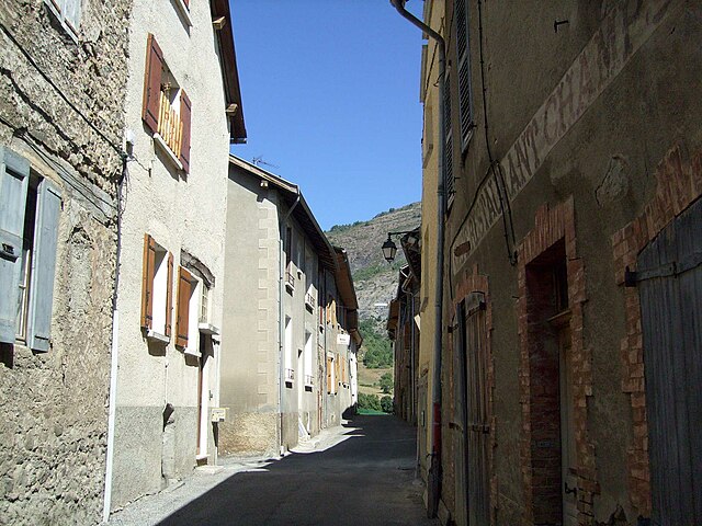
Ла-Бреоль (La Bréole, La Bréole)

- коммуна во Франции
 Hiking in Ла-Бреоль
La Bréole is a picturesque village located in the Alpes-de-Haute-Provence region of southeastern France. It sits at an altitude of approximately 1,100 meters and offers a variety of hiking opportunities that cater to different skill levels.
Highlights of Hiking in La Bréole:
-
Stunning Scenery: The region boasts stunning views of the surrounding mountains, forests, and lakes. The turquoise waters of Lake Serre-Ponçon, one of the largest artificial lakes in Europe, are a short distance away and can often be incorporated into hiking routes.
-
Diverse Trails: There are numerous trails ranging from easy walks to more challenging hikes. The marked paths traverse different terrains, including forests, rocky paths, and alpine meadows. Always check trail markers and maps before heading out.
-
Flora and Fauna: The region is rich in biodiversity. While hiking, you can often spot various species of wildlife and enjoy the beautiful alpine flora in bloom, especially in late spring and summer.
-
Historical Sites: Some trails may lead you to historical sites, including ancient ruins, chapels, and charming traditional buildings. This adds a cultural aspect to your hiking experience.
-
Seasonal Hiking: The best time to hike in La Bréole is from late spring to early autumn (May to September). However, if you’re an experienced hiker, winter hiking and snowshoeing can also be an option during the colder months, but ensure you have the right gear and knowledge of winter hiking safety.
Tips for Hiking in La Bréole:
- Stay Hydrated: Carry enough water and snacks for your hike, especially on longer trails.
- Proper Gear: Wear sturdy hiking boots and dress in layers to accommodate changing weather conditions.
- Trail Maps: Use local maps or download hiking apps to help navigate the trails; sometimes, paths can be less marked.
- Guided Tours: If you're unfamiliar with the area, consider joining a guided hike with a local instructor who knows the best routes and can provide insight into local ecology and history.
- Respect Nature: Practice Leave No Trace principles by staying on trails, not disturbing wildlife, and taking your trash with you.
Overall, hiking in La Bréole can be a rewarding experience with breathtaking views and a chance to connect with nature. Enjoy your hike!
- Страна:

- Почтовый код: 04340
- Координаты: 44° 27' 24" N, 6° 17' 40" E


- GPS треки (wikiloc): [Ссылка]
- Площадь: 39.66 кв.км
- Население: 358
- Веб сайт: http://www.labreole.fr
- Википедия русская: wiki(ru)
- Википедия английская: wiki(en)
- Википедия национальная: wiki(fr)
- Хранилище Wikidata: Wikidata: Q1020418
- Катеория в википедии: [Ссылка]
- код Freebase: [/m/03m7w4m]
- код Freebase: [/m/03m7w4m]
- код GeoNames: Альт: [3010819]
- код GeoNames: Альт: [3010819]
- WOEID: [597095]
- WOEID: [597095]
- код муниципалитета INSEE: 04033
- код муниципалитета INSEE: 04033
Граничит с регионами:

Сен-Мартен-ле-Сейн
- коммуна во Франции
Hiking in Сен-Мартен-ле-Сейн
Saint-Martin-lès-Seyne is a charming village located in the Alpes-de-Haute-Provence region of France. The area surrounding the village offers a range of hiking opportunities, characterized by its stunning natural landscapes including mountains, forests, and rivers....
- Страна:
- Почтовый код: 04140
- Координаты: 44° 23' 8" N, 6° 15' 24" E
- GPS треки (wikiloc): [Ссылка]
- Площадь: 12.27 кв.км
- Население: 13

Ле-Соз-дю-Лак
- коммуна во Франции
Hiking in Ле-Соз-дю-Лак
Le Sauze-du-Lac is a picturesque village located in the French Alps, known for its stunning natural beauty, pristine lakes, and accessibility to various hiking routes. Here’s what you should know about hiking in this delightful area:...
- Страна:
- Почтовый код: 05160
- Координаты: 44° 28' 42" N, 6° 18' 50" E
- GPS треки (wikiloc): [Ссылка]
- Высота над уровнем моря: 1052 м m
- Площадь: 8.49 кв.км
- Население: 145
- Веб сайт: [Ссылка]

Монклар
- коммуна во Франции
Hiking in Монклар
Montclar, located in the Alpes-de-Haute-Provence region of France, offers a variety of hiking opportunities for outdoor enthusiasts. This area is known for its stunning landscapes, picturesque mountains, and diverse flora and fauna, making it a fantastic destination for both casual walkers and experienced hikers....
- Страна:
- Почтовый код: 04140
- Координаты: 44° 23' 49" N, 6° 20' 15" E
- GPS треки (wikiloc): [Ссылка]
- Площадь: 23.38 кв.км
- Население: 414

Сен-Венсан-ле-Фор
- коммуна во Франции
Hiking in Сен-Венсан-ле-Фор
Saint-Vincent-les-Forts is a charming village located in the Alpes-de-Haute-Provence region of France, known for its breathtaking scenery and outdoor activities, making it an excellent destination for hiking enthusiasts. Here are some highlights about hiking in the area:...
- Страна:
- Почтовый код: 04340
- Координаты: 44° 26' 42" N, 6° 22' 24" E
- GPS треки (wikiloc): [Ссылка]
- Высота над уровнем моря: 1300 м m
- Площадь: 22.82 кв.км
- Население: 363

Селонне
- коммуна во Франции
Hiking in Селонне
Selonnet, located in the French Alps, is a beautiful destination for hiking enthusiasts. Nestled in the mountainous terrain, the area offers stunning views, a variety of trails, and an opportunity to immerse yourself in nature....
- Страна:
- Почтовый код: 04140
- Координаты: 44° 22' 16" N, 6° 18' 40" E
- GPS треки (wikiloc): [Ссылка]
- Площадь: 29.55 кв.км
- Население: 429
- Веб сайт: [Ссылка]

Рошбрюн
- коммуна во Франции
Hiking in Рошбрюн
Rochebrune is a beautiful area located in the Hautes-Alpes region of southeastern France, known for its stunning alpine scenery, diverse trails, and opportunities for outdoor activities. Here’s an overview of what you can expect when hiking in Rochebrune:...
- Страна:
- Почтовый код: 05190
- Координаты: 44° 27' 22" N, 6° 10' 37" E
- GPS треки (wikiloc): [Ссылка]
- Площадь: 12.37 кв.км
- Население: 170

Ле-Лозе-Юбей
- коммуна во Франции
Hiking in Ле-Лозе-Юбей
Le Lauzet-Ubaye is a beautiful destination located in the Alpes-de-Haute-Provence region of southeastern France. Situated along the Ubaye River, this picturesque area offers stunning landscapes, rich biodiversity, and a variety of hiking trails suitable for different skill levels. Here are some highlights and tips for hiking in Le Lauzet-Ubaye:...
- Страна:
- Почтовый код: 04340
- Координаты: 44° 25' 48" N, 6° 25' 56" E
- GPS треки (wikiloc): [Ссылка]
- Площадь: 66.26 кв.км
- Население: 211

Эспинас
- коммуна в департаменте Верхние Альпы, Франция
Hiking in Эспинас
Espinasses is a charming village located in the French Alps, in the department of Hautes-Alpes. It offers a variety of hiking opportunities suitable for different skill levels, surrounded by stunning natural beauty....
- Страна:
- Почтовый код: 05190
- Координаты: 44° 28' 0" N, 6° 13' 29" E
- GPS треки (wikiloc): [Ссылка]
- Площадь: 13.86 кв.км
- Население: 728
- Веб сайт: [Ссылка]
Брезье
- коммуна во Франции
Hiking in Брезье
Bréziers is a charming town in the Occitanie region of southern France. While it is not as widely known for hiking as some other areas in France, it is surrounded by beautiful landscapes that can offer some great hiking opportunities....
- Страна:
- Почтовый код: 05190
- Координаты: 44° 25' 35" N, 6° 11' 58" E
- GPS треки (wikiloc): [Ссылка]
- Площадь: 30.35 кв.км
- Население: 210

Руссе
Hiking in Руссе
Rousset, located in the Hautes-Alpes region of France, is a fantastic destination for hiking enthusiasts. This picturesque village is surrounded by stunning natural landscapes, ranging from mountainous terrain to lush valleys, making it an ideal spot for hikers of all skill levels....
- Страна:
- Почтовый код: 05190
- Координаты: 44° 27' 59" N, 6° 14' 3" E
- GPS треки (wikiloc): [Ссылка]
- Высота над уровнем моря: 1040 м m
- Площадь: 14.38 кв.км
- Население: 171
- Веб сайт: [Ссылка]