Ланд-Хадельн (Land Hadeln, Samtgemeinde Land Hadeln)

- коммуна в Нижней Саксонии
 Hiking in Ланд-Хадельн
Land Hadeln, located in Lower Saxony, Germany, is a picturesque area known for its natural beauty and accessibility for outdoor activities, including hiking. The region offers a mix of landscapes, from lush meadows and forests to wetlands, making it an ideal destination for nature lovers and hikers.
Hiking Trails
-
Well-Marked Paths: Land Hadeln features a network of well-marked hiking paths that cater to various skill levels. Whether you are looking for a leisurely stroll or a more challenging hike, you can find routes that suit your preferences.
-
Nature Reserves: The area is home to several nature reserves, such as the "Breeser Sand" and "Hadler Moor," which provide unique ecosystems and opportunities for wildlife observation. Hiking through these reserves allows you to connect with nature and learn about local flora and fauna.
-
Historic Sites: Along the hiking trails, you may encounter charming villages and historic sites, which add cultural interest to your hikes. The towns within Land Hadeln often have local museums or landmarks worth visiting.
-
River Paths: The region is also characterized by rivers and canals. Walking along these waterways can offer serene views and opportunities for birdwatching.
Hiking Tips
- Best Time to Hike: The best time for hiking in Land Hadeln generally falls between spring and early autumn when temperatures are milder and nature is in full bloom.
- What to Bring: Make sure to wear sturdy hiking shoes and bring water, snacks, a map, and a first-aid kit. Depending on the season, layers and rain gear may also be necessary.
- Local Guidance: Consider checking local hiking clubs or tourism information centers for guided hikes or meetings. They often have insider knowledge about the best trails and conditions.
Conclusion
Hiking in Land Hadeln offers a delightful way to experience the serene landscapes of Lower Saxony. Whether you are an experienced hiker or a beginner, the diverse range of trails and natural settings make it a wonderful destination for enjoying the great outdoors.
- Страна:

- Координаты: 53° 48' 28" N, 8° 54' 11" E


- GPS треки (wikiloc): [Ссылка]
- Население: 27066
- Веб сайт: http://www.otterndorf.de/
- Википедия английская: wiki(en)
- Википедия национальная: wiki(de)
- Хранилище Wikidata: Wikidata: Q487627
- Катеория в википедии: [Ссылка]
- код Freebase: [/m/0g5s_t2]
- код Freebase: [/m/0g5s_t2]
- код Freebase: [/m/0g5s_t2]
- код GeoNames: Альт: [3208225]
- код GeoNames: Альт: [3208225]
- код GeoNames: Альт: [3208225]
- код VIAF: Альт: [134873623]
- код VIAF: Альт: [134873623]
- код VIAF: Альт: [134873623]
- код LCNAF: Альт: [n81019976]
- код LCNAF: Альт: [n81019976]
- код LCNAF: Альт: [n81019976]
- код региона Германии: 033525410
- код региона Германии: 033525410
- код региона Германии: 033525410
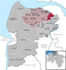
Включает регионы:


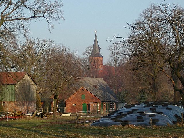
Остербрух
Hiking in Остербрух
Osterbruch is a charming area located in northern Germany, known for its natural beauty and opportunities for outdoor activities, including hiking. While it may not be as widely recognized as some larger national parks, it offers a peaceful experience for those looking to explore the outdoors....
- Страна:
- Почтовый код: 21762
- Телефонный код: 04751
- Код автомобильного номера: CUX
- Координаты: 53° 47' 0" N, 8° 57' 0" E
- GPS треки (wikiloc): [Ссылка]
- Высота над уровнем моря: 2 м m
- Площадь: 10.21 кв.км
- Население: 486
- Веб сайт: [Ссылка]


Вингст
Hiking in Вингст
Wingst is a charming area in northern Germany, situated close to the scenic nature reserves and countryside that the region offers, making it an excellent spot for hiking enthusiasts. Here are some key points you might find useful for hiking in Wingst:...
- Страна:
- Почтовый код: 21789
- Телефонный код: 04778
- Код автомобильного номера: CUX
- Координаты: 53° 43' 0" N, 9° 4' 0" E
- GPS треки (wikiloc): [Ссылка]
- Высота над уровнем моря: 9 м m
- Площадь: 55.62 кв.км
- Население: 3340
- Веб сайт: [Ссылка]


Каденберге
Hiking in Каденберге
Cadenberge is a charming village located in Lower Saxony, Germany, surrounded by beautiful landscapes and natural features that make it a great location for hiking enthusiasts. While the village itself is small, it serves as an excellent base for exploring the surrounding areas, which feature various trails and routes suitable for hikers of all levels....
- Страна:
- Почтовый код: 21781
- Телефонный код: 04777
- Код автомобильного номера: CUX
- Координаты: 53° 46' 9" N, 9° 3' 46" E
- GPS треки (wikiloc): [Ссылка]
- Высота над уровнем моря: 9 м m
- Площадь: 30.98 кв.км
- Население: 4233
- Веб сайт: [Ссылка]


Одисхайм
Hiking in Одисхайм
Odisheim doesn't seem to be a widely recognized hiking destination or location based on available information up to October 2023. However, if you meant a different place, please clarify the name or provide more context, and I would be glad to help with hiking information in that area....
- Страна:
- Почтовый код: 21775
- Телефонный код: 04756
- Код автомобильного номера: CUX
- Координаты: 53° 41' 50" N, 8° 56' 38" E
- GPS треки (wikiloc): [Ссылка]
- Высота над уровнем моря: 2 м m
- Площадь: 13.50 кв.км
- Население: 484
- Веб сайт: [Ссылка]

Оберндорф
Hiking in Оберндорф
Oberndorf in Lower Saxony is a charming area that offers various hiking opportunities. Nestled within the scenic landscapes of Lower Saxony, it is surrounded by forests, hills, and rivers, making it ideal for nature lovers and outdoor enthusiasts....
- Страна:
- Почтовый код: 21787
- Телефонный код: 04778; 04772; 04771
- Код автомобильного номера: CUX
- Координаты: 53° 45' 0" N, 9° 9' 0" E
- GPS треки (wikiloc): [Ссылка]
- Высота над уровнем моря: 1 м m
- Площадь: 32.71 кв.км
- Население: 1365
- Веб сайт: [Ссылка]

Ванна
Hiking in Ванна
Wanna, located in Lower Saxony, Germany, is a small town that offers a peaceful environment for nature lovers and hiking enthusiasts. The area surrounding Wanna is characterized by flat landscapes, meadows, and wooded areas, making it suitable for various hiking experiences....
- Страна:
- Почтовый код: 21776
- Телефонный код: 04757
- Код автомобильного номера: CUX
- Координаты: 53° 45' 0" N, 8° 48' 0" E
- GPS треки (wikiloc): [Ссылка]
- Высота над уровнем моря: 5 м m
- Площадь: 53.93 кв.км
- Население: 2171
- Веб сайт: [Ссылка]


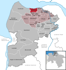
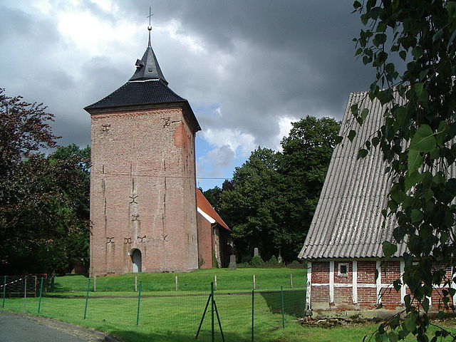
Нойенкирхен
- муниципалитет в германии в Германии, Нижняя Саксония, Куксхафен (район, Управление Хадельн
Hiking in Нойенкирхен
Neuenkirchen is a small municipality located in the Cuxhaven district of Lower Saxony, Germany. While it may not be a widely recognized hiking destination compared to larger nature reserves or mountainous areas, there are opportunities for lovely walks and hikes in and around the village and the surrounding countryside....
- Страна:
- Почтовый код: 21763
- Телефонный код: 04758; 04755; 04751
- Код автомобильного номера: CUX
- Координаты: 53° 46' 40" N, 8° 53' 35" E
- GPS треки (wikiloc): [Ссылка]
- Высота над уровнем моря: 2 м m
- Площадь: 19.65 кв.км
- Население: 1326
- Веб сайт: [Ссылка]


Белум
Hiking in Белум
Belum, also known as the Belum-Temengor Forest Complex, is located in the northern part of Peninsular Malaysia and is one of the largest contiguous forest reserves in the country. This area is known for its rich biodiversity, encompassing tropical rainforest and wildlife, making it an intriguing destination for hikers and nature enthusiasts....
- Страна:
- Почтовый код: 21785
- Телефонный код: 04752
- Код автомобильного номера: CUX
- Координаты: 53° 49' 5" N, 8° 59' 44" E
- GPS треки (wikiloc): [Ссылка]
- Высота над уровнем моря: 2 м m
- Площадь: 25.72 кв.км
- Население: 825
- Веб сайт: [Ссылка]


Бюлькау
Hiking in Бюлькау
Bülkau, a small town located in the district of Cuxhaven in Lower Saxony, Germany, may not be widely known as a hiking destination compared to larger nature reserves or national parks, but it can offer some charming and scenic walking opportunities in the surrounding countryside....
- Страна:
- Почтовый код: 21782
- Телефонный код: 04777; 04754
- Код автомобильного номера: CUX
- Координаты: 53° 45' 0" N, 8° 52' 0" E
- GPS треки (wikiloc): [Ссылка]
- Высота над уровнем моря: 1 м m
- Площадь: 23.22 кв.км
- Население: 855
- Веб сайт: [Ссылка]


Нойхаус
Hiking in Нойхаус
Neuhaus (Oste) is a charming village in the Lower Saxony region of Germany, nestled near the Oste River and surrounded by scenic landscapes. It's a wonderful location for hiking, offering a mix of natural beauty, tranquility, and historical sights. Here are some insights to help you plan your hiking adventure in this area:...
- Страна:
- Почтовый код: 21785
- Телефонный код: 04752
- Код автомобильного номера: CUX
- Координаты: 53° 48' 0" N, 9° 2' 0" E
- GPS треки (wikiloc): [Ссылка]
- Высота над уровнем моря: 2 м m
- Площадь: 9.86 кв.км
- Население: 1151
- Веб сайт: [Ссылка]

Оттерндорф
Hiking in Оттерндорф
Otterndorf, located in Lower Saxony, Germany, is a charming town that offers various outdoor activities, including hiking. Situated near the River Elbe and the North Sea, the area is known for its picturesque landscapes, wetlands, and scenic coastal views. Here are some key points about hiking in Otterndorf:...
- Страна:
- Почтовый код: 21762
- Телефонный код: 04751
- Код автомобильного номера: CUX
- Координаты: 53° 48' 0" N, 8° 54' 0" E
- GPS треки (wikiloc): [Ссылка]
- Высота над уровнем моря: 2 м m
- Площадь: 33.55 кв.км
- Население: 7283
- Веб сайт: [Ссылка]


Илинворт
Hiking in Илинворт
Ihlienworth is a charming village located in Lower Saxony, Germany, surrounded by picturesque landscapes that offer a variety of hiking opportunities. The region is characterized by its flat terrain, scenic fields, and scenic routes that are suitable for all levels of hikers. Here are some key points to consider for hiking in Ihlienworth:...
- Страна:
- Почтовый код: 21775
- Телефонный код: 04755
- Код автомобильного номера: CUX
- Координаты: 53° 44' 0" N, 8° 55' 0" E
- GPS треки (wikiloc): [Ссылка]
- Высота над уровнем моря: 1 м m
- Площадь: 40.29 кв.км
- Население: 1529
- Веб сайт: [Ссылка]

Нордледа
Hiking in Нордледа
Nordleda is a small municipality in the Cuxhaven district of Lower Saxony, Germany. While it may not be the most well-known hiking destination, it offers a serene environment with picturesque landscapes that can be appealing to outdoor enthusiasts. Here’s an overview of what you might expect when hiking in Nortleda and the surrounding regions:...
- Страна:
- Почтовый код: 21765
- Телефонный код: 04758
- Код автомобильного номера: CUX
- Координаты: 53° 46' 0" N, 8° 50' 0" E
- GPS треки (wikiloc): [Ссылка]
- Высота над уровнем моря: 1 м m
- Площадь: 21.29 кв.км
- Население: 1047
- Веб сайт: [Ссылка]


Штайнау
Hiking in Штайнау
Steinau, located in Lower Saxony, Germany, is a lovely destination for hiking enthusiasts. Surrounded by picturesque landscapes, forests, and hills, this area offers several hiking trails that cater to different skill levels. Here are some insights into hiking in Steinau:...
- Страна:
- Почтовый код: 21775
- Телефонный код: 04756
- Код автомобильного номера: CUX
- Координаты: 53° 41' 0" N, 8° 53' 0" E
- GPS треки (wikiloc): [Ссылка]
- Высота над уровнем моря: 1 м m
- Площадь: 36.07 кв.км
- Население: 825
- Веб сайт: [Ссылка]