Лаурито (Laurito, Laurito)

- коммуна в Италии
 Hiking in Лаурито
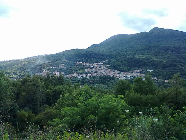
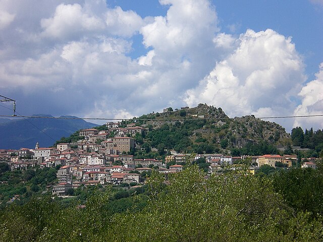
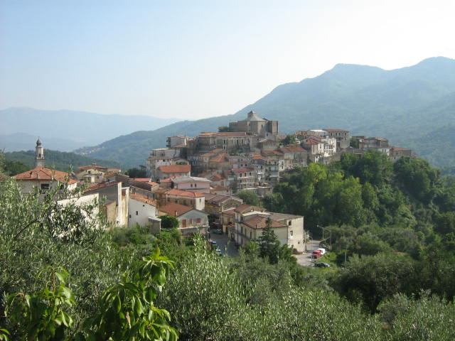
Laurito is a charming village located in the Campania region of Italy, nestled in the mountains of the Cilento and Vallo di Diano National Park. This area is known for its stunning landscapes, rich biodiversity, and historical significance.
Hiking in Laurito
-
Scenic Trails: Laurito offers a variety of hiking trails that cater to different skill levels. Whether you're looking for a leisurely stroll or a more challenging trek, you'll find paths that lead through lush forests, along stunning ridges, and to breathtaking viewpoints.
-
Cilento National Park: The nearby Cilento and Vallo di Diano National Park is a UNESCO World Heritage site. It boasts numerous trails with diverse ecosystems, including coastal paths, hills, and ancient ruins. Hiking here allows you to experience the rich flora and fauna of the area.
-
Historical and Cultural Sites: Many hiking routes in and around Laurito pass by historical landmarks such as ancient churches and ruins, allowing hikers to combine adventure with cultural exploration.
-
Flora and Fauna: The area is home to a variety of wildlife, including several rare species. Keep your eyes peeled for local flora and fauna as you hike through meadows and forests.
-
Best Time to Hike: The best time for hiking in Laurito is during the spring and fall months when temperatures are mild, and the landscape is particularly beautiful. Summer can be hot, so early morning hikes are recommended to avoid the heat.
-
Local Guides: To make the most of your hiking experience, consider hiring a local guide. They can provide valuable insights about the trails, local history, and the best spots to visit.
-
Preparation: Make sure to wear appropriate hiking gear, bring plenty of water, and have a map or GPS device if you’re exploring the area.
-
Connecting with Nature: The serene environment around Laurito is perfect for connecting with nature, offering peace and tranquility away from the hustle and bustle of city life.
If you're planning a hiking trip in Laurito, be sure to check local resources for trail maps and any specific regulations for visitors in the national park area. Happy hiking!
- Страна:

- Почтовый код: 84050
- Телефонный код: 0974
- Код автомобильного номера: SA
- Координаты: 40° 10' 0" N, 15° 24' 0" E


- GPS треки (wikiloc): [Ссылка]
- Высота над уровнем моря: 475 м m
- Площадь: 20.22 кв.км
- Население: 782
- Веб сайт: http://www.comune.laurito.sa.it/
- Википедия русская: wiki(ru)
- Википедия английская: wiki(en)
- Википедия национальная: wiki(it)
- Хранилище Wikidata: Wikidata: Q49716
- Катеория в википедии: [Ссылка]
- код Freebase: [/m/04s_z2]
- код GeoNames: Альт: [6538208]
- ID отношения в OpenStreetMap: [40305]
- код TGN: [1045037]
- код ISTAT: 065062
- кадастровый код Италии: E486
Граничит с регионами:

Альфано
- коммуна Италии
Hiking in Альфано
Alfano is a small yet fascinating area located in the Campania region of Italy, primarily known for its picturesque landscapes, historical sites, and connection to nature. When it comes to hiking in and around Alfano, there are several key points to consider:...
- Страна:
- Почтовый код: 84040
- Телефонный код: 0974
- Код автомобильного номера: SA
- Координаты: 40° 10' 39" N, 15° 25' 29" E
- GPS треки (wikiloc): [Ссылка]
- Высота над уровнем моря: 250 м m
- Площадь: 4.82 кв.км
- Население: 1011
- Веб сайт: [Ссылка]


Челле-ди-Булгерия
- коммуна Италии
Hiking in Челле-ди-Булгерия
Celle di Bulgheria, a charming village located in the Cilento and Vallo di Diano National Park in southern Italy, offers a variety of hiking opportunities that cater to both novice and experienced hikers. Here are some key points to consider when hiking in this beautiful area:...
- Страна:
- Почтовый код: 84040
- Телефонный код: 0974
- Код автомобильного номера: SA
- Координаты: 40° 6' 0" N, 15° 24' 0" E
- GPS треки (wikiloc): [Ссылка]
- Высота над уровнем моря: 234 м m
- Площадь: 31.62 кв.км
- Население: 1861
- Веб сайт: [Ссылка]


Монтано-Антилия
- коммуна Италии
Hiking in Монтано-Антилия
Montano Antilia is a charming town located in the Campania region of Italy, surrounded by the majestic landscapes of the Cilento National Park. This area is known for its rugged terrain, lush greenery, and stunning coastal views, making it an excellent destination for hiking enthusiasts....
- Страна:
- Почтовый код: 84060
- Телефонный код: 0974
- Код автомобильного номера: SA
- Координаты: 40° 9' 43" N, 15° 22' 0" E
- GPS треки (wikiloc): [Ссылка]
- Высота над уровнем моря: 700 м m
- Площадь: 33.44 кв.км
- Население: 2019
- Веб сайт: [Ссылка]


Нови-Велия
- коммуна Италии
Hiking in Нови-Велия
Novi Velia is a charming town located in the Cilento region of southern Italy, known for its beautiful landscapes and opportunities for hiking. Nestled in the Parco Nazionale del Cilento, Vallo di Diano e Alburni, it offers stunning views, diverse terrains, and a rich natural environment....
- Страна:
- Почтовый код: 84060
- Телефонный код: 0974
- Код автомобильного номера: SA
- Координаты: 40° 13' 0" N, 15° 17' 0" E
- GPS треки (wikiloc): [Ссылка]
- Высота над уровнем моря: 648 м m
- Площадь: 34.71 кв.км
- Население: 2292
- Веб сайт: [Ссылка]
Роккаглориоза
- коммуна Италии
Hiking in Роккаглориоза
Roccagloriosa, located in the Campania region of Italy, is a lesser-known but stunning destination for hiking enthusiasts. Nestled in the Cilento and Vallo di Diano National Park, this picturesque village offers a unique combination of natural beauty, historical ruins, and a rich local culture....
- Страна:
- Почтовый код: 84060
- Телефонный код: 0974
- Код автомобильного номера: SA
- Координаты: 40° 7' 0" N, 15° 26' 0" E
- GPS треки (wikiloc): [Ссылка]
- Высота над уровнем моря: 430 м m
- Площадь: 40.56 кв.км
- Население: 1698
- Веб сайт: [Ссылка]

Рофрано
- коммуна Италии
Hiking in Рофрано
Rofrano, a picturesque village in the Campania region of southern Italy, is surrounded by the stunning landscapes of the Cilento and Vallo di Diano National Park. This area is rich in natural beauty, offering a variety of hiking opportunities suitable for different skill levels....
- Страна:
- Почтовый код: 84070
- Телефонный код: 0974
- Код автомобильного номера: SA
- Координаты: 40° 13' 0" N, 15° 26' 0" E
- GPS треки (wikiloc): [Ссылка]
- Высота над уровнем моря: 450 м m
- Площадь: 63.59 кв.км
- Население: 1509
- Веб сайт: [Ссылка]