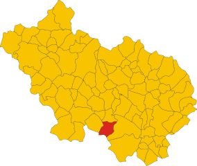
Ленола (Lenola, Lazio, Lenola)
.svg)
- коммуна Италии
 Hiking in Ленола
Lenola, located in the province of Latina in the Lazio region of Italy, is an excellent destination for hiking enthusiasts. Nestled in the Aurunci Mountains, this charming town offers a blend of stunning natural beauty, historical sites, and diverse hiking trails.
Hiking Opportunities
-
Trails and Difficulty Levels: Lenola features a variety of trails, suitable for all levels of hikers. You can find both easy walking paths and more challenging routes for experienced hikers. The trails often weave through picturesque landscapes, including forests, vineyards, and panoramic views of the surrounding mountains and coastline.
-
Monte Leano: One of the most popular hikes is the ascent to Monte Leano. This challenge offers rewarding views at the summit, where hikers can see the Tyrrhenian Sea and the mountain ranges extending into the distance.
-
Natural Reserves: The nearby Parco Naturale Regionale dei Monti Aurunci provides excellent opportunities for hiking. The park is home to diverse flora and fauna, as well as breathtaking scenery that changes with the seasons.
-
Historical Sites: While hiking, you may come across ancient ruins, monasteries, and quaint churches that add cultural depth to your outdoor experience.
Tips for Hiking in Lenola
-
Best Time to Hike: The ideal times for hiking in Lenola are spring (April to June) and fall (September to October) when the weather is mild and the landscape is vibrant.
-
Preparation: Always carry a map or a GPS device, as some trails may not be well-marked. It's also essential to wear appropriate footwear and clothing suited for hiking.
-
Hydration and Snacks: Bring plenty of water and snacks, especially on longer hikes, as facilities may be sparse once you venture out of town.
-
Local Guide: If you're unfamiliar with the area, consider hiring a local guide who can enhance your experience with insights about the terrain and local history.
Lenola offers a unique hiking experience where outdoor adventure meets rich history. Whether you're looking for a peaceful walk through nature or a challenging climb, you’ll find plenty to enjoy in this beautiful part of Italy.
- Страна:

- Почтовый код: 04025
- Телефонный код: 0771
- Код автомобильного номера: LT
- Координаты: 41° 24' 33" N, 13° 27' 45" E


- GPS треки (wikiloc): [Ссылка]
- Высота над уровнем моря: 425 м m
- Площадь: 45.24 кв.км
- Население: 4184
- Веб сайт: http://www.comunedilenola.it/
- Википедия русская: wiki(ru)
- Википедия английская: wiki(en)
- Википедия национальная: wiki(it)
- Хранилище Wikidata: Wikidata: Q128101
- Катеория в википедии: [Ссылка]
- код Freebase: [/m/0f8nb1]
- код GeoNames: Альт: [6538695]
- код VIAF: Альт: [310607719]
- ID отношения в OpenStreetMap: [41274]
- WOEID: [717189]
- код темы Quora: [Lenola]
- код ISTAT: 059012
- кадастровый код Италии: E527
Граничит с регионами:
Кастро-дей-Вольши
- коммуна Италии
Hiking in Кастро-дей-Вольши
Castro dei Volsci is a charming village located in the province of Frosinone, in the Lazio region of Italy. Surrounded by the scenic landscapes of the Aurunci mountains, this area offers a range of hiking opportunities for both beginners and experienced hikers....
- Страна:
- Почтовый код: 03020
- Телефонный код: 0775
- Код автомобильного номера: FR
- Координаты: 41° 31' 0" N, 13° 24' 0" E
- GPS треки (wikiloc): [Ссылка]
- Высота над уровнем моря: 385 м m
- Площадь: 58.45 кв.км
- Население: 4740
- Веб сайт: [Ссылка]
Пастена
- коммуна Италии
Hiking in Пастена
Pastena is a charming town located in the province of Frosinone, in the Lazio region of Italy. It's renowned for its stunning natural landscapes and rich history, making it an excellent destination for hiking enthusiasts. Here are some highlights about hiking in and around Pastena:...
- Страна:
- Почтовый код: 03020
- Телефонный код: 0776
- Код автомобильного номера: FR
- Координаты: 41° 28' 6" N, 13° 29' 28" E
- GPS треки (wikiloc): [Ссылка]
- Высота над уровнем моря: 318 м m
- Площадь: 42.16 кв.км
- Население: 1424
- Веб сайт: [Ссылка]

Пико
- коммуна Италии
Hiking in Пико
Pico is a charming village in the province of Frosinone, in the Lazio region of Italy. It's situated on the slopes of the Aurunci Mountains and offers various hiking opportunities for both experienced hikers and beginners. Here’s what you need to know about hiking in Pico:...
- Страна:
- Почтовый код: 03020
- Телефонный код: 0776
- Код автомобильного номера: FR
- Координаты: 41° 27' 5" N, 13° 33' 42" E
- GPS треки (wikiloc): [Ссылка]
- Высота над уровнем моря: 190 м m
- Площадь: 32.93 кв.км
- Население: 2825
- Веб сайт: [Ссылка]


Валлекорса
- коммуна Италии
Hiking in Валлекорса
Vallecorsa is a charming town located in the Lazio region of Italy, surrounded by the scenic landscapes of the Apennine mountains. The area is ideal for hiking enthusiasts looking to explore picturesque trails and enjoy the natural beauty of the Italian countryside....
- Страна:
- Почтовый код: 03020
- Телефонный код: 0775
- Код автомобильного номера: FR
- Координаты: 41° 27' 0" N, 13° 24' 0" E
- GPS треки (wikiloc): [Ссылка]
- Высота над уровнем моря: 350 м m
- Площадь: 39.28 кв.км
- Население: 2574
- Веб сайт: [Ссылка]


Камподимеле
- коммуна Италии
Hiking in Камподимеле
Campodimele, known as the "Village of Longevity," is a picturesque destination in the Italian region of Lazio, particularly in the province of Latina. Not only is it famous for its scenic beauty and rich history, but it also offers a variety of hiking trails that cater to different skill levels....
- Страна:
- Почтовый код: 04020
- Телефонный код: 0771
- Код автомобильного номера: LT
- Координаты: 41° 23' 0" N, 13° 32' 0" E
- GPS треки (wikiloc): [Ссылка]
- Высота над уровнем моря: 647 м m
- Площадь: 38.38 кв.км
- Население: 598
- Веб сайт: [Ссылка]


Фонди
- коммуна Италии
Hiking in Фонди
Fondi, located in the province of Latina in the Lazio region of Italy, is a beautiful area that offers a range of hiking opportunities. The region is characterized by its stunning landscapes, combining coastal views, rolling hills, and historical sites. Here are some highlights about hiking in Fondi:...
- Страна:
- Почтовый код: 04022
- Телефонный код: 0771
- Код автомобильного номера: LT
- Координаты: 41° 21' 0" N, 13° 25' 0" E
- GPS треки (wikiloc): [Ссылка]
- Высота над уровнем моря: 8 м m
- Площадь: 143.92 кв.км
- Население: 39779
- Веб сайт: [Ссылка]