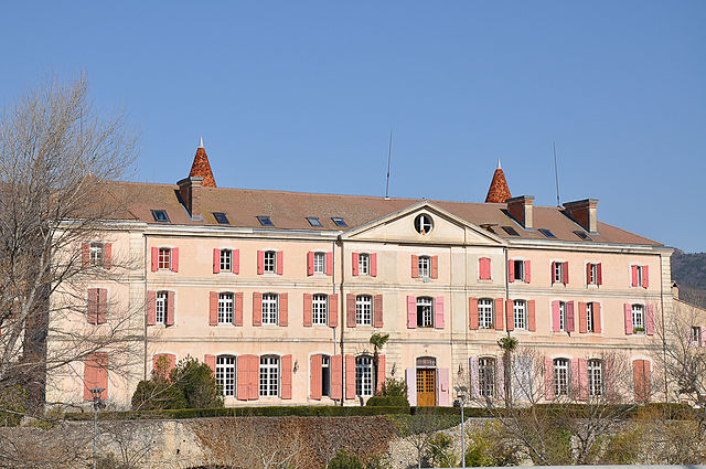
Ле-Ме (Les Mées, Les Mées)
- коммуна во Франции
 Hiking in Ле-Ме
Les Mées, located in the Alpes-de-Haute-Provence region of France, is known for its stunning landscapes, diverse trails, and the unique geological formations that characterize the area. Here’s what you can expect when hiking in Les Mées:
Scenic Landscapes
The region features beautiful wildflower meadows, rocky hills, and panoramic views of the surrounding mountains. The iconic limestone cliffs, known as "Les Mées," offer a dramatic backdrop for hikers and are a photographer's paradise.
Trails and Routes
- Variety of Trails: There are several marked hiking trails ranging from easy walks to more difficult treks. Many routes feature varied terrains, including forests, rocky paths, and open ridges.
- GR Trails: Les Mées is part of the broader network of Grande Randonnée (GR) trails, which are long-distance hiking paths that lead through some of the most scenic areas of France.
Hiking Conditions
- Best Seasons: Spring (April to June) and fall (September to October) are generally the best times for hiking, as temperatures are milder and nature is in full bloom. Summer can be hot, while winter hiking is possible but may require winter gear and experience.
- Trail Difficulty: Routes vary significantly in difficulty. Beginners can find easier paths and loop walks, while experienced hikers can tackle more challenging trails requiring proper gear and skills.
Wildlife and Flora
The region is home to a rich array of wildlife and plant species. Birdwatchers can expect to see various birds of prey, while the flora includes diverse alpine plants, herbs, and wildflowers.
Local Culture and Amenities
The village of Les Mées has a quaint atmosphere with local shops and restaurants where hikers can enjoy regional cuisine. After a day of hiking, you might want to relax at a café or explore the charming streets.
Safety Tips
- Preparation: Always check trail conditions and weather forecasts before heading out. Carry a map or GPS device.
- Hydration and Nutrition: Bring plenty of water and snacks, especially on longer hikes.
- Gear: Wear appropriate hiking boots and dress in layers to accommodate changing weather conditions.
Conclusion
Hiking in Les Mées offers an opportunity to connect with nature and explore the stunning beauty of the Alpes-de-Haute-Provence. With its diverse trails and breathtaking landscapes, it’s a fantastic destination for hikers of all levels. Enjoy your adventure!
- Страна:

- Почтовый код: 04190
- Координаты: 44° 1' 46" N, 5° 58' 35" E


- GPS треки (wikiloc): [Ссылка]
- Площадь: 65.4 кв.км
- Население: 3664
- Веб сайт: http://www.mairie-lesmees04.com
- Википедия русская: wiki(ru)
- Википедия английская: wiki(en)
- Википедия национальная: wiki(fr)
- Хранилище Wikidata: Wikidata: Q473275
- Катеория в википедии: [Ссылка]
- код Freebase: [/m/03m7wvz]
- код Freebase: [/m/03m7wvz]
- код GeoNames: Альт: [6455460]
- код GeoNames: Альт: [6455460]
- номер SIREN: [210401162]
- номер SIREN: [210401162]
- код BNF: [131153062]
- код BNF: [131153062]
- код VIAF: Альт: [300865926]
- код VIAF: Альт: [300865926]
- код тезауруса PACTOLS: [pcrt1jeGHU0bYv]
- код тезауруса PACTOLS: [pcrt1jeGHU0bYv]
- код муниципалитета INSEE: 04116
- код муниципалитета INSEE: 04116
Граничит с регионами:

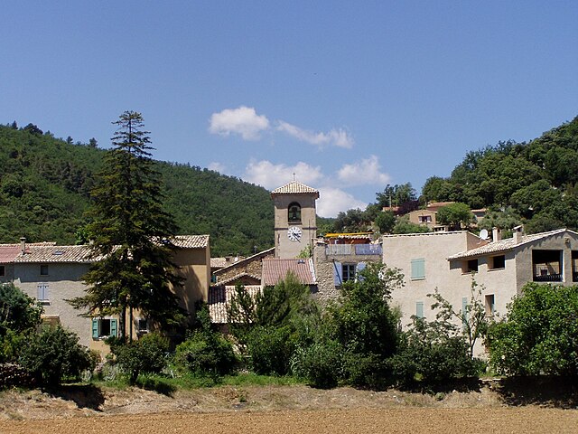
Пюимишель
- коммуна во Франции
Hiking in Пюимишель
Puimichel is a picturesque village located in the Provence-Alpes-Côte d'Azur region of southeastern France. It is known for its natural beauty, charming landscapes, and opportunities for outdoor activities such as hiking. Here’s what you can expect when hiking in and around Puimichel:...
- Страна:
- Почтовый код: 04700
- Координаты: 43° 58' 26" N, 6° 1' 14" E
- GPS треки (wikiloc): [Ссылка]
- Площадь: 36.81 кв.км
- Население: 218
- Веб сайт: [Ссылка]
Малиже
- коммуна во Франции
Hiking in Малиже
Malijai is a small commune in the Alpes-de-Haute-Provence department in southeastern France. It's nestled in a picturesque landscape, making it a great location for hiking enthusiasts. While it may not be as well-known as larger national parks or hiking regions in France, it offers several opportunities for outdoor activities....
- Страна:
- Почтовый код: 04510
- Координаты: 44° 2' 45" N, 6° 1' 49" E
- GPS треки (wikiloc): [Ссылка]
- Площадь: 26.56 кв.км
- Население: 1987

Люр
- коммуна во Франции
Hiking in Люр
Lurs, located in the Alpes-de-Haute-Provence region of France, offers a unique and picturesque setting for hiking enthusiasts. This charming village is perched on a hill and is surrounded by beautiful landscapes, including rolling hills, olive groves, and views of the lavender fields that the region is famous for....
- Страна:
- Почтовый код: 04700
- Координаты: 43° 58' 10" N, 5° 53' 21" E
- GPS треки (wikiloc): [Ссылка]
- Площадь: 22.48 кв.км
- Население: 377

Ганагоби
- коммуна во Франции
Hiking in Ганагоби
Ganagobie is a beautiful region located in the Alpes-de-Haute-Provence department of southeastern France. It is known for its stunning landscapes, rich biodiversity, and the historic Saint-Marie de Ganagobie Monastery, which sits on a hill overlooking the countryside. Here are some highlights about hiking in Ganagobie:...
- Страна:
- Почтовый код: 04310
- Координаты: 44° 0' 32" N, 5° 54' 59" E
- GPS треки (wikiloc): [Ссылка]
- Площадь: 10.5 кв.км
- Население: 85
Ле-Кастелле
- коммуна во Франции
Hiking in Ле-Кастелле
Le Castellet, located in the Alpes-de-Haute-Provence region of France, offers a variety of beautiful hiking opportunities amidst stunning landscapes and rich natural beauty. Here are some key points to consider when hiking in this area:...
- Страна:
- Почтовый код: 04700
- Координаты: 43° 56' 19" N, 5° 58' 48" E
- GPS треки (wikiloc): [Ссылка]
- Площадь: 18.87 кв.км
- Население: 292
- Веб сайт: [Ссылка]

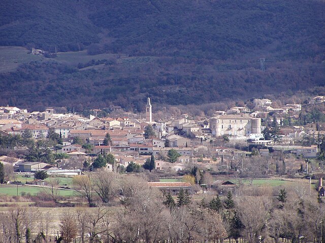
Шато-Арну-Сент-Обан
- коммуна во Франции
Hiking in Шато-Арну-Сент-Обан
Château-Arnoux-Saint-Auban, located in the Alpes-de-Haute-Provence region of southeastern France, offers a picturesque backdrop for hiking enthusiasts. The area is characterized by beautiful landscapes, including rolling hills, rocky outcrops, and lush greenery....
- Страна:
- Почтовый код: 04160
- Координаты: 44° 5' 36" N, 6° 0' 30" E
- GPS треки (wikiloc): [Ссылка]
- Площадь: 18.34 кв.км
- Население: 5184

Пейрюи
- коммуна во Франции
Hiking in Пейрюи
Peyruis, located in the Alpes-de-Haute-Provence region of France, offers some charming hiking opportunities that attract nature enthusiasts. The area is characterized by its picturesque landscapes, rolling hills, and scenic views of the surrounding alpine environment. Here are some key points to consider when hiking in and around Peyruis:...
- Страна:
- Почтовый код: 04310
- Координаты: 44° 1' 44" N, 5° 56' 25" E
- GPS треки (wikiloc): [Ссылка]
- Площадь: 23.23 кв.км
- Население: 2849

Л’Эскаль
- коммуна во Франции
Hiking in Л’Эскаль
L'Escale, located in the French region of Provence-Alpes-Côte d'Azur, offers a variety of hiking opportunities for outdoor enthusiasts. The region is known for its stunning landscapes, including rugged mountains, scenic valleys, and picturesque villages. Here are some key points to consider when hiking in L'Escale:...
- Страна:
- Почтовый код: 04160
- Координаты: 44° 5' 7" N, 6° 1' 23" E
- GPS треки (wikiloc): [Ссылка]
- Площадь: 20.36 кв.км
- Население: 1408
Орезон
- коммуна во Франции
Hiking in Орезон
Oraison, a charming village in the Alpes-de-Haute-Provence region of France, offers a variety of hiking opportunities suitable for different skill levels. The surrounding landscape features rolling hills, lavender fields, and stunning views of the nearby Lure Mountain. Here are some highlights for hiking in and around Oraison:...
- Страна:
- Почтовый код: 04700
- Координаты: 43° 55' 2" N, 5° 55' 7" E
- GPS треки (wikiloc): [Ссылка]
- Площадь: 38.42 кв.км
- Население: 5854
- Веб сайт: [Ссылка]

Монфор
- коммуна во Франции
Hiking in Монфор
Montfort is a charming village in the Alpes-de-Haute-Provence region of France, surrounded by stunning natural landscapes that are perfect for hiking enthusiasts. The area is characterized by its picturesque scenery, including rolling hills, lush forests, and the nearby Verdon River, which offers a variety of hiking trails suitable for different skill levels....
- Страна:
- Почтовый код: 04600
- Координаты: 44° 3' 49" N, 5° 58' 22" E
- GPS треки (wikiloc): [Ссылка]
- Площадь: 12.08 кв.км
- Население: 346
- Веб сайт: [Ссылка]