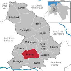
Линдерн (Lindern, Lindern)
%20in%20CLP.svg)
 Hiking in Линдерн
Lindern, located in the Lower Saxony region of Germany, offers a charming setting for hiking enthusiasts. While it's a smaller village, its surrounding areas provide opportunities for enjoying nature and experiencing the tranquility of the countryside.
Hiking Trails:
-
Nature Routes: The region around Lindern features a mix of flat and slightly hilly terrain, ideal for gentle hiking. You can explore rural landscapes, scenic fields, and nearby forests.
-
Local Parks and Reserves: Look for nearby nature parks or reserves that might offer marked trails. These areas may feature local flora and fauna, providing an opportunity for wildlife observation.
-
Distance and Duration: Many trails in this area can be family-friendly and range from short walks of about 1-2 hours to longer hikes lasting half a day or more, depending on your experience level.
Recommendations:
- Preparation: Always check local maps and guides for hiking routes. It’s helpful to have a good sense of the landscape and any potential challenges along the way.
- Safety: Carry plenty of water, wear appropriate footwear, and dress in layers, as weather can change quickly.
- Local Attractions: Take time to explore the village of Lindern itself, its local culture, and cuisine.
Best Time to Hike:
The best seasons for hiking in Lindern are typically spring and fall when the weather is mild, and the scenery is particularly beautiful with blooming flowers in spring and stunning autumn colors.
Additional Tips:
- Hiking Groups: Consider joining a local hiking group if you're looking to meet fellow outdoor enthusiasts or explore more challenging trails.
- Guided Tours: Check if there are any guided hiking tours available for a more informative experience.
Always remember to respect nature, stay on trails, and follow local regulations to preserve the beauty of the area for future generations. Happy hiking!
- Страна:

- Почтовый код: 49699
- Телефонный код: 05957
- Код автомобильного номера: CLP
- Координаты: 52° 50' 42" N, 7° 46' 41" E


- GPS треки (wikiloc): [Ссылка]
- Высота над уровнем моря: 37 м m
- Площадь: 65.81 кв.км
- Население: 4817
- Веб сайт: http://www.lindern.de
- Википедия русская: wiki(ru)
- Википедия английская: wiki(en)
- Википедия национальная: wiki(de)
- Хранилище Wikidata: Wikidata: Q559571
- Катеория в википедии: [Ссылка]
- Карты в википедии: [Ссылка]
- код Freebase: [/m/0c45sl]
- код GeoNames: Альт: [6552876]
- ID отношения в OpenStreetMap: [1101318]
- код GND: Альт: [4290533-3]
- идентификатор муниципалитетов в Германии: 03453010
Граничит с регионами:


Лёнинген
Hiking in Лёнинген
Löningen is a picturesque town located in Lower Saxony, Germany, which offers some lovely hiking opportunities. The surrounding area is characterized by a mix of woodlands, heathlands, and agricultural fields, making it perfect for nature enthusiasts....
- Страна:
- Почтовый код: 49624
- Телефонный код: 05964; 05962; 05437; 05434; 05432
- Код автомобильного номера: CLP
- Координаты: 52° 43' 0" N, 7° 46' 0" E
- GPS треки (wikiloc): [Ссылка]
- Высота над уровнем моря: 24 м m
- Площадь: 143 кв.км
- Население: 13366
- Веб сайт: [Ссылка]

Ластруп
Hiking in Ластруп
Lastrup, a small town in Lower Saxony, Germany, offers a range of outdoor activities including hiking. While it may not be as widely known for hiking as some larger locations, it still presents opportunities to explore the scenic countryside....
- Страна:
- Почтовый код: 49688
- Телефонный код: 04472
- Код автомобильного номера: CLP
- Координаты: 52° 46' 0" N, 7° 50' 0" E
- GPS треки (wikiloc): [Ссылка]
- Высота над уровнем моря: 45 м m
- Площадь: 85 кв.км
- Население: 6985
- Веб сайт: [Ссылка]