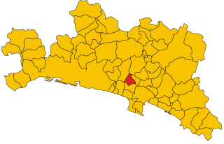
Лумарцо (Lumarzo, Lumarzo)
.svg)
- коммуна Италии
 Hiking in Лумарцо
Lumarzo is a charming village located in the Liguria region of Italy, near the eastern side of the Mediterranean coast. It is surrounded by beautiful natural landscapes, making it an excellent spot for hiking enthusiasts. The area features scenic trails that take you through lush forests, vineyards, and offer stunning views of the surrounding hills and valleys.
Hiking Trails in Lumarzo:
-
The Sentiero dei Tribulae: This trail takes you through some picturesque landscapes, and you’ll have the opportunity to discover local flora and fauna. Ideal for nature lovers, it offers varied terrain, from easy paths to more challenging sections.
-
Monte Cordona: A hike to this peak provides a fantastic panoramic view of the surrounding Ligurian countryside. The trail can be steep in places, but the breathtaking vistas are well worth the effort.
-
Nearby Trails in the Portofino Protected Area: Just a short drive from Lumarzo, you can explore the trails within the Portofino Natural Park. Here, you will find routes that lead to the coast, featuring dramatic cliffs, hidden coves, and the opportunity to swim in the sea after a hike.
Tips for Hiking in Lumarzo:
-
Best Time to Visit: Spring (March to June) and fall (September to October) provide the best hiking weather, with mild temperatures and fewer crowds.
-
Gear: Wear comfortable hiking shoes with good grip, pack enough water, and carry snacks. A map or GPS device is also helpful, as some trails may not be well marked.
-
Local Regulations: Be mindful of the local wildlife and stay on designated trails to protect the ecosystem.
-
Check for Guided Tours: If you are unfamiliar with the area or prefer a guided experience, consider joining a local hiking tour. This can provide insights into the region's flora, fauna, and history.
Lumarzo offers a serene hiking experience away from the hustle and bustle of more crowded tourist destinations, allowing hikers to fully immerse themselves in the natural beauty of Liguria.
- Страна:

- Почтовый код: 16024
- Телефонный код: 0185
- Код автомобильного номера: GE
- Координаты: 44° 26' 37" N, 9° 8' 14" E


- GPS треки (wikiloc): [Ссылка]
- Высота над уровнем моря: 325 м m
- Площадь: 25.51 кв.км
- Население: 1527
- Веб сайт: http://www.comune.lumarzo.genova.it
- Википедия русская: wiki(ru)
- Википедия английская: wiki(en)
- Википедия национальная: wiki(it)
- Хранилище Wikidata: Wikidata: Q267268
- Катеория в википедии: [Ссылка]
- код Freebase: [/m/0ghwbp]
- код GeoNames: Альт: [6542732]
- ID отношения в OpenStreetMap: [43149]
- код ISTAT: 010031
- кадастровый код Италии: E737
Граничит с регионами:


Баргальи
- коммуна Италии
Hiking in Баргальи
Bargagli is a picturesque municipality in the Metropolitan City of Genoa, Italy, surrounded by beautiful landscapes that are perfect for hiking enthusiasts. The area features a mix of lush forests, charming villages, and scenic views of the surrounding mountains and valleys. Here are some key points to consider if you're planning a hiking trip to Bargagli:...
- Страна:
- Почтовый код: 16021
- Телефонный код: 010
- Код автомобильного номера: GE
- Координаты: 44° 26' 40" N, 9° 5' 19" E
- GPS треки (wikiloc): [Ссылка]
- Высота над уровнем моря: 341 м m
- Площадь: 16.28 кв.км
- Население: 2700
- Веб сайт: [Ссылка]


Даванья
- коммуна Италии
Hiking in Даванья
Davagna is a beautiful municipality in the Canton of Ticino in Switzerland, known for its stunning landscapes and diverse hiking trails. The area offers a variety of hiking experiences, ranging from easy walks to more challenging treks. Here’s a brief overview of what you can expect when hiking in Davagna:...
- Страна:
- Почтовый код: 16022
- Телефонный код: 010
- Код автомобильного номера: GE
- Координаты: 44° 28' 1" N, 9° 5' 24" E
- GPS треки (wikiloc): [Ссылка]
- Высота над уровнем моря: 516 м m
- Площадь: 20.53 кв.км
- Население: 1905
- Веб сайт: [Ссылка]


Торрилья
- коммуна Италии
Hiking in Торрилья
Torriglia, located in the Liguria region of Italy, is a fantastic destination for hiking enthusiasts. Nestled in the Apennine Mountains, this quaint town offers a variety of landscapes, from lush forests to scenic mountain vistas....
- Страна:
- Почтовый код: 16029
- Телефонный код: 010
- Код автомобильного номера: GE
- Координаты: 44° 31' 7" N, 9° 9' 29" E
- GPS треки (wikiloc): [Ссылка]
- Высота над уровнем моря: 769 м m
- Площадь: 60.02 кв.км
- Население: 2270
- Веб сайт: [Ссылка]


Сори
- коммуна Италии
Hiking in Сори
Sori, a charming coastal town in Liguria, Italy, is nestled between the lush hills of the Italian Riviera and the sparkling Ligurian Sea. It offers a wealth of hiking opportunities for outdoor enthusiasts looking to explore the dramatic landscapes, picturesque views, and the region’s natural beauty....
- Страна:
- Почтовый код: 16031
- Телефонный код: 0185
- Код автомобильного номера: GE
- Координаты: 44° 22' 22" N, 9° 6' 15" E
- GPS треки (wikiloc): [Ссылка]
- Высота над уровнем моря: 14 м m
- Площадь: 13.07 кв.км
- Население: 4176
- Веб сайт: [Ссылка]

Ушио
- коммуна Италии
Hiking in Ушио
Uscio is a charming municipality located in the Italian region of Liguria, close to the coast and surrounded by picturesque landscapes. The region offers a variety of hiking opportunities that cater to different skill levels, from leisurely walks to more challenging treks....
- Страна:
- Почтовый код: 16036
- Телефонный код: 0185
- Код автомобильного номера: GE
- Координаты: 44° 24' 48" N, 9° 9' 47" E
- GPS треки (wikiloc): [Ссылка]
- Высота над уровнем моря: 361 м m
- Площадь: 9.63 кв.км
- Население: 2222
- Веб сайт: [Ссылка]


Нейроне
- коммуна Италии
Hiking in Нейроне
Neirone is a charming village located in the Metropolitan City of Genoa, in the Liguria region of Italy. Nestled in the Italian Alps, it offers a beautiful landscape for hiking enthusiasts. Here's a quick overview of what you can expect when hiking in Neirone:...
- Страна:
- Почтовый код: 16040
- Телефонный код: 0185
- Код автомобильного номера: GE
- Координаты: 44° 27' 15" N, 9° 11' 27" E
- GPS треки (wikiloc): [Ссылка]
- Высота над уровнем моря: 350 м m
- Площадь: 30.24 кв.км
- Население: 849
- Веб сайт: [Ссылка]