Луцайн (Luzein, Luzein)

 Hiking in Луцайн
Luzein is a picturesque Swiss village located in the canton of Graubünden, surrounded by stunning alpine landscapes. It’s a great destination for hiking enthusiasts, offering a diverse range of trails that cater to different skill levels. Here are some details about hiking in Luzein:
Trail Options
-
Beginner Trails: For those new to hiking or looking for easier routes, there are several well-marked paths that offer gentle slopes and beautiful views of the surrounding mountains and valleys. These trails often pass through lush meadows and might include charming spots for picnicking.
-
Intermediate Trails: More experienced hikers can explore intermediate-level paths that provide a bit more challenge, such as moderate ascents. These trails may lead you to panoramic viewpoints or take you deeper into the natural flora and fauna of the region.
-
Advanced Routes: For seasoned hikers, there are also advanced trails that involve steeper climbs and can reach higher altitudes. These hikes typically reward you with breathtaking vistas and the chance to explore the area’s rugged terrains.
Highlights
- Natural Beauty: The region is known for its diverse ecosystems, including forests, alpine meadows, and rocky outcrops. Keep an eye out for local wildlife and unique flora along your hike.
- Cultural Experience: As you hike through the area, you might come across traditional Swiss chalets and farms that add to the cultural richness of the experience.
- Accessibility: Many trails can be accessed from the village, making it easy to start your hiking adventure. Local signs are usually well-maintained and provide useful information about distances and estimated hiking times.
Best Seasons
- Summer (June to September): This is the prime hiking season, with trails fully accessible and wildflowers in bloom. Weather conditions are generally mild.
- Autumn (October): While the summer crowds diminish, the fall colors create a stunning backdrop for hiking. However, prepare for cooler temperatures and potentially variable weather.
- Winter (December to March): For those interested in snowshoeing or winter hiking, the area can offer serene snowy landscapes, though trail access may be limited.
Preparation Tips
- Hydration: Always carry enough water, especially on longer hikes.
- Footwear: Invest in good-quality hiking boots for comfort and protection.
- Map and Navigation: Even though trails are usually well-marked, having a map or GPS device is advisable.
- Dress in Layers: Weather can change rapidly in the Alps, so dress in layers and be prepared for quick shifts in temperature.
Local Amenities
Luzein has a few local inns and restaurants where you can enjoy traditional Swiss cuisine after a day on the trails. Engaging with local guides is also a great way to learn more about the region and its history.
In summary, hiking in Luzein offers a blend of natural beauty, cultural experiences, and varying levels of trail difficulty, making it an attractive option for hikers of all abilities. Enjoy your adventure!
- Страна:

- Почтовый код: 7242
- Телефонный код: 081
- Код автомобильного номера: GR
- Координаты: 46° 55' 11" N, 9° 46' 0" E


- GPS треки (wikiloc): [Ссылка]
- Высота над уровнем моря: 1892 м m
- Площадь: 31.60 кв.км
- Население: 1573
- Веб сайт: http://www.luzein.ch
- Википедия русская: wiki(ru)
- Википедия английская: wiki(en)
- Википедия национальная: wiki(de)
- Хранилище Wikidata: Wikidata: Q65296
- Катеория в википедии: [Ссылка]
- код Freebase: [/m/026f725]
- код GeoNames: Альт: [7286408]
- код VIAF: Альт: [249396555]
- ID отношения в OpenStreetMap: [5817241]
- идентификатор HDS: [1579]
- код швейцарского муниципалитета: [3891]
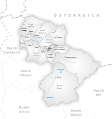
Граничит с регионами:


Енац
Hiking in Енац
Jenaz is a charming village located in the Prättigau region of the Swiss Alps, known for its stunning natural beauty and excellent hiking opportunities. The area offers a variety of trails suitable for different skill levels, from easy walks to more challenging hikes....
- Страна:
- Почтовый код: 7233
- Телефонный код: 081
- Код автомобильного номера: GR
- Координаты: 46° 54' 23" N, 9° 42' 7" E
- GPS треки (wikiloc): [Ссылка]
- Высота над уровнем моря: 1469 м m
- Площадь: 25.91 кв.км
- Население: 1161
- Веб сайт: [Ссылка]

Кюблис
Hiking in Кюблис
Küblis, located in the Prättigau region of Switzerland, is a lovely spot for hiking enthusiasts. Nestled between the mountains and close to the Landquart River, this area offers a variety of trails that cater to different skill levels, from easy walks to more challenging hikes....
- Страна:
- Почтовый код: 7240
- Телефонный код: 081
- Код автомобильного номера: GR
- Координаты: 46° 54' 53" N, 9° 46' 27" E
- GPS треки (wikiloc): [Ссылка]
- Высота над уровнем моря: 814 м m
- Площадь: 8.14 кв.км
- Население: 853
- Веб сайт: [Ссылка]


Фидерис
Hiking in Фидерис
Fideris is a picturesque village located in the canton of Graubünden in Switzerland. It's a great base for hiking enthusiasts due to its diverse trails and stunning alpine scenery. Here’s what you need to know about hiking in and around Fideris:...
- Страна:
- Почтовый код: 7235
- Телефонный код: 081
- Код автомобильного номера: GR
- Координаты: 46° 53' 12" N, 9° 44' 22" E
- GPS треки (wikiloc): [Ссылка]
- Высота над уровнем моря: 1653 м m
- Площадь: 25.36 кв.км
- Население: 598
- Веб сайт: [Ссылка]


Санкт-Антёниен
Hiking in Санкт-Антёниен
St. Antönien is a beautiful valley located in the Prättigau region of Switzerland, known for its stunning landscapes and excellent hiking opportunities. It’s a fantastic destination for both novice and experienced hikers, with trails that range from easy walks to more challenging hikes offering breathtaking panoramas of the Swiss Alps....
- Страна:
- Почтовый код: 7246
- Телефонный код: 081
- Код автомобильного номера: GR
- Координаты: 46° 58' 27" N, 9° 50' 31" E
- GPS треки (wikiloc): [Ссылка]
- Высота над уровнем моря: 1459 м m
- Площадь: 52.28 кв.км
- Веб сайт: [Ссылка]


Контерс
Hiking in Контерс
Conters im Prättigau is a charming village located in the Graubünden region of Switzerland, surrounded by stunning natural landscapes and offering various hiking opportunities. Here are some key points to consider when planning your hiking adventure in and around Conters:...
- Страна:
- Почтовый код: 7241
- Телефонный код: 081
- Код автомобильного номера: GR
- Координаты: 46° 53' 59" N, 9° 47' 0" E
- GPS треки (wikiloc): [Ссылка]
- Высота над уровнем моря: 1110 м m
- Площадь: 18.40 кв.км
- Население: 225
- Веб сайт: [Ссылка]


Ширс
Hiking in Ширс
Schiers is a picturesque village located in the Prättigau Valley in the Swiss canton of Graubünden, and it offers a variety of hiking opportunities suitable for all levels of enthusiasts. The region is renowned for its stunning landscapes, featuring lush green pastures, rugged mountains, and tranquil streams. Here are some highlights and tips for hiking in and around Schiers:...
- Страна:
- Почтовый код: 7220
- Код автомобильного номера: GR
- Координаты: 46° 59' 32" N, 9° 44' 46" E
- GPS треки (wikiloc): [Ссылка]
- Высота над уровнем моря: 1115 м m
- Площадь: 61.66 кв.км
- Население: 2613
- Веб сайт: [Ссылка]