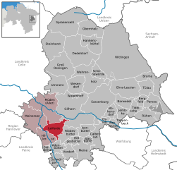
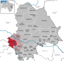
Мюден (Müden (Aller), Müden (Aller))
Müden (Aller) is a charming village located in Lower Saxony, Germany, surrounded by beautiful nature, making it a great spot for hiking enthusiasts. The area offers a variety of trails that cater to different skill levels and preferences, along with picturesque landscapes, including forests, meadows, and the scenic Aller River.
Popular Hiking Routes:
-
Aller River Trail: One of the most beautiful trails, this route follows the river and provides stunning views of the water and surrounding nature. It's generally flat and suitable for families.
-
Lüneburg Heath Trails: Nearby Müden, you can access trails that lead into the larger Lüneburg Heath area. These trails often feature unique heath landscapes, making it a colorful and fragrant hiking experience, especially in late summer and fall.
-
Forested Areas: The trails through the extensive forests around Müden offer a more secluded hiking experience. You can encounter various wildlife and enjoy the tranquility of the woods.
Tips for Hiking in Müden (Aller):
-
Seasonal Variations: Spring and fall are particularly nice times to hike, with blooming flowers and colorful foliage. Summer can be warm, while winter might require preparation for colder temperatures.
-
Local Regulations: Always check for local regulations and trail conditions, as they can change due to weather or maintenance work.
-
Pick Up Maps: It’s a good idea to pick up hiking maps from local tourist information centers or online resources to help navigate the area.
-
Stay Hydrated: Ensure you have enough water, especially on longer hikes, and consider packing snacks for energy.
-
Respect Nature: Carry out what you carry in and respect the local flora and fauna.
Müden (Aller) offers a peaceful backdrop for hiking, filled with natural beauty and opportunities for outdoor adventures. Enjoy your time exploring this lovely area!
- Страна:

- Почтовый код: 38518; 38539
- Телефонный код: 05371; 05375
- Код автомобильного номера: GF
- Координаты: 52° 32' 0" N, 10° 22' 0" E


- GPS треки (wikiloc): [Ссылка]
- Высота над уровнем моря: 47 м m
- Площадь: 67.27 кв.км
- Население: 5392
- Веб сайт: http://www.mueden-aller.de
- Википедия русская: wiki(ru)
- Википедия английская: wiki(en)
- Википедия национальная: wiki(de)
- Хранилище Wikidata: Wikidata: Q684029
- Катеория в википедии: [Ссылка]
- код Freebase: [/m/02ry1r0]
- код Freebase: [/m/02ry1r0]
- код GeoNames: Альт: [2868861]
- код GeoNames: Альт: [2868861]
- код VIAF: Альт: [236129235]
- код VIAF: Альт: [236129235]
- ID отношения в OpenStreetMap: [1375205]
- ID отношения в OpenStreetMap: [1375205]
- код GND: Альт: [4701003-4]
- код GND: Альт: [4701003-4]
- место в MusicBrainz: [fc8d6b44-e78d-49f4-8308-d2531636eaa6]
- место в MusicBrainz: [fc8d6b44-e78d-49f4-8308-d2531636eaa6]
- WOEID: [676410]
- WOEID: [676410]
- код TGN: [1136942]
- код TGN: [1136942]
- код Historical Gazetteer: [MUDDENJO52EM]
- код Historical Gazetteer: [MUDDENJO52EM]
- идентификатор муниципалитетов в Германии: 03151018
- идентификатор муниципалитетов в Германии: 03151018
- код GNS: -1827994
- код GNS: -1827994
Граничит с регионами:


Гифхорн
- город в земле Нижняя Саксония (Германия)
Gifhorn is a charming town in Lower Saxony, Germany, surrounded by natural beauty and offers a range of hiking opportunities. Here are some highlights about hiking in and around Gifhorn:...
- Страна:

- Почтовый код: 38518
- Телефонный код: 05371
- Код автомобильного номера: GF
- Координаты: 52° 29' 19" N, 10° 32' 47" E


- GPS треки (wikiloc): [Ссылка]
- Высота над уровнем моря: 53 м m
- Площадь: 104.86 кв.км
- Население: 42019
- Веб сайт: [Ссылка]


Лайферде
Leiferde is a small village located in the Lower Saxony region of Germany, near the larger town of Gifhorn. While it may not be as well-known as some other hiking destinations, it can still offer a pleasant experience for outdoor enthusiasts....
- Страна:

- Почтовый код: 38542
- Телефонный код: 05373
- Код автомобильного номера: GF
- Координаты: 52° 26' 20" N, 10° 26' 19" E


- GPS треки (wikiloc): [Ссылка]
- Высота над уровнем моря: 62 м m
- Площадь: 27.88 кв.км
- Население: 4401
- Веб сайт: [Ссылка]
Уммерн
Ummern is a scenic area that offers a variety of hiking opportunities for outdoor enthusiasts. Here are some key points to consider when planning a hike in Ummern:...
- Страна:

- Почтовый код: 29369
- Телефонный код: 05083
- Код автомобильного номера: GF
- Координаты: 52° 35' 28" N, 10° 25' 55" E


- GPS треки (wikiloc): [Ссылка]
- Высота над уровнем моря: 54 м m
- Площадь: 40.32 кв.км
- Население: 1587


Майнерзен
Meinersen, located in Lower Saxony, Germany, offers a charming mix of natural beauty and rural tranquility, making it a lovely spot for hiking enthusiasts. Here’s what you can expect when hiking in the area:...
- Страна:

- Почтовый код: 38536
- Телефонный код: 05372
- Код автомобильного номера: GF
- Координаты: 52° 28' 0" N, 10° 22' 0" E


- GPS треки (wikiloc): [Ссылка]
- Высота над уровнем моря: 52 м m
- Площадь: 53.83 кв.км
- Население: 8235
- Веб сайт: [Ссылка]

