Мальфугас-Оже (Mallefougasse-Augès, Mallefougasse-Augès)
- коммуна во Франции
 Hiking in Мальфугас-Оже
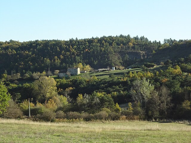
Mallefougasse-Augès is a charming village located in the Provence-Alpes-Côte d'Azur region of southeastern France. It's situated near the Luberon Regional Natural Park, which offers excellent opportunities for hiking, thanks to its diverse landscapes, picturesque villages, and rich flora and fauna.
Hiking Opportunities
-
Surrounding Trails: The area around Mallefougasse-Augès features a range of hiking trails suitable for various skill levels. You can find paths that meander through fields, forests, and along riversides.
-
Luberon Hiking Trails: The nearby Luberon region is famous for its hiking. Popular routes include the Sentier des Ocres to explore the ochre cliffs of Roussillon and trails that lead to the beautiful hilltop villages of the Luberon, such as Gordes and Ménerbes.
-
Great Views: Many trails offer stunning views of the Luberon mountains, vineyards, and lavender fields (particularly beautiful in the summer months).
-
Wildlife Observation: The region is rich in biodiversity, making it a great place for nature lovers. You might spot various bird species, butterflies, and native plants.
-
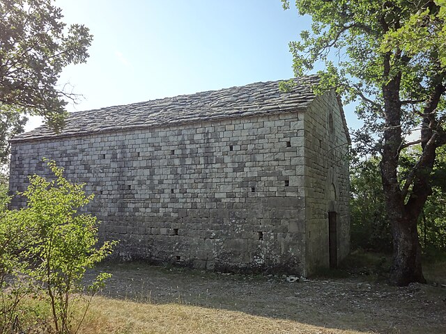
Cultural Sites: Hiking in this area often leads to ancient ruins, historic châteaux, and local farms. Engaging with local history and culture can enhance your hiking experience.
Practical Tips
- Trail Maps: It’s advisable to bring trail maps or download hiking apps that provide GPS routes.
- Hydration and Snacks: Be sure to carry sufficient water and snacks, particularly during warmer months.
- Weather Considerations: Check the local weather conditions before setting out, as they can change rapidly in mountainous regions.
- Respect Nature: Follow Leave No Trace principles to protect the environment and local wildlife.
Getting There
Mallefougasse-Augès is accessible by road, and having a car is usually the easiest way to explore the various trails in the surrounding area.
Whether you are a casual walker or an experienced hiker, the region offers a stunning backdrop of natural beauty and cultural richness perfect for hiking adventures.
- Страна:

- Почтовый код: 04230
- Координаты: 44° 3' 58" N, 5° 53' 52" E


- GPS треки (wikiloc): [Ссылка]
- Высота над уровнем моря: 700 м m
- Площадь: 19.71 кв.км
- Население: 326
- Википедия русская: wiki(ru)
- Википедия английская: wiki(en)
- Википедия национальная: wiki(fr)
- Хранилище Wikidata: Wikidata: Q1018627
- Катеория в википедии: [Ссылка]
- код Freebase: [/m/03m7wty]
- код Freebase: [/m/03m7wty]
- код GeoNames: Альт: [2996400]
- код GeoNames: Альт: [2996400]
- номер SIREN: [210401097]
- номер SIREN: [210401097]
- код тезауруса PACTOLS: [pcrtNSsLprqcSH]
- код тезауруса PACTOLS: [pcrtNSsLprqcSH]
- код муниципалитета INSEE: 04109
- код муниципалитета INSEE: 04109
Граничит с регионами:

Вальбель
- коммуна во Франции
Hiking in Вальбель
Valbelle, located in France, is known for its natural beauty and scenic hiking trails. While it may not be one of the most famous hiking destinations, it offers a variety of experiences for hikers of all levels....
- Страна:
- Почтовый код: 04200
- Координаты: 44° 8' 52" N, 5° 52' 54" E
- GPS треки (wikiloc): [Ссылка]
- Высота над уровнем моря: 580 м m
- Площадь: 32.99 кв.км
- Население: 271

Пейрюи
- коммуна во Франции
Hiking in Пейрюи
Peyruis, located in the Alpes-de-Haute-Provence region of France, offers some charming hiking opportunities that attract nature enthusiasts. The area is characterized by its picturesque landscapes, rolling hills, and scenic views of the surrounding alpine environment. Here are some key points to consider when hiking in and around Peyruis:...
- Страна:
- Почтовый код: 04310
- Координаты: 44° 1' 44" N, 5° 56' 25" E
- GPS треки (wikiloc): [Ссылка]
- Площадь: 23.23 кв.км
- Население: 2849
Монло
- коммуна во Франции
Hiking in Монло
Montlaux is a charming destination for hiking enthusiasts, located in the Provence-Alpes-Côte d'Azur region of France. Nestled in the picturesque Verdon region, it offers a variety of trails that cater to different levels of hikers, from beginners to experienced trekkers....
- Страна:
- Почтовый код: 04230
- Координаты: 44° 2' 49" N, 5° 50' 40" E
- GPS треки (wikiloc): [Ссылка]
- Высота над уровнем моря: 550 м m
- Площадь: 19.75 кв.км
- Население: 143
Шатонёф-Валь-Сен-Дона
- коммуна во Франции
Hiking in Шатонёф-Валь-Сен-Дона
Châteauneuf-Val-Saint-Donat, located in the Alpes-de-Haute-Provence region of France, offers a range of beautiful hiking opportunities that showcase the picturesque landscapes of the area. Here are some aspects of hiking in this region:...
- Страна:
- Почтовый код: 04200
- Координаты: 44° 5' 39" N, 5° 56' 58" E
- GPS треки (wikiloc): [Ссылка]
- Площадь: 21.1 кв.км
- Население: 503

Крюи
- коммуна во Франции
Hiking in Крюи
Cruis, a picturesque village located in the Provence-Alpes-Côte d'Azur region of France, offers a charming landscape for hiking enthusiasts. The area boasts rolling hills, olive groves, and scenic views characteristic of southern France. Here are some highlights regarding hiking in and around Cruis:...
- Страна:
- Почтовый код: 04230
- Координаты: 44° 3' 45" N, 5° 50' 9" E
- GPS треки (wikiloc): [Ссылка]
- Площадь: 36.47 кв.км
- Население: 645

Монфор
- коммуна во Франции
Hiking in Монфор
Montfort is a charming village in the Alpes-de-Haute-Provence region of France, surrounded by stunning natural landscapes that are perfect for hiking enthusiasts. The area is characterized by its picturesque scenery, including rolling hills, lush forests, and the nearby Verdon River, which offers a variety of hiking trails suitable for different skill levels....
- Страна:
- Почтовый код: 04600
- Координаты: 44° 3' 49" N, 5° 58' 22" E
- GPS треки (wikiloc): [Ссылка]
- Площадь: 12.08 кв.км
- Население: 346
- Веб сайт: [Ссылка]