Марцаботто (Marzabotto, Marzabotto)
.svg)
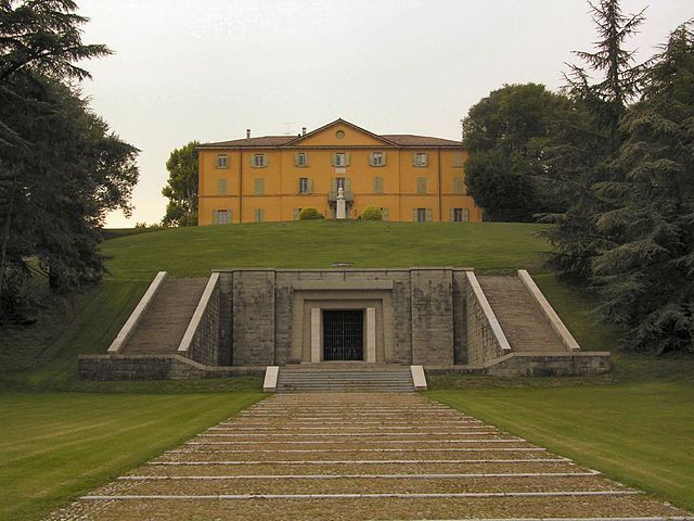
- коммуна Италии
 Hiking in Марцаботто
Marzabotto, located in the Emilia-Romagna region of Italy, is not only known for its historical significance but also offers a variety of hiking opportunities that showcase the region's natural beauty and rich culture.
Hiking Trails
-
Monte Sole: The Monte Sole Regional Park offers several trails with varying difficulty levels. Hiking here allows you to explore the stunning landscapes and enjoy panoramic views. The trails often lead you through lush forests and alongside historic sites, reflecting the area's significance during World War II.
-
Historical Trails: Following the paths that commemorate the events of the Marzabotto massacre, you can combine hiking with education. These trails provide insights into the history of the area and its cultural importance.
-
Valle del Setta: This area provides more gentle hiking options, perfect for families and those looking for a leisurely walk. The trails here are surrounded by beautiful scenery, including rivers and hills.
Best Time to Hike
The ideal times for hiking in Marzabotto are during the spring and fall months when temperatures are mild, and the landscapes are vibrant. Summers can be quite warm, while winters may bring snow to higher elevations.
What to Bring
- Footwear: Sturdy hiking boots are essential, especially if the trails are rugged or during wet conditions.
- Clothing: Dress in layers. Weather can change quickly, and it’s better to be prepared. Also, consider breathable fabrics.
- Navigation Tools: A map or GPS device will help you stay on track, though many trails are well-marked.
- Water and Snacks: Stay hydrated and bring energy-boosting snacks for your hike.
- First Aid Kit: Always a good idea to have on hand.
Local Attractions
After a day of hiking, you can explore Marzabotto's historical center, visit the Etruscan archaeological site, or enjoy local cuisine in one of the charming restaurants.
Safety Tips
- Always inform someone about your hiking plans.
- Check weather conditions before heading out.
- Stick to designated trails to preserve the natural environment.
- Carry a fully charged mobile phone for emergencies.
Hiking in Marzabotto offers a unique blend of natural beauty and historical context that makes for a rewarding outdoor experience. Enjoy your adventure!
- Страна:

- Почтовый код: 40043
- Телефонный код: 051
- Код автомобильного номера: BO
- Координаты: 44° 20' 0" N, 11° 12' 0" E


- GPS треки (wikiloc): [Ссылка]
- Высота над уровнем моря: 130 м m
- Площадь: 74.53 кв.км
- Население: 6853
- Веб сайт: http://www.comune.marzabotto.bo.it
- Википедия русская: wiki(ru)
- Википедия английская: wiki(en)
- Википедия национальная: wiki(it)
- Хранилище Wikidata: Wikidata: Q94936
- Галерея изображений в википедии: [Ссылка]
- Катеория в википедии: [Ссылка]
- код Freebase: [/m/045ld3]
- код GeoNames: Альт: [6536741]
- код BNF: [120887317]
- ID отношения в OpenStreetMap: [43031]
- WOEID: [717999]
- UN/LOCODE: [ITMRR]
- код ISTAT: 037036
- кадастровый код Италии: B689
Граничит с регионами:
Вергато
- коммуна Италии
Hiking in Вергато
Vergato, located in the Emilia-Romagna region of Italy, offers a variety of hiking opportunities surrounded by beautiful landscapes and historical sites. Situated in the foothills of the Apennines, Vergato provides access to trails that cater to hikers of all levels, from leisurely walks to more challenging treks....
- Страна:
- Почтовый код: 40038
- Телефонный код: 051
- Код автомобильного номера: BO
- Координаты: 44° 17' 0" N, 11° 7' 0" E
- GPS треки (wikiloc): [Ссылка]
- Высота над уровнем моря: 193 м m
- Площадь: 59 кв.км
- Население: 7664
- Веб сайт: [Ссылка]


Гриццана-Моранди
- коммуна Италии
Hiking in Гриццана-Моранди
Grizzana Morandi, located in the Apennine Mountains of northern Italy, offers a wonderful hiking experience surrounded by stunning landscapes, rich flora and fauna, and historical sites. Here are some highlights to consider when hiking in this beautiful area:...
- Страна:
- Почтовый код: 40030
- Телефонный код: 051
- Код автомобильного номера: BO
- Координаты: 44° 15' 0" N, 11° 9' 0" E
- GPS треки (wikiloc): [Ссылка]
- Высота над уровнем моря: 547 м m
- Площадь: 77 кв.км
- Население: 3694
- Веб сайт: [Ссылка]
Монте-Сан-Пьетро
- коммуна Италии
Hiking in Монте-Сан-Пьетро
Monte San Pietro, located in the Emilia-Romagna region of Italy, offers a variety of hiking opportunities for outdoor enthusiasts. The area is characterized by its beautiful landscapes, rolling hills, and picturesque views, making it an ideal spot for both casual walkers and experienced hikers....
- Страна:
- Почтовый код: 40050
- Телефонный код: 051
- Код автомобильного номера: BO
- Координаты: 44° 26' 19" N, 11° 8' 3" E
- GPS треки (wikiloc): [Ссылка]
- Высота над уровнем моря: 112 м m
- Площадь: 74.69 кв.км
- Население: 10960
- Веб сайт: [Ссылка]


Монцуно
- коммуна Италии
Hiking in Монцуно
Monzuno is located in the Emilia-Romagna region of Italy, nestled within the beautiful hills of the Apennine Mountains. It’s a wonderful destination for hikers and nature enthusiasts, offering a variety of trails that cater to different skill levels. Here are some highlights to consider when hiking in Monzuno:...
- Страна:
- Почтовый код: 40036
- Телефонный код: 051
- Код автомобильного номера: BO
- Координаты: 44° 17' 0" N, 11° 16' 0" E
- GPS треки (wikiloc): [Ссылка]
- Высота над уровнем моря: 621 м m
- Площадь: 65.01 кв.км
- Население: 6375
- Веб сайт: [Ссылка]

Сассо-Маркони
- коммуна Италии
Hiking in Сассо-Маркони
Sasso Marconi, located in the Emilia-Romagna region of Italy, is a great area for hiking enthusiasts. Nestled in the Apennine Mountains, it offers a range of trails suited for different skill levels, with beautiful landscapes that include hills, forests, and panoramic views of the surrounding countryside....
- Страна:
- Почтовый код: 40037
- Телефонный код: 051
- Код автомобильного номера: BO
- Координаты: 44° 24' 0" N, 11° 15' 0" E
- GPS треки (wikiloc): [Ссылка]
- Высота над уровнем моря: 128 м m
- Площадь: 96.45 кв.км
- Население: 14903
- Веб сайт: [Ссылка]
Савиньо
- коммуна Италии
Hiking in Савиньо
Savigno, a charming village in the province of Bologna, Italy, is known for its beautiful landscapes and picturesque countryside, making it an excellent destination for hiking enthusiasts. The area is characterized by rolling hills, lush vineyards, and ancient woods, offering a variety of trails suitable for different skill levels....
- Страна:
- Почтовый код: 40060
- Телефонный код: 051
- Код автомобильного номера: BO
- Координаты: 44° 24' 0" N, 11° 5' 0" E
- GPS треки (wikiloc): [Ссылка]
- Высота над уровнем моря: 259 м m
- Площадь: 54.84 кв.км
- Веб сайт: [Ссылка]