
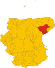
Маттината (Mattinata, Mattinata)
.svg)
- коммуна Италии
 Hiking in Маттината
Mattinata, located in the Apulia region of Italy along the Gargano National Park, offers stunning hiking opportunities with breathtaking views of the Adriatic Sea, dramatic cliffs, and lush Mediterranean vegetation. Here are some key highlights and tips for hiking in the area:
Trails and Routes
-
Sentiero del Fiume: This trail follows the flow of a river, providing a lush environment with a variety of flora and fauna. It’s perfect for nature enthusiasts looking to enjoy a peaceful hike.
-
Monte Sant’Angelo: Hiking in the surrounding areas, especially up to Monte Sant’Angelo, offers incredible panoramic views of the landscape. This route typically includes rocky paths, so suitable footwear is essential.
-
Grotte di Mattinata: Explore the caves along the coastline. Some routes lead to these natural formations, where you can admire unique geological features and possibly spot local wildlife.
-
Coastal Paths: The coastline near Mattinata is breathtaking. Trails often lead along the cliffs, offering views of the sea and opportunities for some great photography.
Best Time to Hike
- Spring and Autumn: These seasons are ideal for hiking in Mattinata due to comfortable temperatures and less crowded trails. Springtime is particularly lovely as wildflowers bloom.
- Summer: It can be hot, so early morning or late afternoon hikes are recommended to avoid the heat.
Preparation Tips
- Footwear: Wear sturdy hiking boots with good traction, as some trails may have uneven terrain.
- Hydration: Always carry enough water, especially if hiking during warmer months.
- Navigation: Some trails may not be well-marked, so a map or GPS device is beneficial.
- Pack Essentials: Include snacks, a small first-aid kit, and sun protection (hat, sunscreen, sunglasses).
Local Attractions
- After a hike, consider exploring the town of Mattinata itself, which features charming streets and local cuisine. Sample fresh seafood and local wines to experience the regional flavors.
Safety Considerations
- Always inform someone about your hiking plans and expected return time. Cell service may be limited in some areas.
- Be wary of sudden weather changes, especially on coastal trails.
Overall, hiking in Mattinata provides a unique combination of natural beauty, cultural richness, and opportunities for adventure. Enjoy your hikes and embrace the stunning scenery that this beautiful region has to offer!
- Страна:

- Почтовый код: 71030
- Телефонный код: 0884
- Код автомобильного номера: FG
- Координаты: 41° 43' 0" N, 16° 3' 0" E


- GPS треки (wikiloc): [Ссылка]
- Высота над уровнем моря: 80 м m
- Площадь: 73.48 кв.км
- Население: 6261
- Веб сайт: http://www.comune.mattinata.fg.it/
- Википедия русская: wiki(ru)
- Википедия английская: wiki(en)
- Википедия национальная: wiki(it)
- Хранилище Wikidata: Wikidata: Q51934
- Галерея изображений в википедии: [Ссылка]
- Катеория в википедии: [Ссылка]
- код Freebase: [/m/0fz617]
- код GeoNames: Альт: [6540742]
- код BNF: [15566167z]
- код VIAF: Альт: [240124715]
- ID отношения в OpenStreetMap: [41492]
- код GND: Альт: [7559020-7]
- код ISTAT: 071031
- кадастровый код Италии: F059
Граничит с регионами:

Монте-Сант'Анджело
- коммуна Италии
Hiking in Монте-Сант'Анджело
Monte Sant'Angelo is a scenic town located in the Apulia region of southern Italy, situated on the Gargano Peninsula. It offers a variety of hiking opportunities, characterized by stunning landscapes, rich historical sites, and diverse flora and fauna....
- Страна:
- Почтовый код: 71037
- Телефонный код: 0884
- Код автомобильного номера: FG
- Координаты: 41° 42' 0" N, 15° 58' 0" E
- GPS треки (wikiloc): [Ссылка]
- Высота над уровнем моря: 796 м m
- Площадь: 245.13 кв.км
- Население: 12342
- Веб сайт: [Ссылка]


Вьесте
- коммуна Италии
Hiking in Вьесте
Vieste, located in the Gargano National Park in the Apulia region of Italy, offers a stunning backdrop for hiking enthusiasts. The combination of dramatic coastlines, lush forests, and charming historical sites makes it an attractive destination for outdoor activities....
- Страна:
- Почтовый код: 71019
- Телефонный код: 0884
- Код автомобильного номера: FG
- Координаты: 41° 53' 0" N, 16° 10' 0" E
- GPS треки (wikiloc): [Ссылка]
- Высота над уровнем моря: 43 м m
- Площадь: 169.19 кв.км
- Население: 13943
- Веб сайт: [Ссылка]