
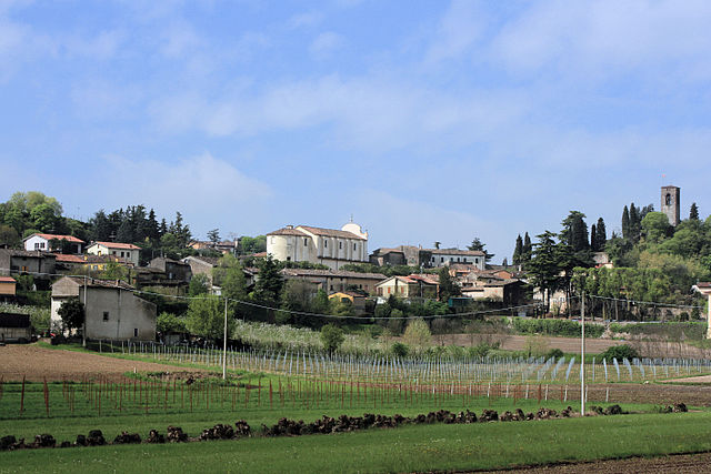
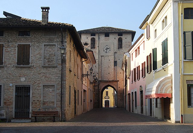
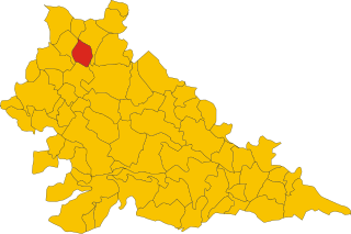
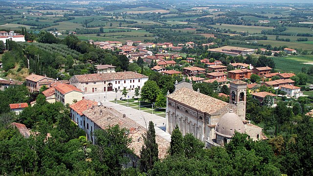
Медоле (Medole, Medole)
.svg)
- коммуна Италии
 Hiking in Медоле
Medole is located in the Lombardy region of Italy, known for its picturesque landscapes and proximity to various outdoor activities, including hiking. While Medole itself may not be a major hiking destination, its surrounding area offers a variety of trails and natural settings that are great for hikers.
Nearby Hiking Areas:
-
Morainic Hills (Colline Moreniche): Just a short drive from Medole, the Morainic Hills provide a great backdrop for hiking, featuring rolling hills, vineyards, and scenic views of Lake Garda.
-
Lake Garda: To the west of Medole, Lake Garda boasts numerous trails, including paths along the lake’s shoreline and routes that lead into the surrounding mountains. The area is suitable for both beginner and experienced hikers.
-
Parco del Mincio: This park is located south of Medole and offers easy to moderate hiking trails along the Mincio River, ideal for nature lovers who enjoy observing local wildlife and plant species.
Hiking Tips:
- Preparation: Always check the weather forecast and trail conditions before heading out. Bring sufficient water, snacks, and a map or GPS device.
- Footwear: Wear sturdy hiking boots or shoes to ensure comfort and prevent injuries.
- Respect Nature: Stay on marked trails and carry out any trash to preserve the beauty of the environment.
Best Times to Hike:
- Spring: The weather is mild, and the scenery is vibrant with blooming flowers.
- Fall: The colors of the leaves change, offering stunning views and cooler temperatures for hiking.
Local Culture:
Embrace the local culture by exploring Medole's history and perhaps visiting vineyards or tasting local foods after a day of hiking. The region is known for its rich agricultural heritage, and many local products are available.
If you plan on hiking in or around Medole, you'll find a blend of natural beauty and cultural experiences that make it a rewarding destination for outdoor enthusiasts.
- Страна:

- Почтовый код: 46046
- Телефонный код: 0376
- Код автомобильного номера: MN
- Координаты: 45° 20' 0" N, 10° 31' 0" E


- GPS треки (wikiloc): [Ссылка]
- Высота над уровнем моря: 62 м m
- Площадь: 25.73 кв.км
- Население: 4055
- Веб сайт: http://www.comune.medole.mn.it/
- Википедия русская: wiki(ru)
- Википедия английская: wiki(en)
- Википедия национальная: wiki(it)
- Хранилище Wikidata: Wikidata: Q42347
- Катеория в википедии: [Ссылка]
- код Freebase: [/m/0gk095]
- код GeoNames: Альт: [6540376]
- код VIAF: Альт: [238161983]
- ID отношения в OpenStreetMap: [44649]
- UN/LOCODE: [ITDLE]
- код ISTAT: 020034
- кадастровый код Италии: F086
Граничит с регионами:

Кавриана
- коммуна Италии
Hiking in Кавриана
Cavriana is a charming town located in the Lombardy region of Italy, surrounded by beautiful landscapes that are perfect for hiking. The area is characterized by gentle hills, vineyards, and historic sites, making it an attractive destination for hikers of all levels....
- Страна:
- Почтовый код: 46040
- Телефонный код: 0376
- Код автомобильного номера: MN
- Координаты: 45° 21' 0" N, 10° 36' 0" E
- GPS треки (wikiloc): [Ссылка]
- Высота над уровнем моря: 170 м m
- Площадь: 36.91 кв.км
- Население: 3828
- Веб сайт: [Ссылка]

Черезара
- коммуна Италии
Hiking in Черезара
Ceresara is a charming village located in the Lombardy region of Italy, near the banks of the Po River. While it may not be as well-known as some of Italy’s more famous hiking destinations, the surrounding areas offer a variety of trails and natural landscapes for outdoor enthusiasts to explore....
- Страна:
- Почтовый код: 46040
- Телефонный код: 0376
- Код автомобильного номера: MN
- Координаты: 45° 15' 44" N, 10° 34' 10" E
- GPS треки (wikiloc): [Ссылка]
- Высота над уровнем моря: 44 м m
- Площадь: 37.31 кв.км
- Население: 2609
- Веб сайт: [Ссылка]
Гуидиццоло
- коммуна Италии
Hiking in Гуидиццоло
Guidizzolo is a small town located in the Lombardy region of Italy, near Mantua. While it might not be a well-known hiking destination like the Dolomites or Lake Como, there are still opportunities to explore the beautiful countryside around the area....
- Страна:
- Почтовый код: 46040
- Телефонный код: 0376
- Код автомобильного номера: MN
- Координаты: 45° 19' 0" N, 10° 35' 0" E
- GPS треки (wikiloc): [Ссылка]
- Высота над уровнем моря: 46 м m
- Площадь: 22.38 кв.км
- Население: 6013
- Веб сайт: [Ссылка]

Сольферино
- коммуна Италии
Hiking in Сольферино
Hiking in Solferino, located in the Lombardy region of Italy, is a delightful experience characterized by scenic landscapes, historical significance, and a variety of trails that cater to different skill levels. Here are some key points about hiking in this area:...
- Страна:
- Почтовый код: 46040
- Телефонный код: 0376
- Код автомобильного номера: MN
- Координаты: 45° 22' 20" N, 10° 33' 59" E
- GPS треки (wikiloc): [Ссылка]
- Высота над уровнем моря: 124 м m
- Площадь: 13.08 кв.км
- Население: 2631
- Веб сайт: [Ссылка]


Кастильоне-делле-Стивьере
- коммуна Италии
Hiking in Кастильоне-делле-Стивьере
Castiglione delle Stiviere is a charming town located in the Lombardy region of northern Italy, known for its rich history, beautiful landscapes, and proximity to various natural attractions. While it may not be as famous for hiking as other areas in Italy, there are several opportunities for outdoor activities and exploration in the surrounding region....
- Страна:
- Почтовый код: 46043
- Телефонный код: 0376
- Код автомобильного номера: MN
- Координаты: 45° 24' 0" N, 10° 30' 0" E
- GPS треки (wikiloc): [Ссылка]
- Высота над уровнем моря: 111 м m
- Площадь: 42.02 кв.км
- Население: 23570
- Веб сайт: [Ссылка]


Кастель-Гоффредо
- коммуна Италии
Hiking in Кастель-Гоффредо
Castel Goffredo, located in the Lombardy region of Italy, is not as widely recognized for hiking as some other mountainous areas, but it offers a charming landscape and opportunities for outdoor activities. The region is primarily agricultural, characterized by rolling hills, vineyards, and small bodies of water, providing a serene backdrop for hiking enthusiasts....
- Страна:
- Почтовый код: 46042
- Телефонный код: 0376
- Код автомобильного номера: MN
- Координаты: 45° 17' 52" N, 10° 28' 30" E
- GPS треки (wikiloc): [Ссылка]
- Высота над уровнем моря: 50 м m
- Площадь: 42.4 кв.км
- Население: 12633
- Веб сайт: [Ссылка]