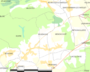
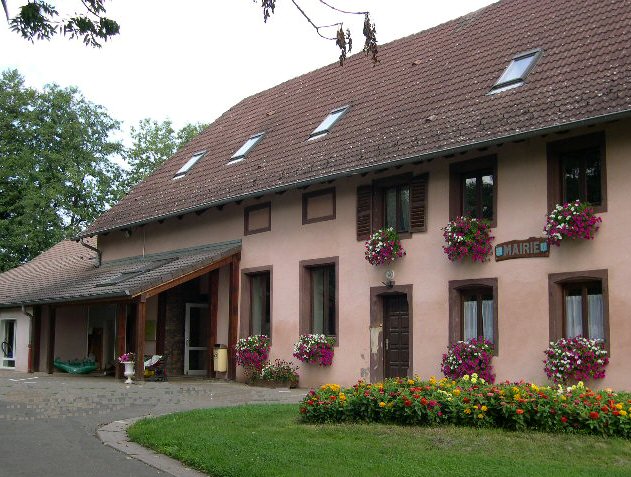
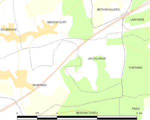
Menoncourt (Menoncourt)

- коммуна во Франции
 Hiking in Menoncourt
Menoncourt is a charming commune located in the Doubs department in eastern France, close to the border with Switzerland. While it may not be widely recognized as a hiking destination, the surrounding region offers a variety of trails and scenic landscapes ideal for outdoor enthusiasts.
Hiking Opportunities in Menoncourt and Surroundings:
-
Scenic Trails:
- The area is characterized by rolling hills, forests, and farmland, providing a mix of scenic country paths and woodland trails. Look for local paths that take you through the picturesque countryside.
-
Nearby Natural Parks:
- Menoncourt is not far from the Jura Mountains, which boast numerous hiking trails ranging from easy to challenging. The Parc Naturel Régional du Doubs Horloger is particularly noteworthy for its beautiful landscapes and diverse flora and fauna.
-
Local Trails:
- Check local tourism websites or visitor centers for maps of specific hiking trails in and around Menoncourt. Many trails may be marked and offer insights into the region’s ecology and history.
-
Seasonal Hiking:
- Different times of the year may offer unique hiking experiences. Spring and summer typically provide mild weather and blooming flora, while autumn showcases vibrant foliage. Winter hiking can also be enjoyed, with opportunities for snowshoeing in higher elevations nearby.
Preparation Tips:
- Gear: Wear comfortable hiking shoes, and dress in layers to be prepared for changing weather conditions. Don't forget to bring plenty of water and snacks.
- Navigation: A map or GPS device can help you stay on track, especially in more remote areas.
- Safety: Inform someone of your hiking plans, especially if you're venturing into less-trafficked areas.
Conclusion:
Hiking in and around Menoncourt offers a unique opportunity to enjoy the natural beauty of eastern France. Whether you are a beginner or an experienced hiker, you'll find trails that suit your preference and skill level. Be sure to explore the local area for more specific trails and join local hiking clubs or tours for a guided experience if available!
- Страна:

- Почтовый код: 90150
- Координаты: 47° 40' 14" N, 6° 56' 38" E


- GPS треки (wikiloc): [Ссылка]
- Площадь: 4.7 кв.км
- Население: 397
- Веб сайт: http://www.menoncourt.fr
- Википедия английская: wiki(en)
- Википедия национальная: wiki(fr)
- Хранилище Wikidata: Wikidata: Q367625
- Катеория в википедии: [Ссылка]
- код Freebase: [/m/03mhfgz]
- код Freebase: [/m/03mhfgz]
- код Freebase: [/m/03mhfgz]
- код GeoNames: Альт: [6451915]
- код GeoNames: Альт: [6451915]
- код GeoNames: Альт: [6451915]
- номер SIREN: [219000676]
- номер SIREN: [219000676]
- номер SIREN: [219000676]
- код BNF: [15280008m]
- код BNF: [15280008m]
- код BNF: [15280008m]
- код муниципалитета INSEE: 90067
- код муниципалитета INSEE: 90067
- код муниципалитета INSEE: 90067
Граничит с регионами:


Anjoutey
- коммуна во Франции
- Страна:
- Почтовый код: 90170
- Координаты: 47° 42' 4" N, 6° 55' 57" E
- GPS треки (wikiloc): [Ссылка]
- Площадь: 7.69 кв.км
- Население: 618

Eguenigue
- коммуна во Франции
Hiking in Eguenigue
It seems there might be a misunderstanding, as "Eguenigue" doesn't appear to correspond to any well-known hiking destination or region that I'm familiar with. It's possible that the name may be misspelled or it refers to a lesser-known location....
- Страна:
- Почтовый код: 90150
- Координаты: 47° 40' 13" N, 6° 56' 5" E
- GPS треки (wikiloc): [Ссылка]
- Площадь: 2.49 кв.км
- Население: 281
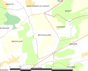
Bethonvilliers
- коммуна во Франции
Hiking in Bethonvilliers
Bethonvilliers, a picturesque village in the French countryside, offers beautiful hiking opportunities for both beginners and experienced hikers. The surrounding area is characterized by rolling hills, lush forests, and charming rural landscapes, making it an ideal location for outdoor activities....
- Страна:
- Почтовый код: 90150
- Координаты: 47° 40' 50" N, 6° 57' 44" E
- GPS треки (wikiloc): [Ссылка]
- Площадь: 1.9 кв.км
- Население: 254


Saint-Germain-le-Châtelet
- коммуна во Франции
- Страна:
- Почтовый код: 90110
- Координаты: 47° 41' 46" N, 6° 57' 31" E
- GPS треки (wikiloc): [Ссылка]
- Площадь: 3.36 кв.км
- Население: 640
Lacollonge
- коммуна во Франции
Hiking in Lacollonge
Lacollonge is not a widely recognized hiking destination as of my last update, and it seems you might be referring to a lesser-known area. It could also be a misspelling or a specific local area that might not be well-documented in broader hiking resources. However, if you meant "La Collonge" or a similar-sounding area, please specify the location or region to provide you with relevant hiking tips, trails, and advice....
- Страна:
- Почтовый код: 90150
- Координаты: 47° 39' 50" N, 6° 57' 36" E
- GPS треки (wikiloc): [Ссылка]
- Площадь: 1.92 кв.км
- Население: 239


Phaffans
- коммуна во Франции
Hiking in Phaffans
It appears there may be a mix-up with the name "Phaffans," as I couldn't find any specific hiking locations or trails with that exact name. However, if you're referring to a specific region, place, or trail that might be commonly known by another name, please clarify, and I'd be happy to provide information....
- Страна:
- Почтовый код: 90150
- Координаты: 47° 39' 37" N, 6° 56' 4" E
- GPS треки (wikiloc): [Ссылка]
- Площадь: 3.24 кв.км
- Население: 442


Larivière
- коммуна во Франции
Hiking in Larivière
Larivière, located in the Territoire de Belfort region in eastern France, offers a variety of hiking opportunities that showcase the beautiful landscapes of this area. This region is characterized by its rolling hills, dense forests, and scenic views of the surrounding countryside....
- Страна:
- Почтовый код: 90150
- Координаты: 47° 40' 35" N, 6° 59' 52" E
- GPS треки (wikiloc): [Ссылка]
- Площадь: 4.84 кв.км
- Население: 325