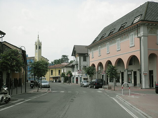
Мерлино (Merlino, Merlino)
.svg)
- коммуна Италии
 Hiking in Мерлино
Merlino is a small town located in the Lombardy region of Italy. Although it may not be as well-known as some of the larger cities, the surrounding areas offer a variety of scenic landscapes and hiking opportunities that can appeal to nature lovers and outdoor enthusiasts.
Hiking Opportunities Around Merlino
-
Natural Parks and Reserves: The region around Merlino is characterized by agricultural landscapes, riverbanks, and small forests. You might explore areas such as the nearby Adda River Park, which features trails that follow the river and provide beautiful views and diverse ecosystems.
-
Nearby Hills and Trails: While Merlino itself is relatively flat, there are hills and elevated trails within a short drive. The hills in the eastern part of Lombardy, such as the Oltrepò Pavese area, offer more challenging hikes with stunning panoramas.
-
Cultural Hiking: Many hiking routes in the vicinity may also incorporate historical sites, old villages, and local vineyards. This allows hikers to enjoy both natural beauty and cultural heritage.
Hiking Essentials
- Preparation: It’s advisable to check local hiking maps and guides to plan your route effectively. Ensure that you have a good map or GPS device, especially when exploring less-marked trails.
- Clothing: Wear comfortable hiking boots and clothing suitable for the weather. Layers are a good choice as temperatures can fluctuate.
- Supplies: Bring plenty of water, snacks, a first-aid kit, sun protection, and a charged mobile device for safety.
Best Times to Hike
The best seasons for hiking around Merlino are typically spring (March to June) and fall (September to October) when the weather is mild, and the landscapes are vibrant with colors.
Local Tips
- Check Local Regulations: Some trails may have specific rules or may require permits, so it's always a good idea to check ahead.
- Guided Tours: If you're unfamiliar with the area, consider joining a guided hike. Local guides can provide insights into the flora, fauna, and history of the region.
Enjoy your hiking adventures in and around Merlino!
- Страна:

- Почтовый код: 26833
- Телефонный код: 02
- Код автомобильного номера: LO
- Координаты: 45° 26' 3" N, 9° 25' 51" E


- GPS треки (wikiloc): [Ссылка]
- Высота над уровнем моря: 101 м m
- Площадь: 10.73 кв.км
- Население: 1746
- Веб сайт: http://www.comune.merlino.lo.it
- Википедия русская: wiki(ru)
- Википедия английская: wiki(en)
- Википедия национальная: wiki(it)
- Хранилище Wikidata: Wikidata: Q42978
- Катеория в википедии: [Ссылка]
- код Freebase: [/m/0gr5wr]
- код GeoNames: Альт: [6543690]
- ID отношения в OpenStreetMap: [44970]
- UN/LOCODE: [ITMIN]
- код ISTAT: 098039
- кадастровый код Италии: F149
Граничит с регионами:


Комаццо
- коммуна Италии
Hiking in Комаццо
Comazzo is a small town located in the Lombardy region of Italy, and while it may not be widely known for hiking, it is situated near various natural areas and provides access to scenic countryside trails. Here are some insights that could enhance your hiking experience in and around Comazzo:...
- Страна:
- Почтовый код: 26833
- Телефонный код: 02
- Код автомобильного номера: LO
- Координаты: 45° 26' 31" N, 9° 27' 57" E
- GPS треки (wikiloc): [Ссылка]
- Высота над уровнем моря: 98 м m
- Площадь: 12.8 кв.км
- Население: 2301
- Веб сайт: [Ссылка]


Сеттала
- коммуна Италии
Hiking in Сеттала
Settala, located in the Lombardy region of Italy, is not primarily known as a hiking destination compared to other areas in the region, such as the nearby Alps or Apennines. However, it offers some opportunities for outdoor activities and exploration of the surrounding natural beauty....
- Страна:
- Почтовый код: 20090
- Телефонный код: 02
- Код автомобильного номера: MI
- Координаты: 45° 27' 21" N, 9° 23' 31" E
- GPS треки (wikiloc): [Ссылка]
- Высота над уровнем моря: 108 м m
- Площадь: 17.42 кв.км
- Население: 7399
- Веб сайт: [Ссылка]


Ривольта-д'Адда
- коммуна Италии
Hiking in Ривольта-д'Адда
Rivolta d'Adda is a charming town located in the Lombardy region of Italy, near the Adda River. While it may not be as well-known for hiking as some other destinations in Italy, it offers a variety of outdoor activities and scenic trails that are ideal for those looking to enjoy nature....
- Страна:
- Почтовый код: 26027
- Телефонный код: 0363
- Код автомобильного номера: CR
- Координаты: 45° 28' 0" N, 9° 31' 0" E
- GPS треки (wikiloc): [Ссылка]
- Высота над уровнем моря: 101 м m
- Площадь: 30.4 кв.км
- Население: 8133
- Веб сайт: [Ссылка]

Спино-д'Адда
- коммуна Италии
Hiking in Спино-д'Адда
Spino d'Adda is a picturesque town in Lombardy, Italy, located along the Adda River. It offers a variety of hiking opportunities that allow you to explore the natural beauty of the area and its surrounding landscapes. Here are some highlights and tips for hiking in Spino d'Adda:...
- Страна:
- Почтовый код: 26016
- Телефонный код: 0373
- Код автомобильного номера: CR
- Координаты: 45° 24' 0" N, 9° 30' 0" E
- GPS треки (wikiloc): [Ссылка]
- Высота над уровнем моря: 84 м m
- Площадь: 20.02 кв.км
- Население: 6843
- Веб сайт: [Ссылка]


Паулло
- коммуна Италии
Hiking in Паулло
Paullo, located in the Metropolitan City of Milan, Italy, offers various opportunities for hiking enthusiasts, especially for those looking to escape the busy urban environment. While Paullo itself may not have extensive hiking trails, it serves as a good starting point for accessing nearby natural areas and parks that provide beautiful landscapes and outdoor experiences....
- Страна:
- Почтовый код: 20067
- Телефонный код: 02
- Код автомобильного номера: MI
- Координаты: 45° 25' 0" N, 9° 24' 0" E
- GPS треки (wikiloc): [Ссылка]
- Высота над уровнем моря: 97 м m
- Площадь: 8.82 кв.км
- Население: 11461
- Веб сайт: [Ссылка]


Зело-Буон-Персико
- коммуна Италии
Hiking in Зело-Буон-Персико
Zelo Buon Persico, a small town in the Lombardy region of Italy, is situated near the larger city of Lodi and is known for its natural surroundings, which offer opportunities for outdoor activities, including hiking. Although Zelo Buon Persico itself may not have an extensive network of hiking trails, the surrounding area features beautiful landscapes that are suitable for leisurely hikes....
- Страна:
- Почтовый код: 26839
- Телефонный код: 02
- Код автомобильного номера: LO
- Координаты: 45° 24' 48" N, 9° 26' 1" E
- GPS треки (wikiloc): [Ссылка]
- Высота над уровнем моря: 90 м m
- Площадь: 18.88 кв.км
- Население: 7373
- Веб сайт: [Ссылка]