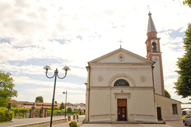
Местрино (Mestrino, Mestrino)
- коммуна Италии
 Hiking in Местрино
Mestrino, a charming town located in the Veneto region of Italy, offers several opportunities for hiking enthusiasts to explore the picturesque landscapes of the area. While Mestrino itself might not be known for extensive hiking trails, its proximity to various natural parks and the beautiful countryside makes it an excellent base for outdoor activities.
Nearby Hiking Areas
-
Colli Euganei Regional Park: This regional park is just a short drive from Mestrino and features a network of hiking trails that traverse rolling hills, vineyards, and wooded areas. The park is known for its volcanic origins, unique flora, and diverse wildlife. Popular trails here include those leading to viewpoints such as Monte Rua and Monte Venda.
-
Parco del Gran Fiume: Located along the Brenta River, this park offers scenic paths along the riverbanks, suitable for leisurely hikes. It's a great spot for birdwatching and enjoying the serene landscape.
-
Mount Venda: One of the highest peaks in the Colli Euganei, Mount Venda offers more challenging hikes. The summit provides panoramic views of the surrounding area and, on a clear day, you can see as far as the Venetian lagoon.
Practical Tips
-
Trail Maps: Always carry a detailed trail map or use a hiking app to navigate. Many trails are well-marked, but it’s good to have a backup.
-
Local Advice: Check in with local hiking clubs or visitor centers for the latest trail conditions and any recommendations on routes that suit your experience level.
-
Weather Considerations: The best time for hiking in this region is during spring (April to June) and early autumn (September to October) when temperatures are mild and the scenery is at its best.
-
Equipment: Wear comfortable hiking shoes, and carry plenty of water and snacks. Sunscreen and a hat are advisable during summer months.
Whether you are looking for an easy stroll or a more challenging hike, the areas surrounding Mestrino provide a fulfilling hiking experience set in the heart of Italian nature. Enjoy your hike!
- Страна:

- Почтовый код: 35035
- Телефонный код: 049
- Код автомобильного номера: PD
- Координаты: 45° 27' 0" N, 11° 46' 0" E


- GPS треки (wikiloc): [Ссылка]
- Высота над уровнем моря: 20 м m
- Площадь: 19.22 кв.км
- Население: 11502
- Веб сайт: http://www.comuneweb.it/MestrinoHome/shared/contenuto.phtml
- Википедия русская: wiki(ru)
- Википедия английская: wiki(en)
- Википедия национальная: wiki(it)
- Хранилище Wikidata: Wikidata: Q34457
- Катеория в википедии: [Ссылка]
- код Freebase: [/m/0gk4t3]
- код GeoNames: Альт: [6540398]
- код VIAF: Альт: [237046517]
- ID отношения в OpenStreetMap: [45004]
- код GND: Альт: [7637929-2]
- WOEID: [718270]
- UN/LOCODE: [ITZND]
- код Цифрового атласа Римской империи: [17840]
- код ISTAT: 028054
- кадастровый код Италии: F161
Граничит с регионами:
Рубано
- коммуна Италии
Hiking in Рубано
Rubano is a charming town located in the Veneto region of Italy, near the city of Padua. While it may not be widely recognized for its hiking trails, there are several beautiful opportunities for outdoor enthusiasts in the surrounding areas....
- Страна:
- Почтовый код: 35030
- Телефонный код: 049
- Код автомобильного номера: PD
- Координаты: 45° 26' 0" N, 11° 47' 0" E
- GPS треки (wikiloc): [Ссылка]
- Высота над уровнем моря: 16 м m
- Площадь: 14.51 кв.км
- Население: 16448
- Веб сайт: [Ссылка]
Сакколонго
- коммуна Италии
Hiking in Сакколонго
Saccolongo is a small town located in the Veneto region of Italy, known for its picturesque landscapes and proximity to the beautiful Euganean Hills (Colli Euganei). Hiking in and around Saccolongo can be a rewarding experience, offering a mix of gentle slopes, scenic views, and opportunities to explore the local flora and fauna....
- Страна:
- Почтовый код: 35030
- Телефонный код: 049
- Код автомобильного номера: PD
- Координаты: 45° 24' 0" N, 11° 45' 0" E
- GPS треки (wikiloc): [Ссылка]
- Высота над уровнем моря: 19 м m
- Площадь: 13.8 кв.км
- Население: 4945
- Веб сайт: [Ссылка]

Виллафранка-Падована
- коммуна Италии
Hiking in Виллафранка-Падована
Villafranca Padovana is a small town located in the province of Padua, in the northeastern region of Italy. While it may not be as renowned for hiking as other areas in the Italian Alps or Apennines, there are still opportunities for outdoor enthusiasts in and around the area....
- Страна:
- Почтовый код: 35010
- Телефонный код: 049
- Код автомобильного номера: PD
- Координаты: 45° 30' 0" N, 11° 48' 0" E
- GPS треки (wikiloc): [Ссылка]
- Высота над уровнем моря: 22 м m
- Площадь: 23.96 кв.км
- Население: 10458
- Веб сайт: [Ссылка]
Камподоро
- коммуна Италии
Hiking in Камподоро
Campodoro is a lesser-known region situated in Italy, particularly in the Province of Padova in the Veneto region. When planning a hiking trip in this area, there are a few important points to keep in mind:...
- Страна:
- Почтовый код: 35010
- Телефонный код: 049
- Код автомобильного номера: PD
- Координаты: 45° 29' 0" N, 11° 45' 0" E
- GPS треки (wikiloc): [Ссылка]
- Высота над уровнем моря: 23 м m
- Площадь: 11.22 кв.км
- Население: 2652
- Веб сайт: [Ссылка]
Вегджано
- коммуна Италии
Hiking in Вегджано
Veggiano is a small town located in the Veneto region of Italy, not far from the city of Padua. While it may not be a famous hiking destination, the surrounding area offers several opportunities for outdoor activities, including hiking....
- Страна:
- Почтовый код: 35030
- Телефонный код: 049
- Код автомобильного номера: PD
- Координаты: 45° 27' 0" N, 11° 43' 0" E
- GPS треки (wikiloc): [Ссылка]
- Высота над уровнем моря: 21 м m
- Площадь: 16.41 кв.км
- Население: 4765
- Веб сайт: [Ссылка]
Гризиньяно-ди-Цокко
- коммуна Италии
Hiking in Гризиньяно-ди-Цокко
Grisignano di Zocco is located in the province of Vicenza, in the Veneto region of Italy. While it might not be the most renowned hiking destination, it offers a charming setting with picturesque landscapes typical of the Italian countryside....
- Страна:
- Почтовый код: 36040
- Телефонный код: 0444
- Код автомобильного номера: VI
- Координаты: 45° 29' 0" N, 11° 42' 0" E
- GPS треки (wikiloc): [Ссылка]
- Высота над уровнем моря: 23 м m
- Площадь: 17.02 кв.км
- Население: 4293
- Веб сайт: [Ссылка]