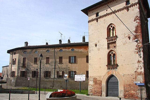
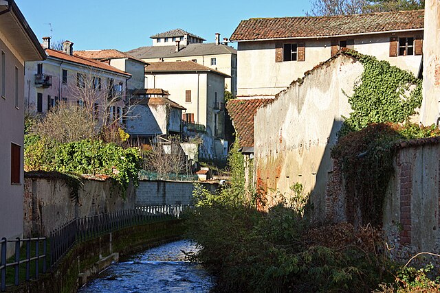
Меццомерико (Mezzomerico, Mezzomerico)
- коммуна Италии
 Hiking in Меццомерико
Mezzomerico is a small town located in the province of Novara, in the Piedmont region of Italy. While it may not be as well-known for hiking as larger national parks or mountainous areas, there are still opportunities for outdoor enthusiasts to explore the surrounding landscapes.
Hiking Opportunities
-
Nature Trails: There are various regional trails that can be accessed from Mezzomerico, showcasing local flora and fauna. These trails often navigate through fields, forests, and along rivers.
-
Parco del Ticino: Located a short drive away, the Ticino Natural Park offers more extensive hiking options. The park features numerous trails that cater to different skill levels. You can enjoy nature walks, bird-watching, and the beautiful Ticino River.
-
Local Routes: Depending on your interests, you might find smaller, local trails that can give you a taste of rural Italian life. These routes could include vineyard paths or agricultural landscapes.
-
Biking and Walking: In addition to hiking, the area supports walking and biking paths, allowing for some variation in exploration.
Recommendations
-
Prepare for Variability: The terrain around Mezzomerico varies, so make sure to wear appropriate footwear and bring water and snacks.
-
Weather Considerations: Check the weather forecast before you go, as conditions can change rapidly.
-
Local Guides: Consider hiring a local guide if you're unfamiliar with the area. They can provide insights into local culture, history, and the best routes.
-
Safety First: Always let someone know your hiking plans, follow trail markers, and carry a map or a GPS device.
Conclusion
Hiking in and around Mezzomerico can be a pleasant experience, especially if you are looking to explore a quieter, less touristy side of Italy. While the immediate area may not offer extensive trails, nearby parks and natural reserves provide ample outdoor opportunities. Always respect the environment and enjoy your hike!
- Страна:

- Почтовый код: 28040
- Телефонный код: 0321
- Код автомобильного номера: NO
- Координаты: 45° 37' 0" N, 8° 36' 0" E


- GPS треки (wikiloc): [Ссылка]
- Высота над уровнем моря: 266 м m
- Площадь: 7.72 кв.км
- Население: 1235
- Веб сайт: http://www.comune.mezzomerico.no.it/
- Википедия русская: wiki(ru)
- Википедия английская: wiki(en)
- Википедия национальная: wiki(it)
- Хранилище Wikidata: Wikidata: Q22500
- Катеория в википедии: [Ссылка]
- код Freebase: [/m/0g8thm]
- код GeoNames: Альт: [6539553]
- ID отношения в OpenStreetMap: [45510]
- UN/LOCODE: [ITZOR]
- код ISTAT: 003097
- кадастровый код Италии: F188
Граничит с регионами:

Аграте-Контурбия
- коммуна Италии
Hiking in Аграте-Контурбия
Agrate Conturbia is a charming town in the Piedmont region of northern Italy, situated near Lake Maggiore and surrounded by beautiful natural landscapes, making it a great location for hiking enthusiasts. Here are some key points about hiking in the area:...
- Страна:
- Почтовый код: 28010
- Телефонный код: 0322
- Код автомобильного номера: NO
- Координаты: 45° 40' 35" N, 8° 33' 8" E
- GPS треки (wikiloc): [Ссылка]
- Высота над уровнем моря: 337 м m
- Площадь: 14.54 кв.км
- Население: 1544
- Веб сайт: [Ссылка]
Дивиньяно
- Коммуна в Италии, располагается в регионе Пьемонт, подчиняется административному центру Новара.
Hiking in Дивиньяно
Divignano is a small municipality located in the Province of Novara, in the Piedmont region of northern Italy. While it may not be as widely recognized as some other hiking destinations in Italy, the surrounding areas offer beautiful landscapes and opportunities for outdoor activities, including hiking. Here are some key points to consider when planning a hike in and around Divignano:...
- Страна:
- Почтовый код: 28010
- Телефонный код: 0321
- Код автомобильного номера: NO
- Координаты: 45° 40' 0" N, 8° 36' 0" E
- GPS треки (wikiloc): [Ссылка]
- Высота над уровнем моря: 337 м m
- Площадь: 5.1 кв.км
- Население: 1404
- Веб сайт: [Ссылка]
Марано-Тичино
- коммуна Италии
Hiking in Марано-Тичино
Marano Ticino is a charming village located in the Piedmont region of Italy, surrounded by picturesque landscapes that make it an excellent destination for hiking enthusiasts. Located near the Ticino River and the nearby Ticino Natural Park, the area offers a variety of trails suitable for different skill levels....
- Страна:
- Почтовый код: 28040
- Телефонный код: 0321
- Код автомобильного номера: NO
- Координаты: 45° 38' 0" N, 8° 38' 0" E
- GPS треки (wikiloc): [Ссылка]
- Высота над уровнем моря: 258 м m
- Площадь: 7.79 кв.км
- Население: 1654
- Веб сайт: [Ссылка]

Оледжо
- коммуна Италии
Hiking in Оледжо
Oleggio is a small town located in the Piedmont region of northern Italy, near the beautiful Lake Maggiore and surrounded by picturesque landscapes. While not as widely known for hiking as some other Italian regions, Oleggio offers access to several trails and natural areas that can be explored by outdoor enthusiasts....
- Страна:
- Почтовый код: 28047
- Телефонный код: 0321
- Код автомобильного номера: NO
- Координаты: 45° 36' 0" N, 8° 38' 0" E
- GPS треки (wikiloc): [Ссылка]
- Высота над уровнем моря: 232 м m
- Площадь: 37.79 кв.км
- Население: 14135
- Веб сайт: [Ссылка]
Суно
- коммуна Италии
Hiking in Суно
Suno is not widely recognized as a specific hiking destination, so it's possible you might be referring to a local or lesser-known area. However, if you're talking about hiking in general or a place similar to "Suno," I can provide some general guidance on what to look for in a hiking location and tips for your hikes....
- Страна:
- Почтовый код: 28019
- Телефонный код: 0322
- Код автомобильного номера: NO
- Координаты: 45° 38' 0" N, 8° 32' 0" E
- GPS треки (wikiloc): [Ссылка]
- Высота над уровнем моря: 250 м m
- Площадь: 21.33 кв.км
- Население: 2788
- Веб сайт: [Ссылка]

Ваприо-д'Агонья
- коммуна Италии
Hiking in Ваприо-д'Агонья
Vaprio d'Agogna is a charming town located in the Piedmont region of Italy, surrounded by picturesque landscapes that are ideal for hiking and outdoor activities. The area features a mix of flat terrain and gentle hills, making it suitable for various levels of hikers....
- Страна:
- Почтовый код: 28010
- Телефонный код: 0321
- Код автомобильного номера: NO
- Координаты: 45° 36' 0" N, 8° 33' 0" E
- GPS треки (wikiloc): [Ссылка]
- Высота над уровнем моря: 232 м m
- Площадь: 10.01 кв.км
- Население: 997
- Веб сайт: [Ссылка]