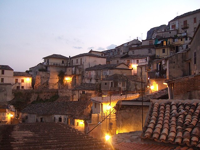
Монастераче (Monasterace, Monasterace)
.svg)
- коммуна Италии
 Hiking in Монастераче
Monasterace, a charming town located in Calabria, Italy, offers a unique blend of history and natural beauty that can make for an enriching hiking experience. Here are some key points about hiking in this area:
Natural Landscape
-
Coastal Trails: Monasterace is situated near the Ionian Sea, providing stunning coastal views. You can find trails that lead to beautiful beaches and cliffs offering panoramic vistas of the ocean.
-
Hills and Olive Groves: Surrounding Monasterace are rolling hills and vineyards, as well as numerous olive groves. Hiking here allows you to explore the rural landscape and enjoy the tranquility of the countryside.
-
Mountaineering Opportunities: If you're looking for more challenging hikes, nearby mountain areas, such as the Aspromonte National Park, offer rugged trails and higher altitudes.
Historical and Cultural Aspects
-
Archaeological Sites: The area around Monasterace is rich in history, with ruins from ancient Greek settlements including the ancient site of Kaulonia. Incorporating a hike with a visit to these sites can enhance your experience.
-
Local Villages: Consider hikes that pass through or lead to nearby quaint villages. Engaging with local culture, trying regional foods, and enjoying the hospitality of the Calabrians can offer a holistic hiking experience.
Practical Considerations
-
Trail Difficulty: Hikes can vary significantly in difficulty. It is essential to choose trails suited to your experience level. Local guides or tourist information centers can provide recommendations and safety tips.
-
Best Time to Visit: Spring and early autumn are ideal for hiking in Calabria, as the weather is generally mild, and the landscapes are vibrant with wildflowers or autumn foliage.
-
Equipment and Preparation: Ensure you have sturdy footwear, hydration supplies, and perhaps a map or a GPS device. It’s also wise to inform someone of your hiking plans, especially if you’re venturing into more remote areas.
Local Guidance
If you're unfamiliar with the area, consider hiring a local guide who can lead you on the best trails and provide insights into the region’s history and natural environment.
In summary, hiking in Monasterace encompasses an enriching mix of stunning landscapes, cultural heritage, and outdoor adventure, making it a worthwhile destination for hiking enthusiasts. Enjoy your explorations!
- Страна:

- Почтовый код: 89040
- Телефонный код: 0964
- Код автомобильного номера: RC
- Координаты: 38° 27' 0" N, 16° 33' 0" E


- GPS треки (wikiloc): [Ссылка]
- Высота над уровнем моря: 138 м m
- Площадь: 15.73 кв.км
- Население: 3510
- Веб сайт: http://www.comune.monasterace.rc.it
- Википедия русская: wiki(ru)
- Википедия английская: wiki(en)
- Википедия национальная: wiki(it)
- Хранилище Wikidata: Wikidata: Q54628
- Галерея изображений в википедии: [Ссылка]
- Катеория в википедии: [Ссылка]
- код Freebase: [/m/0gnyqk]
- код GeoNames: Альт: [6539861]
- код VIAF: Альт: [154733753]
- ID отношения в OpenStreetMap: [39632]
- код GND: Альт: [4534510-7]
- код LCNAF: Альт: [n00044323]
- код TGN: [1045433]
- код ISTAT: 080052
- кадастровый код Италии: F324
Граничит с регионами:

Гуардавалле
- коммуна Италии
Hiking in Гуардавалле
Guardavalle, located in the Calabria region of southern Italy, is a picturesque destination offering a range of hiking opportunities. The area is characterized by its stunning landscapes, which include mountains, forests, and coastline along the Ionian Sea....
- Страна:
- Почтовый код: 88065
- Телефонный код: 0967
- Код автомобильного номера: CZ
- Координаты: 38° 30' 18" N, 16° 30' 24" E
- GPS треки (wikiloc): [Ссылка]
- Высота над уровнем моря: 225 м m
- Площадь: 60.27 кв.км
- Население: 4529
- Веб сайт: [Ссылка]

Стило
- коммуна Италии
Hiking in Стило
Stilo, located in Calabria, Italy, is known for its beautiful landscapes, rich history, and diverse hiking opportunities. Here are some key points to consider if you're planning a hiking trip in Stilo:...
- Страна:
- Почтовый код: 89049
- Телефонный код: 0964
- Код автомобильного номера: RC
- Координаты: 38° 29' 0" N, 16° 28' 0" E
- GPS треки (wikiloc): [Ссылка]
- Высота над уровнем моря: 386 м m
- Площадь: 78.11 кв.км
- Население: 2573
- Веб сайт: [Ссылка]