
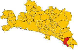
Монелья (Moneglia, Moneglia)
.svg)
- коммуна Италии
 Hiking in Монелья
Moneglia is a charming seaside village located in the Liguria region of Italy, nestled between the Cinque Terre and Portofino. It offers beautiful hiking opportunities with stunning coastal views and lush landscapes. Here are some aspects of hiking in and around Moneglia:
Trails and Routes
-
Sentiero Verde Azzurro (Blue Green Trail): This is the most popular route in the area, connecting Moneglia to the nearby towns of Bonassola and Framura. The trail offers breathtaking views of the coastline and is approximately 10 km long.
-
Moneglia to the San Giorgio Monastery: A short but steep hike that takes you to the ancient San Giorgio Monastery, which overlooks the village. The panoramic views from the monastery are rewarding.
-
Hiking to Punta Rospo: This route allows you to explore the rugged coastline while enjoying scenic views of the sea. It's an excellent option for those who want to experience the natural beauty of the area.
-
Trail to Lemeglio: This trail leads you to the nearby village of Lemeglio, offering a chance to explore local landscapes and enjoy the tranquility of the Ligurian hills.
Best Time to Hike
- The ideal months for hiking in Moneglia are from late spring to early autumn (May to October) when the weather is mild, and the landscapes are lush and vibrant.
- In mid-spring and early autumn, the trails are less crowded, making for a more peaceful hiking experience.
What to Expect
- Scenery: Expect to see beautiful coastal views, Mediterranean vegetation, terraced vineyards, and the charm of small Ligurian villages.
- Wildlife: The area is home to various birds and local fauna, and you may spot interesting plant species along the trails.
- Facilities: Moneglia offers various amenities, including eateries and shops where you can replenish after your hike.
Hiking Tips
- Footwear: Good hiking shoes are essential, as some trails can be rocky or steep.
- Water and Snacks: Always carry enough water and some snacks, as some trails do not have refreshment points.
- Trail Maps: Consider obtaining a trail map or using a hiking app for better navigation.
- Local Guidance: If you’re unfamiliar with the area, joining a guided hike or consulting local guides can enhance your experience.
Cultural Aspects
- Moneglia and its surrounding areas are rich in history and culture, so take some time to explore the town and its historical sites, such as the Church of Santa Croce and the ancient ruins.
Hiking in Moneglia provides a perfect blend of natural beauty, physical activity, and cultural exploration. Whether you're a beginner or an experienced hiker, the trails around Moneglia cater to all levels, making it an inviting destination for outdoor enthusiasts.
- Страна:

- Почтовый код: 16030
- Телефонный код: 0185
- Код автомобильного номера: GE
- Координаты: 44° 14' 19" N, 9° 29' 25" E


- GPS треки (wikiloc): [Ссылка]
- Высота над уровнем моря: 4 м m
- Площадь: 15.61 кв.км
- Население: 2809
- Веб сайт: http://www.comune.moneglia.ge.it
- Википедия русская: wiki(ru)
- Википедия английская: wiki(en)
- Википедия национальная: wiki(it)
- Хранилище Wikidata: Wikidata: Q267005
- Катеория в википедии: [Ссылка]
- код Freebase: [/m/0ghwh1]
- код GeoNames: Альт: [6536097]
- код VIAF: Альт: [130261568]
- ID отношения в OpenStreetMap: [49134]
- код GND: Альт: [4448471-9]
- место в MusicBrainz: [137cbd32-1c7d-41da-872e-90112ab475b6]
- код Цифрового атласа Римской империи: [17188]
- dmoz: Альт: [Regional/Europe/Italy/Liguria/Localities/Moneglia/]
- код ISTAT: 010037
- кадастровый код Италии: F354
Граничит с регионами:

Сестри-Леванте
- коммуна Италии
Hiking in Сестри-Леванте
Sestri Levante, located on the Italian Riviera in the Liguria region, is a beautiful destination for hiking enthusiasts. The area offers stunning landscapes, charming coastal views, and a mix of challenging trails and easier walks suitable for various skill levels....
- Страна:
- Почтовый код: 16039
- Телефонный код: 0185
- Код автомобильного номера: GE
- Координаты: 44° 16' 24" N, 9° 23' 36" E
- GPS треки (wikiloc): [Ссылка]
- Высота над уровнем моря: 10 м m
- Площадь: 33.62 кв.км
- Население: 18339
- Веб сайт: [Ссылка]


Казарца-Лигуре
- коммуна Италии
Hiking in Казарца-Лигуре
Casarza Ligure, located in the Liguria region of Italy, offers a mix of beautiful landscapes, charming villages, and scenic trails that appeal to hikers of all levels. Here are some highlights and tips for hiking in and around Casarza Ligure:...
- Страна:
- Почтовый код: 16030
- Телефонный код: 0185
- Код автомобильного номера: GE
- Координаты: 44° 16' 29" N, 9° 27' 12" E
- GPS треки (wikiloc): [Ссылка]
- Высота над уровнем моря: 34 м m
- Площадь: 27.82 кв.км
- Население: 6851
- Веб сайт: [Ссылка]


Кастильйоне-Кьяварезе
- коммуна Италии
Hiking in Кастильйоне-Кьяварезе
Castiglione Chiavarese is a charming village located in the Liguria region of Italy, nestled between the mountains and the sea, making it an excellent destination for hiking enthusiasts. The area offers a range of trails that showcase stunning landscapes, Mediterranean flora, and panoramic views of the Ligurian coastline....
- Страна:
- Почтовый код: 16030
- Телефонный код: 0185
- Код автомобильного номера: GE
- Координаты: 44° 16' 28" N, 9° 30' 49" E
- GPS треки (wikiloc): [Ссылка]
- Высота над уровнем моря: 271 м m
- Площадь: 29.75 кв.км
- Население: 1574
- Веб сайт: [Ссылка]


Дейва-Марина
- коммуна Италии
Hiking in Дейва-Марина
Deiva Marina, located in the Liguria region of Italy, is a picturesque coastal town nestled between the hills and the Mediterranean Sea. It's a great starting point for hikers looking to explore the beautiful landscapes of the surrounding area. Here are some highlights and tips for hiking in and around Deiva Marina:...
- Страна:
- Почтовый код: 19013
- Телефонный код: 0187
- Код автомобильного номера: SP
- Координаты: 44° 13' 0" N, 9° 31' 0" E
- GPS треки (wikiloc): [Ссылка]
- Высота над уровнем моря: 18 м m
- Площадь: 14.09 кв.км
- Население: 1338
- Веб сайт: [Ссылка]